
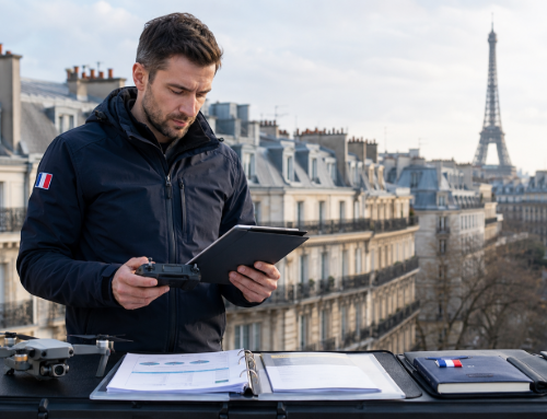
Searching for the best thermal drones for your operations? Whether you’re inspecting rooftops or powerlines, tracking wildlife, looking to equip your search and rescue team, or implementing a Drone As A First Responder (DFR) service, you have plenty of options to pick from. Things to consider range from advanced imaging systems, flight performance, to data safety concerns. Geopoliticas adds another layer of complexity—especially due to legislation affecting foreign-made drones.
This guide breaks it all down, spotlighting the top picks, their standout features, and why they might be perfect for you, and even includes examples of agencies using the drones.
We’ll start off with a quick overview, then continue with a deeper analysis of each model.
Top 14 Thermal Drones Based On Imaging Systems & Flight Performance
| # | Drone Model | Thermal Imaging System | Visual Camera Specs | Max Flight Time (minutes) | Flight Range (km/miles) | Durability | Obstacle Avoidance | Navigation System | Unique Features |
|---|---|---|---|---|---|---|---|---|---|
| 1. | DJI Matrice 350 RTK | Supports Zenmuse H20T and H30T payloads with thermal camera (1280×1024 resolution, 30fps) | For H30T: Zoom camera with up to 400x hybrid zoom; Wide-angle camera with enhanced low-light performance |
55 | Up to 20 km | IP55 rating for resistance to rain and dust; Built for extreme conditions |
Advanced sensors ensure safe navigation in challenging environments | RTK for centimeter-level accuracy; GNSS compatibility for precise positioning |
Hot-swappable TB65 batteries; Night vision and laser rangefinder; Multiple payload support |
| 2. | SwitchBlade-Elite | Wiris Pro thermal camera payload: 640×512 px (1266×1010 px super-res) | RGB camera with Full HD (1920 x 1080 px) resolution | 50 | 20 km (12.4 miles) | IP52 rating; Wind gusts up to 40 kph (25 mph) |
Basic failsafe (Return to Launch at 30% battery) | GNSS for mission planning | Popular for forest firefighting Quick deployment (under 2 minutes) |
| 3. | DJI Matrice 30T | Thermal camera: 640x512 normal, 1280x1024 super-resolution | Wide: 12 MP 1/2'' CMOS; Zoom: 48 MP 1/2'' CMOS |
41 | 15 km | IP55 rating; Wind resistance: 14 m/s; Operating temp: -20°C to 50°C |
Omnidirectional collision avoidance | RTK for high accuracy; Multi-GNSS support |
Advanced redundancy (three-prop emergency landing); Integration with DJI FlightHub 2, CZI LP12 payload |
| 4. | Inspired Flight IF800 Quadcopter, EO/IR | Radiometric thermal camera (640x512 @60Hz); ≤50 mK thermal sensitivity |
4K zoom sensor (20x optical, up to 240x combined) | 54 | 20 kilometers (12 miles) | IP43 rating; Wind resistance up to 23 knots |
Stable flight platform | RTK for centimeter-level accuracy; GNSS support |
NDAA compliant; Blue sUAS approved; Dual hot-swappable batteries; AI-based object tracking |
| 5. | Autel EVO II V3 640T RTK | 640 x 512 resolution, 13mm lens; 16x digital zoom, multiple color palettes; Temperature alarms and measurement modes |
50 MP 1/1.28" CMOS sensor; Moonlight Algorithm 2.0 for low-light performance; Picture-in-Picture mode (thermal + visual) |
38 | Up to 15 km (9.3 miles) | IP43 rating; Wind resistance up to 27 mph |
Omnidirectional system with 19 sensors; Automated return-to-home | RTK for centimeter-level accuracy; GNSS compatibility | Enhanced low-light visibility; Foldable, portable design; Real-time mapping capabilities |
| 6. | DJI Mavic 3 Thermal | 640 x 512 infrared resolution; Uncooled VOx microbolometer, 30Hz; Measurement range: -4°F to 932°F |
48 MP main camera (1/2" CMOS); 12 MP zoom camera with 56x hybrid zoom; Triple-camera setup for comprehensive imaging |
45 | Up to 9.3 miles (15 km under FCC) | No IP rating; Wind resistance: Up to 39 ft/s |
Omnidirectional sensors; APAS 5.0 for automatic rerouting |
GNSS (GPS, Galileo, BeiDou); AES-256 encryption for secure data transmission |
DJI O3 Enterprise transmission; Compatible with PSDK/MSDK, DJI Terra, FlightHub 2, and Thermal Analysis Tool 3.0; Local Data Mode for data security |
| 7. | Anzu Raptor T | 640x512 LWIR thermal camera; Useful for surveillance and night ops |
48 MP camera; 56x hybrid zoom |
45 | Up to 9 miles | Not IP rated; Wind resistance up to 26 mph; Lightweight (~2 lbs) |
Omnidirectional obstacle avoidance (wide-angle lenses on all sides for zero blind spots) | GNSS-based positioning | AES-256 encrypted data; US-based data hosting and firmware control; Modelled after Mavic 3 for US market |
| 8. | Skydio X10 | Radiometric thermal (640x512); <30 mK sensitivity |
Narrow: 64 MP; Telephoto: 48 MP, detailed inspection at distance; Optional wide: 50 MP |
40 | Up to 7.5 miles (direct), extended with 5G | IP55 rating; Magnesium-carbon fiber frame; Wind resistance up to ~28.6 mph |
AI-assisted omnidirectional avoidance; NightSense mode for zero-light navigation |
GNSS-supported; Real-time mapping and AI autonomy |
NVIDIA Jetson Orin GPU for onboard AI; NDAA compliance, encrypted data; Real-time 2D/3D mapping |
| 9. | Autel Evo Max 4T | 640×512 thermal resolution; Detects heat sources through smoke/darkness |
48 MP zoom camera (10x optical, 160x hybrid); 50 MP wide-angle camera |
42 | FCC: 20km CE: 8km | IP43 rating; Wind resistance up to 27 mph |
720° obstacle detection (vision + radar) | A-Mesh networking; Anti-jamming GNSS support |
AI recognition (people, vehicles, flames) with 98% accuracy; EVO NEST integration for automated missions |
| 10. | DJI Matrice 3TD | Infrared: 640x512@30fps, up to 28x digital zoom | Wide-angle: 48 MP; Telephoto: 12 MP with 56x hybrid zoom |
50 | 43 km | IP54 rating | Six-direction obstacle detection | RTK module; GNSS for high-precision positioning |
Part of DJI Dock 2 system for automated missions |
| 11. | Teledyne FLIR SIRAS | FLIR Boson® 640x512 radiometric sensor; 5x digital zoom; MSX® technology (thermal + visible outlines) |
16 MP visible camera; 128x zoom |
31 | 9 km (6 miles) | IP54 rating for varied environments | Front-facing radar (detects obstacles up to 100 ft); Ground sensors for safe landing |
GNSS-supported basic navigation | Geofence-free; Offline operation (no internet/cloud); Secure data storage on internal microSD card |
| 12. | Autel Alpha | Dual thermal cameras (short & long focal); 640x512 resolution, 56x hybrid zoom |
Night vision zoom camera: 4K, up to 560x hybrid zoom; 48 MP wide-angle camera |
45 | Up to 15 km (Skylink 3.0) | IP55 rating; Anti-jamming, adaptive frequency hopping |
720° omnidirectional with dual fisheye + radar | Multi-GNSS (GPS, GLONASS, BeiDou, Galileo); SLAM navigation, global path planning |
A-Mesh networking for drone-to-drone communication; Open SDK for custom payload integration; Strong anti-interference design |
| 13. | Yuneec Typhoon H520E-RTK | E10T/X payload with FLIR Boson thermal camera (320x256 or 640x512 resolutions) and dual RGB-thermal video streams. | Options include: E90X: 20 MP with SONY 1” CMOS sensor. E30Z/X: 30x optical zoom for detailed inspections. |
25 | Up to 3 km (OFDM radio system | Operating tem0°C - 40°C (32°F - 104°F); 5-rotor fail-safe for operation during rotor failure |
Built-in ultrasonic sensors for obstacle avoidance | RTK (Real-Time Kinematic); GNSS-supported. |
Hot-swappable payloads; Team Mode; Yuneec DataPilot™ |
| 14. | Parrot ANAFI USA | FLIR Boson camera (320 x 256 resolution) | Dual 21 MP cameras; 32x digital zoom; Low-noise operation |
32 | Up to 4 km | IP53 rating; Operates from -36°C to +50°C |
No obstacle avoidance. Relies on stable flight control | GNSS (GPS + others) for positioning | Blue sUAS approved; AES-XTS 512-bit SD card encryption; Fast deployment (under 55 seconds) |
Feature Analysis Of Best Thermal Drones
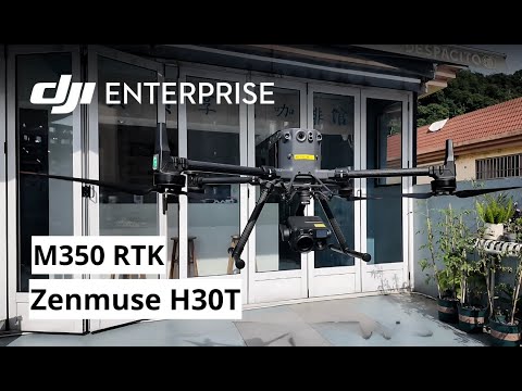
1. DJI Matrice 350 RTK
The DJI M350 is a long range enterprise launched in May 2023. This DJI flagship model gives you flexibility with the thermal camera payloads – including its Zenmuse series, and also features impressive flight endurance. It’s designed for a range of applications, from firefighting and search-and-rescue to inspections and mapping. Boasting a maximum flight time of 55 minutes and a IP55 waterproof rating, it gives you service even in harsh conditions like rain, dust, or smoke. The drone’s ability to carry payloads including loudspeakers, and spotlights, makes it indispensable for emergency response teams.
Feature Highlights
- Flight Time: Up to 55 minutes on a single charge.
- Payload Capacity: 2.7 kg (for cameras, loudspeakers and spotlights)
- Thermal Imaging: Supports thermal camera payloads like Zenmuse H20T and H30T. e.g., with the Zenmuse H30T infrared imaging system comes with 1280×1024 resolution, 32× digital zoom,and measures temperatures up to 1600°C (2912°F). Includes infrared density filter too.
- Advanced Navigation: RTK positioning for centimeter-level mapping accuracy.
- Durability: IP55 waterproof rating; operates in extreme weather.
- Hot-Swappable Batteries: Continuous operation without power interruptions.
- Video Transmission: Triple-channel 1080p HD live feeds up to 20 km.
- Obstacle Avoidance: Sensors ensure safe flights in challenging environments.

Emergency response teams, law enforcement units and building inspection teams can use the DJI Matrice 350 RTK drone with thermal camera. The imaging features will depend on the payload selected.
For instance, in addition to the infrared visuals, the Zenmuse H30T camera system also features:
- 40MP high-resolution zoom camera with up to 34× optical zoom and 400× digital zoom, ideal for detailed close-ups.
- 48MP wide-angle camera with a 1/1.3-inch CMOS sensor captures broader scenes in 3840×2160 resolution at 30fps, ensuring versatility and clarity in various applications.
So as the thermal imagery detects temperature anomalies, pinpointing ignition sources or locating trapped individuals, the drone’s real-time video feed transmits directly to command centers up to 20 km away, empowering decision-makers with accurate visuals. Its ability to fly for up to 55 minutes ensures prolonged monitoring, reducing downtime. And thanks to its IP55 rating and durability, the Matrice 350 performs seamlessly in rain, smoke, or high winds.
Other M350 compatible camera payloads include: Zenmuse L2, Zenmuse H20N, Zenmuse L1, Zenmuse P1, as well as third-party payloads developed based on the Payload SDK.
Learn How Interpret UAS Thermal Images: Drone Thermography Level 1 Certification Course
Mount a loudspeaker like the CZI MP130 V2, and you’ve got a communication powerhouse capable of broadcasting messages up to 1,000 meters away, like when directing evacuation efforts, or controlling crowds. Add the CZI GL60 Spotlight, and illuminate vast areas during night operations.
Its RTK navigation provides centimeter-level accuracy for mapping, vital in post-disaster assessments or infrastructure inspections. Plus, the hot-swappable battery system ensures non-stop operations, saving precious time during emergencies.
See the M350 in Action
2. SwitchBlade-Elite
The SwitchBlade-Elite an American-made tricopter from Vision Aerial built for tasks like firefighting and rescue missions. With flexible payload options like the Wiris Pro drone thermal camera, quick launches and high weather resistance, its used for inspection tasks to law enforcement operations. Designed for quick deployment and portability, and features as a long range drone due to its extended flight times of close to an hour and operating distance of 20 km.
Key Features
- Fast Deployment: Ready to fly in under two minutes.
- Extended Flight Time: Operates for up to 50 minutes on a single charge.
- High Wind Resistance: Stable in gusts up to 40 kph (25 mph).
- Payload Flexibility: Supports the Wiris Pro thermal camera with 45° field of view, and measures up to 1,500° C (2,732° F)
- Payload Capacity: Carries up to 2.0 kg (4.4 lbs) for diverse sensor options.
- Flight Range: Covers up to 20 km (12.4 miles).
- Weather Resistance: IP52-rated, protecting against dust and water spray.
- Powered Landing Gear: 250 mm ground clearance for smooth landings on uneven terrain.
- Failsafe System: Low battery Return to Launch (RTL) activates at 30%.
- Portable Design: Foldable structure and weatherproof Pelican case for easy transport.
With wildfires, thick smoke fills the air, making it impossible to see the fire’s edges or the safest routes for firefighters. This thermal imaging drone, powered by the advanced Wiris Pro camera provides the imagery needed. The camera’s high-resolution LWIR microbolometric sensor provides crisp thermal visuals, revealing fire intensity and spread. Its Super Resolution Mode (1266x1010p) further enhances these thermograms, giving response teams details needed to make critical decisions quickly.
The drone thermal camera isn’t just for fires. During rescue missions, its thermal capabilities help locate individuals, even in pitch darkness or dense forests with its sensitivity of up to 30mK – like finding a lost hiker in the dead of night or locating a stranded victim amidst debris.
Extended flight time of the SwitchBlade-Elite enables emergency response crews to cover vast areas without frequent battery swaps. Pair that with its 12.4 mile-range, and you can cover sprawling forests or urban landscapes. Even when the wind picks up to 40 kph (25 mph), the drone remains steady, ensuring reliable data collection in less-than-ideal weather.
Portability is another standout feature. Its foldable design and weatherproof Pelican case mean you can take it anywhere. From remote mountain trails to crowded urban streets, the SwitchBlade-Elite is ready to deploy quickly, and thanks to its powered landing gear with 250 mm ground clearance, landing on rocky or uneven terrain is a breeze.
The intelligent low battery RTL system ensures the drone returns safely to its launch point before running out of power. This feature gives you peace of mind, even during extended operations.
3. DJI Matrice 30T
The DJI Matrice 30T is a powerhouse drone released in March 2022 as part of DJI’s Matrice 30 Series for enterprise users. From public safety and law enforcement to search and rescue missions, the Matrice 30T has become a preferred tool for professionals. It’s a long range drone with advanced imaging capabilities, including an integrated drone thermal camera with up to 1280×1024 resolution in infrared super-resolution mode. With a foldable design for portability, dual-band video transmission for extended range, and a user-friendly system, this drone is a trusted ally for dynamic field operations.
Feature Highlights
- Flight Time: 41 minutes per charge with hot-swappable batteries for continuity.
- Camera System: Dual visual cameras (12MP wide-angle, 48MP zoom) and a 640×512 thermal imaging drone sensor.
- Durability: IP55 weather-resistant, withstands temperatures from -20°C to 50°C and winds up to 14 m/s.
- Navigation: Equipped with RTK positioning and multiple GNSS systems for enhanced accuracy.
- Video Transmission: O3 Enterprise system with a 15 km range and dual-band support.
- Portability: Foldable design, lightweight for transport, quick-locking arms.
- Safety: Omnidirectional collision avoidance and advanced redundancy systems, including three-prop emergency landing.
- Accessories: Compatible with DJI FlightHub 2 for real-time data sharing and the BS30 charging station for efficient power management.
Its dual-camera system is a standout feature. The drone thermal camera detects heat signatures during search-and-rescue missions or monitoring fire hotspots while the wide-angle 12MP and zoom 48MP visual cameras provides high-detail imaging, even in challenging light conditions.
In Texas, it was deployed during a wildfire near a busy highway, helping responders monitor fire progression in real-time. Using its thermal imaging drone capabilities, responders tracked the fire’s perimeter, pinpointed hotspots, and strategically deployed firefighting resources, successfully containing the fire within hours.
When it comes to flight performance, the Matrice 30T excels. Its top speed of 23 m/s (51 MPH) enables you to cover vast areas quickly. When navigating over rugged terrain or amidst adverse weather conditions, the drone’s durability, IP55 rating and wind resistance make it a dependable choice. The onboard RTK module ensures centimeter-level positioning accuracy, crucial for mapping, surveying, or precise incident tracking.
The drone’s advanced safety systems, including omnidirectional collision avoidance and three-prop emergency landing capabilities, ensure a smooth operation even in complex environments. For ease of use, the drone integrates seamlessly with DJI FlightHub 2, with real-time data synchronization and cloud mapping for situational awareness and operational planning.
Designed with portability in mind, the Matrice 30T features a foldable design that allows for quick deployment. The BS30 charging station streamlines battery management, with three modes to optimize battery health and provide fast charging for emergency response teams. Hot-swappable batteries keep your operations running for longer, a critical feature for extended missions.
See Agencies Using The Matrice 30T
4. Inspired Flight IF800 Tomcat
The IF800 Tomcat is a medium-lift drone designed for professional applications. Launched by Inspired Flight Technologies, a U.S.-based company, this drone hit the market in mid-2023. What sets the IF800 Tomcat apart is its NDAA compliance, making it free from components sourced from prohibited foreign countries. With a remarkable battery life of up to 54 minutes and the ability to carry a payload of 6.6 pounds, this drone caters to a wide range of industries, including search and rescue, infrastructure inspection, and 3D mapping. Its compact, foldable design ensures portability
Feature Highlights
- Flight Performance:
-
- Maximum Flight Time: Up to 54 minutes.
- Maximum Payload Capacity: 6.6 lbs (3 kg).
- Maximum Speed: 49 mph (22 m/s).
- Wind Resistance: Operates in winds up to 23 knots.
- Design and Build:
-
- Portability: Lightweight, foldable frame for easy transport and deployment.
- Ingress Protection: Rated IP43, enabling operation in light rain and dusty environments.
- Dual Hot-Swappable Smart Batteries: Continuous operations with quick battery changes.
- Payload Integration: EO/IR Capabilities – Features Electro-Optical/Infra-Red systems such as the Gremsy VIO F1, with:
-
- 4K zoom sensor offering up to 240x combined zoom.
- Radiometric thermal camera with 640×512 resolution and high thermal sensitivity (≤50 mK).
- Integrated 2400m laser rangefinder for precision measurements.
- AI-based object tracking for precise subject framing.
- Compliance and Reliability:
-
- NDAA Compliance: Free from components made in prohibited countries, ensuring security and reliability.
- Blue UAS Approval: Demonstrates adherence to strict cybersecurity and supply chain standards.
The payload versatility of the the IF800 Tomcat ,means you get to use it with advanced EO/IR imaging systems like the Gremsy VIO F1 as mentioned. Thee laser rangefinder, coupled with AI-based object tracking, allows you to pinpoint targets with unmatched accuracy, even in dynamic environments.
The drone’s NDAA compliance adds a layer of trust and reliability. NDAA, or the National Defense Authorization Act, prohibits components from certain countries to ensure secure supply chains. Unlike many consumer drones, the IF800 Tomcat avoids reliance on restricted sources, making it suitable for government and defense-related use.
While all Blue UAS-certified drones meet NDAA standards, not all NDAA-compliant drones are Blue UAS. And the Tomcat is both. Blue UAS certification entails rigorous testing for cybersecurity and supply chain integrity, conducted by the Department of Defense. While this adds a layer of assurance, it also limits the pool of approved drones to a small group. The IF800 Tomcat bridges this gap by being NDAA-compliant while offering flexibility and innovation that rival many Blue UAS drones.
Related Reading: Key FAA Drone Regulations Every U.S. Pilot Should Know
You’ll also appreciate the dual hot-swappable batteries, designed to minimize downtime in the field. Combined with its 54-minute flight time and resilience against strong winds, this drone ensures seamless operation even in less-than-ideal conditions.
5. Autel EVO II Dual 640T V3
Autel Robotics’ EVO II Dual 640T V3 hit the market in October 2022, and quickly became popular with its dual-camera system and impressive flight time. With features like RTK positioning for centimeter-level accuracy and SkyLink 2.0 for reliable video transmission, this drone caters to professionals from law enforcement to emergency responders and building inspectors.
Feature Highlights
- Flight Performance: 38-minute flight time, 45 mph speed, withstands 39 mph winds.
- Camera System: 50 MP visual camera and 640×512 resolution drone thermal camera.
- Data Transmission: SkyLink 2.0 offers a 15 km range with QHD video within 1 mile.
- Durability: IP43-rated, operates in temperatures from -4°F to 104°F.
- Navigation and Safety: Omnidirectional obstacle avoidance and automated return-to-home.
- Smart Controller: 7.9-inch HD touchscreen with 2000-nit brightness.
- Thermal Features: 16x digital zoom, multiple temperature measurement modes, and color palettes.
Its advanced dual-camera system combines a high-resolution drone thermal camera with a 50 MP visual camera, making it invaluable for public safety, firefighting, and beyond. The thermal imaging camera uses a 13mm focal length lens and 16x digital zoom, enabling you to detect heat signatures even in low-visibility conditions.
Related Reading: The Power Of A Thermal Imaging Drone — Tech Insights And Buying Guide
The RTK positioning of the EVO II V3 ensures precise spatial data, perfect for mapping and site surveys. This feature is crucial for operations like wildfire management, where you need detailed and accurate imagery. The drone’s SkyLink 2.0 transmission provides real-time video, ensuring you maintain control and situational awareness, even during extended missions.
Durability is a strong point of the EVO II V3. It operates reliably in harsh weather, withstanding strong winds and temperatures ranging from -4°F to 104°F. Its IP43 rating further ensures resilience in diverse conditions, whether it’s navigating through smoke in a wildfire or monitoring a crime scene at night. Safety features, like 19 omnidirectional sensors for obstacle avoidance and an automated return-to-home function, make it a reliable choice for high-stakes operations.
This drone is also highly user-friendly. The Smart Controller V3 boasts a 7.9-inch HD touchscreen with 2000 nits of brightness, allowing you to view and control the drone in bright outdoor settings. The foldable design ensures you can deploy it quickly, essential in emergencies where every second counts.
6. DJI Mavic 3 Thermal
The Mavic 3T launched in September 2022 as part of the the Mavic 3 Enterprise series. Its 640x512p infrared imaging ensures you can detect heat signatures even in pitch darkness or bad weather. This drone with thermal camera also has a triple-camera system that adds to the versatility. The 48 MP wide-angle lens captures stunning visuals, the 12 MP zoom lens gets up close without sacrificing clarity, and the thermal lens provides crucial heat mapping. Together, they make this drone a powerhouse for a variety of missions.
Key Features
- Thermal Camera: Infrared resolution of 640 x 512 pixels, temperature range from -4°F to 932°F.
- Triple-Camera System: Includes 48 MP wide-angle, 12 MP zoom with 56× hybrid zoom, and a thermal lens.
- Flight Time: Up to 45 minutes for extended missions.
- Wind Resistance: Handles winds up to 39 ft/s effortlessly.
- Transmission Range: 9.3 miles for real-time data streaming.
- Obstacle Avoidance: Omnidirectional sensors with APAS 5.0 for seamless navigation.
- Durability: Operates in temperatures ranging from -10°C to 40°C.
- Data Security: AES-256 encryption and Local Data Mode for sensitive missions.
- Ease of Use: Compact and portable with the intuitive DJI Pilot 2 app.

With a 45-minute flight time, you’ve got plenty of time to cover large areas. Add to that the drone’s ability to resist strong winds and you’re ready to handle tough conditions. Navigation is a breeze with omnidirectional obstacle avoidance. The drone intelligently detects and avoids obstacles, keeping your missions safe and efficient. With AES-256 encryption and Local Data Mode, your mission data stays secure.
See It in Action
7. Anzu Raptor T
The Anzu Raptor T was launched in April 2024 by Anzu Robotics, an American company headquartered in Austin, Texas. The hardware draws inspiration from DJI’s Mavic 3 Thermal, while the software is from Aloft Technologies, based in Syracuse, New York. While Anzu Robotics collaborates with DJI for key hardware technology under a licensing agreement, the assembly and firmware development are carefully controlled to ensure compliance with stringent U.S. standards.
Feature Highlights
- Dual-Camera System: 48 MP visual camera and 640×512 LWIR thermal camera.
- Flight Time: Up to 45 minutes per charge for extended operations.
- Operational Range: Covers an impressive 9 miles for wide-area missions.
- Advanced Zoom: 56x hybrid zoom for detailed imaging at a distance.
- Data Security: AES-256 encrypted data transmission, with all information stored on US-based ISO 27001 and SOC 2 Type II certified servers.
- Wind Resistance: Operates efficiently in winds up to 26 mph.
- Portability: Lightweight at 2 pounds for quick deployment.
- Live Streaming: Compatible with Air Control app for real-time video and fleet management.
The 640×512 LWIR thermal camera of the Raptor T excels in detecting heat signatures, whether you’re conducting industrial inspections, managing nighttime surveillance, or performing emergency rescue operations. This thermal capability works in tandem with the high-resolution 48 MP visual camera, offering unparalleled clarity and depth.
Extended flight time of 45 minutes ensures uninterrupted missions, from large-scale search-and-rescue efforts to prolonged surveillance tasks. The 56x hybrid zoom is a standout feature, allowing you to monitor distant objects in detail.
The @AnzuRobotics Raptor drone was on display the @aloftai booth at @XPONENTIALshow in San Diego. There’s been a lot of talk recently about drone regulations in the US, mostly around data security and privacy. Is the new Anzu Raptor drone the answer? pic.twitter.com/ZrOkg1oIsg
— Aldryn Estacio (@ace) April 25, 2024
Components are sourced globally and assembled in Malaysia, maintaining high manufacturing standards while avoiding reliance on politically sensitive supply chains. Once assembled, the drones are shipped to the United States, where Anzu completes firmware installations and conducts rigorous quality checks. This dual-country production strategy allows the Raptor T to bypass geopolitical hurdles while delivering a reliable and secure drone, making it an appealing choice for users concerned about data sovereignty and international compliance.
The drone’s lightweight design and 9-mile operational range make it a versatile tool for various industries. Its ability to withstand winds up to 26 mph ensures reliability, even in less-than-ideal weather conditions. Data security is a top priority, with all information encrypted and stored on certified US-based servers, addressing privacy and geopolitical concerns.
The Raptor T is user-friendly, with features like live streaming and fleet management via the Air Control app. This allows for seamless integration into coordinated operations, making it an invaluable asset for teams in law enforcement, energy, and public safety sectors. With no geofencing restrictions, the Raptor T offers greater freedom while maintaining compliance through FAA-approved tools.
Related Reading: Drone Training for First Responders – UAVs, Skills & Certifications For Emergency Personnel
8. Skydio X10
This was launched on September 20, 2023, at Skydio’s Ascend Event, and targets professional users. Manufactured at Skydio’s facility in Hayward, California, this UAV is built to handle everything from challenging search-and-rescue missions to high-tech infrastructure inspections. The Skydio X10 integrates advanced imaging systems and even AI to redefine autonomous operations.
Its ability to withstand tough environments, thanks to its magnesium-carbon fiber frame and IP55 waterproof rating, ensures reliable performance in dust, rain, or high winds. Compact and portable, the Skydio X10 is perfect for rapid deployment, going from packed to operational in under 40 seconds.
Feature Highlights
- High-Performance Cameras: Includes a 64 MP narrow camera, 48 MP telephoto camera, and 50 MP wide camera. The FLIR Boson+ camera offers 640×512 resolution and <30 mK sensitivity for the drone thermal vision.
- NightSense Technology: Enables autonomous navigation in total darkness with visible or infrared illumination.
- Flight Time and Speed: 40 minutes of flight time and a max speed of 45 MPH.
- Weatherproof and Durable: IP55-rated, resistant to dust and water splashes, withstanding extreme temperatures (-20°C to 45°C).
- Connectivity Options: Operates up to 7.5 miles with Skydio Connect SL or extends further with 5G cellular connectivity.
- Payload Flexibility: Supports up to 12 ounces for accessories like spotlights, parachutes, or speakers.
- Real-Time Mapping: Builds 2D and 3D models onboard, compatible with platforms like Pix4D and DroneDeploy.
- Secure Data Handling: AES-256 encryption, NDAA compliance, and ISO-certified data storage for maximum security.
The Skydio X10;s advanced imaging system, featuring a FLIR Boson+ thermal camera, makes it one of the most precise drones with thermal cameras on the market. This thermal imaging capability enables you to detect heat signatures, identify defects, or locate missing persons, even in zero-light conditions. An onboard NVIDIA Jetson Orin GPU provides real-time AI-powered decision-making for smooth autonomous navigation, obstacle avoidance, and flight in GPS-denied environments.
Built for versatility, the Skydio X10 supports modular payloads, allowing users to customize it for specific missions, e.g. VT300-Z with its 48MP telephoto camera, or the VT300-L wthat comes with a 50MP 1″ wide camera.. The 40-minute flight time ensures you can cover extensive areas without frequent recharging, while the AI-driven navigation pairs with NightSense technology, giving you 24/7 operational capability.
The Skydio X10 goes beyond imaging. Its real-time mapping and integration with platforms like DroneDeploy allow you to create actionable models directly in the field. For search-and-rescue teams, the drone’s AI-driven grid patterns ensure no area is left unchecked, making operations faster and more effective.
See It in Action
🚨 @MiamiBeachPD is pioneering Drone as First Responder #DFR with Skydio X10, providing officers with a cutting-edge "eye in the sky" to obtain situational awareness efficiently from above while prioritizing community & officer safety.
— Skydio (@SkydioHQ) April 29, 2024
Watch the story from @CBSMiami ▶️ pic.twitter.com/v0j9PGCHaA
9. Autel EVO Max 4T
Launched on January 5, 2023, at CES in Las Vegas, the Autel EVO Max 4T is one of the drones with thermal cameras with its advanced imaging systems, AI-driven autonomy, and rugged durability. Of particular note is its binocular vision and millimeter-wave radar technology
Feature Highlights
- Tri-Camera System:
- Zoom Camera: 48 MP with 10x optical and 160x hybrid zoom.
- Wide Camera: 50 MP with a 93° field of view for situational awareness.
- Thermal Camera: 640×512 resolution with a temperature detection range of -4°F to 1022°F (-20°C to 550°C).
- Laser Rangefinder: Measures distances from 5 to 1200 meters with ±1 meter accuracy.
- Flight Time and Speed: 42 minutes max flight time and a horizontal speed of 23 m/s.
- Autonomous Operations: Real-time 3D mapping and AI-driven object tracking for efficient mission execution.
- A-Mesh Networking: Enables multi-drone communication for synchronized operations without LTE coverage.
- Weather Resistance: IP43-rated, dustproof and resistant to water sprays.
- Obstacle Avoidance: 720° coverage with dual vision sensors and millimeter-wave radar.
- Payload Options: Supports loudspeakers, strobes, and spotlights for enhanced functionality.
- Fast Deployment: Ready for takeoff within 15 seconds for rapid response.
- Hot-Swappable Batteries: Enables continuous operation with minimal downtime.
The 48 MP zoom camera with 160x hybrid zoom lets you use the EVO Max 4T to focus on distant objects, whether pinpointing a heat source or inspecting a high-rise building. The wide-angle camera offers a broader perspective, ideal for situational awareness during emergency responses or large-scale inspections. Meanwhile, the drone thermal vision provided with the 640×512 res detects heat signatures through smoke, foliage, and darkness.
The drone’s laser rangefinder enhances precision, measuring distances with remarkable accuracy. This capability is essential for mapping fire perimeters, assessing critical infrastructure, or planning complex rescue operations. Coupled with the 720° obstacle avoidance system, the drone navigates safely around hazards, even in GPS-denied environments like dense forests or underground facilities.
EVO NEST Integration: Use the EVO Max 4T with an automated docking and recharging system for continuous, remote deployment and operation.
Its IP43 rating ensures reliable performance in various weather conditions, from light rain to dusty terrains. The A-Mesh networking system allows multiple drones to collaborate seamlessly, enabling comprehensive coverage of large areas. Hot-swappable batteries and fast deployment make it ideal for high-stakes scenarios where every second counts.
Advanced autonomy takes the EVO Max 4T a step further. It can create real-time 3D flight paths, enabling efficient mapping of complex zones. Its AI recognition system identifies and tracks objects like flames, vehicles, and people, displaying real-time data in the Autel Enterprise App.
10. DJI Matrice 3TD
The DJI Matrice 3TD became a hit in 2024 for inspection tasks and even DFR programs. Paired with the DJI Dock 2, the drone can perform automated missions, recharging and redeploying itself for continuous operation. This DJI thermal drone has an IP54 dust and water resistance rating, ensuring dependable performance in harsh environments. With a maximum flight time of 50 minutes, it is ideal for extended missions where uninterrupted aerial coverage is essential. Its advanced camera suite includes a wide-angle camera, a telephoto camera, and a high-resolution thermal camera.
Feature Highlights
- Triple Camera System:
- Wide Camera: 48 MP with a 1/1.32″ CMOS sensor for high-resolution imagery.
- Telephoto Camera: 12 MP with a 56x hybrid zoom for long-range detail.
- Thermal Camera: 640×512 resolution with up to 28x digital zoom for precise heat detection.
- Flight Performance:
- Maximum flight time of 50 minutes per charge.
- Operates within a 6-mile radius, ideal for large-scale operations.
- Rugged Durability:
- IP54-rated for dust and water resistance.
- Operates reliably in challenging weather conditions.
- RTK Module:
- Centimeter-accurate positioning for precise navigation.
- Obstacle Detection:
- Six-direction sensing system ensures safe and reliable flights.
- Compatibility with DJI Dock 2:
- Automated recharging and mission execution for continuous operations.
- Battery Efficiency:
- Up to 400 recharge cycles for long-term durability.
Its triple-camera system provides enahnced imaging capabilities. The wide-angle camera is perfect for capturing expansive areas, while the telephoto camera enables detailed inspections of distant objects like transmission towers or structural components. The DJI thermal drone’s camera detects heat signatures with remarkable precision, even through smoke, fog, or complete darkness.
Safety and precision are at the heart of the Matrice 3TD. Its integrated RTK module ensures centimeter-level accuracy while the drone’s six-direction obstacle detection system enhances its ability to navigate complex environments, from dense forests to urban landscapes, reducing the risk of collisions.
With a maximum flight time of 50 minutes, the Matrice 3TD excels in long, uninterrupted missions. Whether you’re monitoring large agricultural fields, inspecting critical infrastructure, or conducting emergency operations, this drone minimizes downtime and maximizes efficiency. When paired with the DJI Dock 2, the Matrice 3TD takes automation to the next level. It autonomously returns to the dock for recharging and mission updates, enabling round-the-clock aerial coverage without requiring a human operator on-site.
Being IP54-rated, the droneit resistant to dust and water sprays. This ensures reliable performance in demanding conditions, whether it’s scorching heat, rain, or windy environments.
11. Teledyne FLIR SIRAS™
Launched on September 6, 2022, the Teledyne FLIR SIRAS™ is a high-performance drone designed to meet the demanding needs of industrial inspections, firefighting, law enforcement, and search-and-rescue missions. Developed in partnership with Taiwan’s Coretronic Intelligent Robotics Corporation (CIRC), the SIRAS integrates cutting-edge technology while undergoing final assembly and quality checks in the United States.
This thermal drone is an affordable and secure solution that’s big on data integrity and field adaptability. Its standout features include a dual-camera system with a high-resolution visible camera and a FLIR Boson thermal camera. It’s a long range drone with an IP54 durability rating, and quick deployment capabilities, and geofence-free design, making it one of the most flexible drones with thermal cameras.
Feature Highlights
- Dual-Camera System:
- Visible Camera: 16 MP with 128x zoom for high-resolution imagery.
- Thermal Camera: Radiometric FLIR Boson sensor, 640×512 resolution with 5x zoom, enhanced by FLIR MSX® technology.
- Flight Performance:
- 31-minute flight time with hot-swappable batteries for extended operations.
- Maximum speed of 40 mph and wind resistance up to 5 m/s.
- Rugged Design:
- IP54-rated for water and dust resistance, ensuring reliability in harsh environments.
- Operates in temperatures from -10°C to 40°C.
- Advanced Imaging:
- FLIR MSX® technology merges thermal and visible imaging for detailed, composite visuals.
- Obstacle Avoidance:
- Front radar detects obstacles up to 100 feet at speeds under 13 mph.
- Ground sensors for safe landing.
- Data Security:
- Onboard microSD storage with no internet or cloud connectivity required.
- Quick Deployment:
- Ready to fly within 2 minutes, perfect for time-sensitive missions.
- No Geofencing:
- Provides unrestricted operation in any location.
The 16 MP visible camera of the Teledyne FLIR SIRAS™ delivers crisp, detailed imagery, ideal for structural inspections or tracking vehicles. Meanwhile, the FLIR Boson thermal camera offers high-resolution thermal imaging, enabling the detection of heat signatures in smoke, darkness, or dense foliage. With FLIR MSX® technology, thermal and visible images are overlaid to create a detailed composite view, crucial for differentiating between humans, animals, and objects during search-and-rescue or firefighting missions.
Durability and reliability are at the heart of the SIRAS. Its IP54 rating ensures protection from dust and water sprays, making it capable of withstanding challenging weather conditions. Whether you’re operating in a rainstorm or a dry, dusty landscape, this drone gets the job done. The SIRAS can fly at speeds of up to 40 mph and sustain a 31-minute flight time, giving you ample operational range for extensive coverage.
Ease of use sets the SIRAS apart. It’s designed to deploy within two minutes, minimizing delays in critical situations. The intuitive interface allows pilots to navigate missions effortlessly, even in high-pressure scenarios. Without geofencing restrictions, you can launch the drone in any location without waiting for authorizations, saving valuable time during emergencies.
Data security is another strength of the SIRAS. Unlike many drones, it stores data exclusively on an onboard microSD card without requiring cloud connectivity. This ensures the integrity and privacy of sensitive information, a vital feature for law enforcement and industrial inspections.
See It in Action
12. Autel Alpha
Launched in March 2024, the Autel Alpha represents a significant leap in industrial drone innovation. Building on the success of the EVO Max 4T, the Autel Alpha is a newer entrant, having been lauched in March 2024. It comes with a durable design, IP55 rating, and foldable frame. For infrared imaging, the drone is equipped with a new-generation DG-L35T gimbal, that integrates dual thermal cameras for both short- and long-range observations, a 4K night vision zoom camera, and a 48 MP wide-angle camera. With an impressive 45-minute flight time, up to 15 km of transmission range, and advanced SLAM navigation, this drone is designed to handle complex missions in industries like public safety, energy inspection, and emergency management.
Feature Highlights
- Advanced Gimbal and Camera System:
- Dual thermal cameras (short and long focal lengths) with 640×512 resolution and 56x hybrid zoom.
- Night vision zoom camera with 4K resolution and up to 560x hybrid zoom.
- 48 MP wide-angle camera with ultra-high ISO sensitivity for low-light imaging.
- Laser rangefinder with a maximum range of 2 km.
- Flight Performance:
- 45-minute flight time with a dual-battery system.
- Operates at altitudes up to 4,500 meters and in temperatures from -20°C to 50°C.
- Maximum wind resistance of 12 m/s for stable operation in adverse conditions.
- Navigation and Obstacle Avoidance:
- 720° omnidirectional perception using dual fisheye vision and radar sensors.
- SLAM navigation and multi-GNSS support (GPS, GLONASS, BeiDou, Galileo).
- Data Security and Connectivity:
- AES-encrypted data transmission for secure communication.
- Autel Skylink 3.0 with a 20 km transmission range and adaptive frequency hopping.
- Customizability:
- Open SDK for third-party payload integration.
- Supports mounts for searchlights, loudspeakers, and 4G/5G modules.
- Remote Controller:
- Autel Smart Remote Control V3 with a 7.9-inch screen and intuitive interface.
The DG-L35T gimbal is a powerhouse, housing dual thermal cameras that cater to both broad overviews and precise, long-range observations. The 4K zoom camera’s 560x hybrid zoom and ultra-high ISO sensitivity ensure crystal-clear visuals, even in dimly lit environments.
Using 720° omnidirectional perception through fisheye vision and radar, the drone can detect and avoid obstacles from all angles. SLAM navigation and multi-GNSS support ensure precise positioning, even in complex or GPS-denied areas. These capabilities make the Autel Alpha invaluable for navigating urban environments, dense forests, or industrial sites.
Its dual-battery system offers 45 minutes of flight time, minimizing downtime during critical operations. The hot-swappable batteries ensure seamless mission continuity, while the drone’s IP55 rating guarantees durability in harsh weather conditions. Whether operating in extreme heat or cold, the Alpha delivers consistent, reliable performance.
With Autel Skylink 3.0, the Alpha supports secure, long-distance data transmission, making it perfect for large-scale missions. A-Mesh networking technology, slated for future updates, will enhance collaboration by enabling multiple drones and controllers to work in sync, even in areas without public networks.
13. Yuneec Typhoon H520E-RTK
Released in November 2020, the Yuneec Typhoon H520E-RTK has a hexacopter design and can withstand demanding environments. It comes with a 5-rotor fail-safe system, enabling continued operation even in the event of rotor failure. With hot-swappable payloads and compatibility with a range of advanced cameras, this drone can adapt to different missions, and for thermal imaging in particular a payload of choice is the E10T/X.
Feature Highlights
- RTK Navigation: Delivers centimeter-level accuracy, even in tough environments.
- Payload Options: Supports E10T/X, E30Z/X, E90X, and DB2X cameras for diverse applications.
- E10T/X Payload: Dual thermal and RGB FLIR Boson cameras (320×256 or 640×512 resolutions) with simultaneous video streams.
- Team Mode: Enables two operators to independently control the drone and camera.
- Yuneec DataPilot™: Advanced mission planning software for creating orthomaps, 3D scans, and waypoint-based flight paths.
- Hot-Swappable Cameras: Switch payloads without powering down the drone.
- Integrated 7-Inch Controller: Android-based ST16E Ground Station for real-time footage and mission planning.
- 360° Gimbal Rotation: Retractable landing gear ensures an unobstructed camera view.
- Industrial-Grade Stability: Precision flight control, even in high winds, for safe and accurate operations.
- Orbit Flight Mode: Keeps the camera focused on a central point during circular flights.
- High Security: Ensures data remains local with no involuntary server transfers.
Designed with industrial use in mind, the Yuneec Typhoon H520E-RTK is suitable for inspections, safety operations, and data collection. At the heart of its functionality is the RTK navigation system, which provides centimeter-level accuracy. This makes it perfect for surveying, mapping, and operationss. Its hexacopter design and industrial-grade flight control keep the drone stable.
One of the standout features is the E10T/X payload, equipped with dual FLIR Boson cameras. This advanced system combines thermal imaging with RGB video, allowing you to capture detailed visuals in various conditions. The camera supports resolutions of 320×256 or 640×512, ensuring high-quality data for inspections, search and rescue missions, and public safety applications. With dual video streaming, you can view thermal and RGB feeds simultaneously.
The drone’s Team Mode enhances efficiency during operations. While one operator pilots the drone, another can focus entirely on the camera, ensuring precision in capturing footage or conducting inspections. This is particularly valuable for emergency services, where teamwork can make all the difference.
The Yuneec DataPilot™ software takes mission planning to the next level. It enables you to create orthomaps, 3D scans, and waypoint-based flight paths with precision. The ability to cache maps for offline use means you can operate in remote areas without connectivity issues. Plus, the hot-swappable payloads save you time, allowing for quick camera changes without restarting the system.
The ST16E Ground Station, with its integrated 7-inch touchscreen, simplifies flight control and mission planning. It eliminates the need for additional devices, giving you everything you need in one unit. Combined with the drone’s 360° gimbal rotation and retractable landing gear, you get a full panoramic view.
14. Parrot ANAFI USA
The Parrot ANAFI USA, launched in June 2020 by Parrot—a leading European drone manufacturer—has become a trusted tool for first responders, law enforcement, and public safety professionals. Designed and manufactured in the United States with input from the U.S. Army, this drone is a shining example of security, durability, and high-performance imaging.
The drone has made it to this ranking with its its imaging system, featuring dual 21 MP visual cameras and a FLIR Boson thermal camera, making it a standout among thermal drones. Its compact, foldable design ensures portability, while its quick deployment time of under 55 seconds ensures it’s always ready when you need it. Plus the ANAFI USA is approved under the Blue sUAS program, aligning with strict government standards for security and reliability.
Feature Highlights
- Advanced Imaging System:
- Dual 21 MP visual cameras with 32x digital zoom.
- FLIR Boson thermal camera with 320×256 resolution for heat detection and night vision.
- Flight Performance:
- 32-minute maximum flight time for extended coverage.
- Wind resistance up to 14.7 m/s for stable flights in tough conditions.
- Rugged Design:
- IP53-rated for dust and light rain resistance.
- Operates in extreme temperatures from -36°C to +50°C (-33°F to +122°F).
- Quick Deployment: Ready to fly in under 55 seconds.
- Data Security:
- AES-XTS 512-bit encrypted SD card storage.
- No default data sharing, ensuring user control over sensitive information.
- Discreet Operation: Near-silent flight at 130 meters, ideal for covert surveillance.
- User-Friendly Interface: Controlled via Parrot Skycontroller 4 and the FreeFlight 6 USA app.
- Blue sUAS Program Approval: Complies with U.S. government and defense standards, ensuring trust and reliability for critical missions.
The dual-camera system of the ANAFI USA offers a powerful combination of visual and thermal imaging. The 32x digital zoom ensures you can capture precise visuals from up to 5 km (3.1 miles) away, making it indispensable for tasks like locating individuals in rescue missions or surveying large-scale industrial sites. The thermal camera, meanwhile, can detect heat variations with remarkable clarity, helping you identify hotspots or hidden targets even in low-visibility conditions.

Durability is at the core of the ANAFI USA’s design. Its IP53 rating means it can operate reliably in dusty environments and light rain, making it an ideal choice for outdoor applications. The drone’s ability to function in extreme temperatures further enhances its usability, whether you’re navigating icy terrains or monitoring blazing fires.
Ease of use is another standout feature. The ANAFI USA is operational in less than a minute, ensuring minimal downtime during critical missions. Its lightweight, foldable design means it’s easy to transport and deploy, even in remote or hard-to-reach locations. Whether you’re conducting indoor inspections or navigating collapsed structures, this drone offers the flexibility you need.
Post-Mission Analysis Tools: Compatible with Pix4Dmapper for scene mapping and Pix4Dreact for detecting fires or locating individuals.
Data security is a top priority with the ANAFI USA. The drone features encrypted SD card storage and WPA2 Wi-Fi connectivity, ensuring that sensitive mission data remains protected. Unlike many drones, it doesn’t require cloud connectivity or user accounts, giving you full control over your data.
See It in Action
FAQs on Thermal Drones
What is a thermal drone?
A thermal drone is an unmanned aerial vehicle (UAV) equipped with a thermal imaging camera that detects heat signatures, allowing you to see temperature variations in objects and environments.
How does a thermal drone work?
Thermal drones use infrared sensors to capture heat emitted by objects. The camera processes this data into images or videos, displaying temperature differences as various colors, enabling you to identify hot or cold spots.
What are the common uses of thermal drones?
Thermal drones are used in search and rescue operations, firefighting, industrial inspections, agriculture, wildlife monitoring, and security surveillance, helping you detect heat anomalies and gather critical data.
Can thermal drones be used at night?
Yes, thermal drones can operate effectively at night since they detect heat rather than relying on visible light, making them ideal for nighttime operations.
Can thermal drones see through walls?
No, thermal drones cannot see through walls. They detect surface temperatures but cannot penetrate solid objects like walls.
How long can thermal drones fly on a single charge?
Flight times vary by model, but many thermal drones lke the Skydio X10, M30T and the Anzu Raptor T offer flight durations between 30 to 45 minutes per battery charge, giving you ample time for various tasks. Longer range models like the DJI Matrice 350, IF800 Quadcopter and the SwitchBlade-Elite can last for over 50 minutes.
Are thermal drones waterproof?
Some thermal drones are designed to be water-resistant or waterproof, but it’s essential to check the specific model’s specifications to ensure it meets your operational needs. e.g. Autel Evo Max 4T has an IP 43 rating while the Teledyne FLIR SIRAS has an IP54 rating.
Can thermal drones detect people or animals?
Yes, thermal drones can detect living organisms by sensing their body heat, making them useful for search and rescue missions or wildlife monitoring.
What is the resolution of thermal images captured by drones?
Thermal camera resolutions vary; common resolutions include 640×512p up to 1266×1024p providing detailed thermal imagery for accurate analysis.
Are thermal drones legal?
Yes, thermal drones are legal in most countries. However, you must follow local regulations, including airspace restrictions and privacy laws. Learn more here: Drone Pilot Training: Certifications, Benefits And How Much Money You Can Make
Can thermal drones detect gas leaks?
Certain thermal drones can detect gas leaks by identifying temperature differences caused by escaping gases, aiding in industrial inspections.
How accurate are thermal drones in measuring temperature?
Thermal drones provide temperature readings with varying degrees of accuracy of even <30 mK sensitivity; high-quality models offer precise measurements. Check the product specifications of the particular model.
Are thermal drones difficult to operate?
Operating a thermal drone requires some training, but many models come with user-friendly controls and intuitive software interfaces to facilitate ease of use.
Do you need a special license to operate a thermal drone?
Operating a thermal drone may require specific licenses or certifications, depending on your country’s regulations; it’s important to check local laws before flying.
Can thermal drones be used for crop monitoring?
Yes, thermal drones are used in agriculture to monitor crop health, identify areas needing irrigation, and detect heat-stressed crops, helping you optimize farming operations.
Are thermal drones capable of detecting structural defects in buildings?
Thermal drones can detect structural defects by identifying temperature anomalies, such as heat loss or moisture intrusion, assisting in building inspections.
What safety precautions should you take when operating thermal drones?
Ensure you follow local regulations, maintain line-of-sight, avoid flying in restricted areas, and conduct pre-flight checks to ensure safe operation of your thermal drone.
What are thermal drones for hog hunting?
Thermal drones for hog hunting help detect and track wild hogs. They use heat signatures to locate animals, even in dense vegetation or low light.
What is the cost range of thermal drones?
Thermal drones vary in price; entry-level models may start around $3,000 USD, while advanced models can cost between $9,000 to $15,000 USD, depending on features and capabilities.
What DJI drones have thermal imaging?
Several DJI drones have thermal imaging capabilities, including the DJI Mavic 3 Thermal and DJI Matrice 30T. Drones like the DJI Matrice 350 RTK can carry payloads of thermal cameras.
Can thermal drones be integrated with other sensors or equipment?
Many thermal drones can be equipped with additional sensors or payloads, such as RGB cameras or LiDAR, enhancing their versatility for various applications.
Where can you purchase thermal drones?
Thermal drones can be purchased from authorized dealers, online retailers, or directly from manufacturers’ websites; ensure you buy from reputable sources to guarantee authenticity and support.
