

Thermal drones are everywhere.
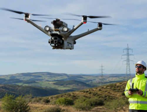
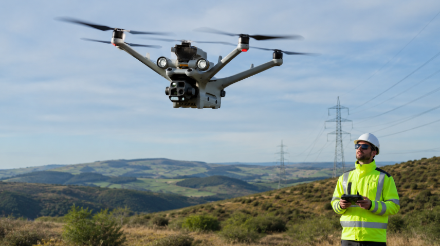
Farmers rely on them to protect crops and livestock. Rescue teams use them to find lost hikers in the woods. During utility inspections, they can detect faults in powerlines without engineers having to scale to dangerous heights.
How are they so effective? Let’s break this down, and more.
Understanding Thermal Imaging Technology
Everything around you gives off heat (even ice cubes!). The amount just varies depending on the object’s temperature. This heat is emitted as infrared radiation (IR).
Now, you can’t see infrared radiation with your naked eye. That’s because it’s on a different part of the electromagnetic spectrum. But you can “see” the heat with thermal cameras.
The Science Behind Heat Detection
Heat, or infrared radiation, is the result of atoms vibrating. The more they vibrate, the hotter the object gets. A thermal camera picks up these vibrations and translates them into an image that we can understand.
Say you’re looking at a cup of hot coffee through a thermal camera. The coffee would appear bright (indicating heat), while the table it’s sitting on would show cooler shades. And that’s how you have search and rescue teams being able to find people in low-visibility conditions including smoke, fog, or darkness.
So, how does a thermal camera turn invisible heat into a visible image?
It starts with specialized lenses that capture IR frequencies. These lenses focus the IR radiation onto a microbolometer, a sensor that detects heat. The microbolometer doesn’t need exotic cooling materials like older models did, making modern thermal cameras more affordable and accessible.
Once the microbolometer captures the heat data, it sends it to an image processor. This processor converts the heat signatures into a digital image displayed on a screen.
Interpreting Thermal Images
The beauty of thermal imaging lies in how the data is displayed. There are several color palettes to help you differentiate between temperatures:
- White Hot: Hot objects appear white; cooler areas are black.
- Black Hot: The reverse—hot areas are black, cool areas are white.
- Rainbow: Uses a spectrum of colors, with warmer hues representing heat.
High-end thermal cameras, like the Zenmuse H30T, offer up to 10 different color palettes. This flexibility helps operators pick out fine details that might otherwise be missed.

Limitations of Thermal Imaging
Some materials, like shiny metals or glass, have low emissivity, meaning they reflect heat instead of absorbing it. It takes more skill to detect them on a thermal camera. That’s compared to materials like wood, concrete, and human skin that have high emissivity, making them easy targets for thermal detection.
Environmental factors can also mess with your readings. Humidity, rain, or even a fresh coat of paint can affect the accuracy of thermal images. It’s essential to understand these aspects to get the most accurate results.
Learn about all this and more, including how to interpret the images, in our Drone Thermography Level 1 Certification course.
Components of a Thermal Drone
Drone Platform
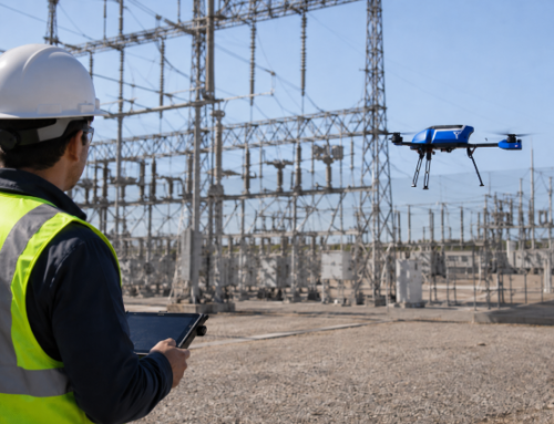
Not every drone can handle thermal imaging. You need thermal drones built for the job. These drones are designed to carry sensitive, often heavy, thermal cameras while staying stable in the air. A shaky drone means blurry thermal image. Not what you want when you’re trying to spot a gas leak or damaged section on a powerline.
Typically, the camera is mounted on a gimbal when attached to a drone. This gimbal stabilizes the image and allows for 360-degree rotation, for a comprehensive view from above.
Fixed-wing drones can cover large areas quickly, perfect for agricultural surveys. But for close-up inspections, like checking power lines or building structures, multirotor drones are the go-to. They can hover in one spot, giving you precise, detailed images.
Thermal Camera Integration
Now, let’s get into the heart of it—the thermal drone camera. There are two main ways with this:
- Thermal camera is part of the drone. It’s integrated into its structure. This camera works seamlessly with the drone’s onboard systems, without additional adjustments. Such cameras are often factory-calibrated, offering higher accuracy and better stability. These drones are usually more compact and easier to operate, making them ideal for quick deployments
- Thermal camera is fixed onto the drone as a separate payload. The camera has to be securely attached, perfectly balanced, and calibrated to the drone’s system to avoid any shaky footage or inaccurate readings. This setup provides more flexibility, as different cameras can be swapped depending on the mission requirements.
High-end drones come with built-in gimbals that stabilize the drone thermal camera. This ensures smooth, clear images, even when the drone is moving or hovering in windy conditions. But if you’re customizing your own setup, you’ll need to adjust for weight distribution. Too heavy on one side? Your drone will tilt, and that means blurry thermal data.
The camera must sync with the drone’s GPS and flight controls to collect accurate, geo-tagged thermal images. Without proper calibration, you risk missing critical details.
How To Choose A Thermal Camera Payload
Here are the key factors to consider:
- Field of View (FOV): How much of the scene can the camera within each frame? A wider FOV is excellent for scanning large areas, like forests or agricultural fields.
- Weather Resistance (Ingress Protection – IP Rating): You want to be ready for whatever Mother Nature throws your way. For flying in rain, fog, or dusty conditions, you’ll need a camera with a high IP rating. For example, an IP67 rating means the device is dust-tight and can handle being submerged in water up to 1 meter for 30 minutes.
- Spectral Band: This refers to the range of infrared wavelengths the camera can detect. Different applications require different spectral bands. Some bands are better for subtle temperature changes, while others are more suited to identifying high-heat areas.
- Thermal Sensitivity: Also known as Noise Equivalent Differential Temperature (NEDT), this measures the smallest temperature difference a camera can detect. A lower NEDT means higher sensitivity, allowing the camera to pick up even minor temperature changes. This is crucial in applications like electrical inspections, where detecting a slight temperature variation can prevent a disaster.
- Image Resolution: Higher resolution means more detailed images.
Software and Data Processing
So, you’ve got your thermal drone camera in the air, snapping heat maps. Now what? That’s where software steps in. Raw thermal images aren’t very useful unless they’re processed. Specialized programs convert the data into readable, actionable insights. Tools like FLIR Tools and DJI Thermal Analysis let you tweak temperature scales, highlight hotspots, and overlay thermal images with visual maps.
Learn more about the DJI Thermal Analysis Tool here: Thermal Imaging Best Practices For Industrial Inspections With DJI Drones
How Thermal Drones Operate
Flight Operation
Most thermal drones come equipped with GPS-based autopilot systems. This means they can follow pre-set routes with pinpoint accuracy. You can plan a flight path ahead of time, and the drone will stick to it—no drifting off course. That’s crucial when you’re inspecting large areas like solar farms or crop fields.
But it’s not all about automation. Manual control plays a big role too. You’ll need to adjust the drone’s position in real-time when inspecting specific spots, like a faulty power line or a hidden heat source in a burning building. Stability is key here, which you get in thermal drones with advanced gyroscopic stabilization.
Some drones even come with obstacle avoidance systems. Flying near buildings, trees, or other structures? The drone senses them and adjusts its path to avoid crashes.
These smart systems let you focus on capturing the best thermal data, without worrying about piloting errors.
Data Collection and Analysis
As your drone flies, the thermal camera for drone captures temperature variations across the landscape. It picks up on the smallest changes—whether that’s a warm body in a cold forest or a faulty wire overheating in a power grid. The data is also packed with metadata like GPS coordinates, altitude, and timestamps.
Once the flight is over, it’s time for analysis. Specialized software processes the thermal images, helping you highlight critical details. You can adjust temperature scales, compare heat signatures over time, and even overlay thermal data on regular maps for a complete view.
Applications of Thermal Drones
Firefighting
Thermal drones have become an asset in firefighter’s toolkit for seeing through smoke and flames. Identifying hotspots helps crews attack the fire more effectively, such as during wildfires. This data helps them position resources where they’re needed most. Fire departments also use drones when locating trapped people inside burning buildings.
Related Reading: FBI Tracks DJI Drone Pilot in LA Wildfire Crisis
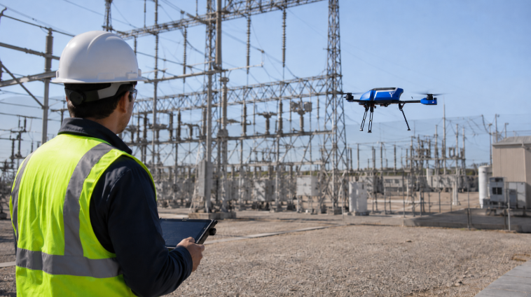
Infrastructure Inspections
Inspecting power lines, solar panels, and building rooftops is no small task. Drones with thermal cameras dentify overheating components in power grids, cracks in building insulation, and malfunctioning solar panels—all without anyone climbing a ladder.
Agriculture
Healthy crops mean higher yields, and thermal drones are helping farmers achieve just that. A thermal camera for drone can detect irrigation issues, pest infestations, and plant diseases before they become visible to the naked eye.
By spotting dry areas or unhealthy plants, farmers can adjust their irrigation systems and apply treatments exactly where needed. This precision farming saves water, reduces costs, and boosts crop health.
Search and Rescue Operations
Whether it’s a a disaster victim trapped under rubble or a rescue operation on the mountain,, thermal imaging drones can spot body heat in seconds. Unlike traditional search methods, that take time (combing through the terrain on foot), or cost loads of money (helicopter searches), emergency services now rely on these drones to locate people faster and more safely.
Advantages and Limitations of Thermal Drones
Advantages
Using a thermal drone camera gives you a serious edge. First off, these drones collect data faster and more accurately than traditional methods. You can cover large areas quickly, spotting issues like heat leaks, faulty wiring, or hidden hotspots in minutes.
Safety is another big win. Instead of sending people into dangerous situations—like climbing towers or entering burning buildings—you can send in the drone. This reduces risks and keeps crews out of harm’s way.
Plus, thermal drones work in all light conditions. Day or night, they deliver clear thermal images that reveal what standard cameras can’t.
Limitations
But drone thermal cameras aren’t perfect. For one, weather can be a problem. Strong winds or heavy rain can mess with flight stability and image quality.
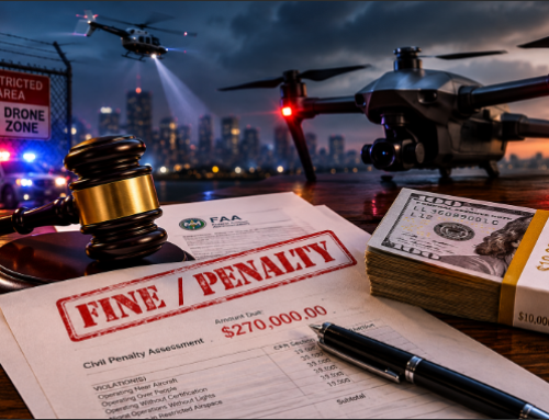
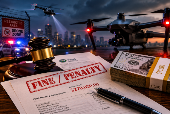
Regulations are another hurdle. Many areas have strict drone laws, limiting where and how high you can fly. You’ll need the right licenses to stay compliant.
And let’s talk costs. High-quality thermal drone cameras aren’t cheap. Between purchasing the drone, maintaining it, and training operators, the expenses can add up.
Despite these challenges, the benefits often outweigh the drawbacks, especially when accuracy and safety are priorities.
FAQs About Thermal Drones
What is the best thermal drone?
The DJI Matrice 350 RTK is a top enterprise drone that supports Zenmuse H20T and H30T thermal payloads with high-resolution cameras (1280×1024, 30fps) and features a 400x hybrid zoom with enhanced low-light performance. This drone has a 55-minute flight time, 20 km range, and IP55 rating for extreme conditions RTK navigation for centimeter-level accuracy and hot-swappable batteries make it ideal for professional thermography applications.
The SwitchBlade-Elite drone operates with a Wiris Pro thermal camera with 640×512 px resolution, a 50-minute flight time, and a 20 km range. It’s popular for forest firefighting operations, with aspects like quick deployment and wind resistance up to 40 kph.
For thermal drones where the camera is integrated into the aircraft, the DJI Matrice 30T is a leading choice with its 1280×1024 super-resolution, 41-minute flight time, and 15 km range.
See more options here: Top 14 Thermal Drones Based On Imaging Systems & Flight Performance
What are the four types of drones?
The four main types of drones are multi-rotor, fixed-wing, single-rotor helicopter, and fixed-wing hybrid VTOL.
What is the difference between a drone and a UAV?
“Drone” is a common term for unmanned aerial vehicles (UAVs); all UAVs are drones, but not all drones are UAVs, as some operate on land or underwater.
Why are thermal drones expensive?
Thermal drones are cost more than standard options due to advanced thermal imaging sensors and the sophisticated technology required to integrate these sensors with high-performance drones.
What DJI drones have thermal?
DJI drones like the Mavic 3T and the Matrice 30T have integrated thermal imaging capabilities. Models like the flagship Matrice 350 can support thermal camera payloads.
Are thermal drones legal?
Yes, thermal drones are legal in many countries. However, their use is subject to aviation regulations and privacy laws. Familiarize yourself with what your jurisdiction requires before operating one.
Can thermal drones see through walls?
No, thermal drones cannot see through walls; they detect surface temperatures and can identify heat variations on surfaces but cannot penetrate solid structures.
Can thermal drones see through trees?
Thermal drones can detect heat signatures through light foliage but struggle with dense canopies; effectiveness depends on vegetation thickness and temperature differences.