

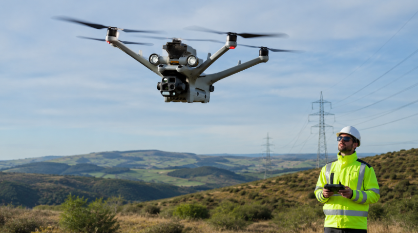
Drones with multispectral cameras capture light beyond ordinary RGB, showing details about plant health, water quality, and more. If you work in farming or environmental science, these flying sensors help you check crop health, spot stressed vegetation, and monitor ecosystems from above, all in a few clicks. In this guide, we’ll walk through some of the top drones with multispectral cameras, comparing features and how they perform.
Why Multispectral Cameras Matter for Farming & Environment
Multispectral cameras capture multiple bands of light – including wavelengths like near-infrared and red-edge – that plants and materials reflect differently than visible light. This lets you create maps and indices (like NDVI for vegetation health) to reveal things like crop vigor, soil moisture, or pollution that your eyes can’t see. For example, a multispectral drone can fly over a field and highlight which areas of corn are drought-stressed or where pests might be lurking, long before the damage is obvious. In environmental monitoring, these drones help track forest health, map invasive species, or even monitor water quality in wetlands by detecting algae blooms or vegetation changes. You get data-driven insights to make smarter decisions, whether you’re a farmer fine-tuning fertilizer use or a researcher surveying a coastline.
Top 8 Multispectral Drones in 2025
1. DJI Mavic 3 Multispectral – Portable Precision for Crops
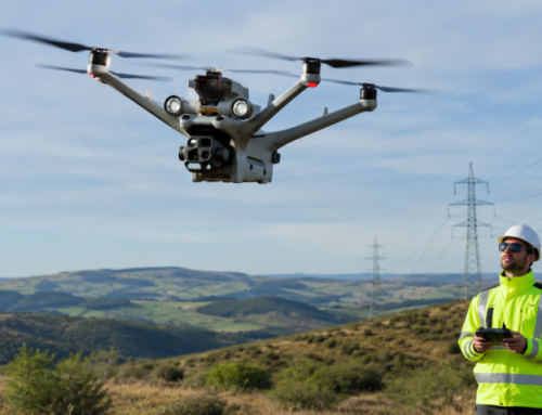
For a compact drone that doesn’t skimp on sensor power, the DJI Mavic 3 Multispectral (Mavic 3M) is hard to beat. This foldable quadcopter weighs under 1 kg, yet it carries a full multispectral payload. It has four 5-megapixel multispectral cameras (green, red, red-edge, near-infrared) plus a 20 MP RGB camera. That means it captures both standard photos and the “invisible” spectra in one flight. Notably, DJI skipped the blue band on the Mavic 3M, focusing on the core bands most needed for crop indices. The result is a streamlined system aimed at precision agriculture.

Performance and Features
The Mavic 3M boasts up to 43 minutes of flight time, far outlasting older models like the Phantom 4M’s 27 minutes. In perfect conditions, that lets you survey roughly 200 hectares (about 500 acres) on one battery. It also includes an RTK module for centimeter-level positioning accuracy, so your maps are extremely precise. Users love that it’s compact and foldable, making it easy to transport between fields. The built-in sunlight sensor and automated flight planning (via DJI Terra or the SmartFarm platform) ensure you get consistent data every time.
Use Cases
This drone is built with farming in mind. You can scout crops for nutrient deficiencies or pest hotspots by generating NDVI or NDRE maps on the fly. Or orchard mapping on rolling hills, since terrain-follow mode and obstacle sensors help it handle sloped vineyards with ease. Beyond agriculture, the M3M has been used for environmental surveys, like monitoring forest health and urban green spaces. Its high-resolution RGB camera (with a big 4/3” sensor and mechanical shutter) also doubles for regular mapping and even 3D modeling tasks.
What Users Are Saying:
One surveyor was very impressed after a month of fieldwork. He noted the image quality was excellent even in low winter light, thanks to the larger sensor and smart exposure controls. Compared to older drones, users highlight the Mavic’s convenience and efficiency – no need to lug a big case or spend time changing batteries frequently. Farmers also appreciate that it’s more affordable than previous generation multispectral rigs. At around $5,000, it’s considered a cost-effective all-in-one package for serious crop scouting.
All in all, the Mavic 3M quickly became a favorite for precision farming since its launch in November 2022. Delivering pro-grade data in a user-friendly form factor, at a favorable price point, enables the drone with multispectral camera to still still command its spot at the top in 2025.
2. DJI Matrice 350 RTK (with Multispectral Payload) – Heavy-Duty Versatility
If you have huge areas to cover or need a custom sensor setup, the DJI Matrice 350 RTK is the industrial-grade solution. Now, out of the box, the Matrice 300/350 series doesn’t include a multispectral camera – it’s essentially a powerful drone platform. But that’s the point: it can carry a variety of payloads, including advanced multispectral sensors like the AgEagle/MicaSense RedEdge-P or Altum-PT. In fact, the RedEdge-P (a 5-band + panchromatic pro sensor) is fully compatible with the Matrice 350. By mounting such a camera, the Matrice becomes a high-end multispectral beast. This setup is popular with research institutions and large agribusinesses that demand top-tier data quality.
Performance and Features
The Matrice 350 RTK is built for endurance and power. It boasts 55 minutes of max flight time (no payload) and still a very long time even with heavy cameras. It’s a tough, weather-resistant hexacopter that can fly in wind and light rain, so you can survey fields in less-than-ideal conditions. With hot-swappable batteries, you can land and swap packs without powering down, then resume the mission – effectively giving continuous operation. The RTK on board provides pinpoint positioning for mapping. A key advantage is the high payload capacity (~2.7 kg, meaning you could carry a multispectral camera and another sensor (like a thermal camera or high-res RGB) at the same time. This modular approach offers flexibility that smaller drones can’t match. However, with great power comes complexity: the Matrice isn’t a beginner drone. It requires trained operation and more logistics (it’s big and not cheap).
Use Cases
Large-scale farming operations and environmental surveys over wide areas are where the Matrice shines. Think of surveying a 5,000-acre plantation or mapping an entire wildlife reserve. With the right multispectral camera attached, it can generate ultra-detailed crop health maps, moisture indices, or even multispectral 3D models for research. Conservation teams have used Matrice drones to carry not just multispectral sensors but also LiDAR or infrared, creating a one-flight solution for complex environmental monitoring missions. It’s also employed in forestry (for tree health and inventory) and coastal management (e.g., mapping coral health with special cameras). Basically, if the project is big or demands custom sensors, a Matrice can probably do it.
What Users Are Saying
Because the Matrice 300/350 is a high-end platform, you mostly hear from enterprise users. They often comment on its rock-solid reliability and the quality of data when using professional sensors. That’s in addition to the industry-leading flight time and a modular payload system. The ability to swap cameras is a huge plus. On the downside, folks acknowledge the premium price point and training required. It’s a heavy lifter for multispectral tasks – but it’s only the right choice if you truly need that power and are prepared to handle a bigger drone.
Explore the future of forestry management with cutting-edge drone technology🌲
— DJI Enterprise (@DJIEnterprise) October 4, 2023
Join Biodrone and Allskog SA on a journey as they discuss how the DJI Matrice 350 RTK has transformed the way that they manage forests in Norway.
View the full video here 👉 https://t.co/DPJ5ZVpnN3 pic.twitter.com/lfsFBw5B6S
3. AgEagle (senseFly) eBee X – Fixed-Wing for Large Areas
When it comes to surveying huge areas efficiently, fixed-wing drones like the AgEagle eBee X are in a league of their own. The eBee X (originally by senseFly, now under AgEagle) is a lightweight flying wing that specializes in mapping hundreds of acres in one go. It doesn’t come with a built-in camera by default – instead, it supports interchangeable payloads including multispectral cameras like the Parrot Sequoia+ or MicaSense sensors. In an “Ag” package, it’s often bundled with the Sequoia+ multispectral camera. The fixed-wing design gives it incredible range and efficiency, making it perfect for large farms or environmental surveys.
Our #MicaSense cameras and #eBee drones were showcased worldwide, supporting industries like #agriculture, urban planning, #publicsafety w/ reliable aerial data
— AgEagle Aerial Systems (@AgEagleUAVS) June 6, 2025
Thanks to our partners
✔️JapanDrone @Jepico_official
✔️DroneShow @santiagoecintra
✔️Export Smart Cities @eCompass_SAS pic.twitter.com/Hs8qvbn82f
Performance and Features
The eBee X can fly up to 55–90 minutes on a single battery (depending on battery options). That endurance is huge – we’re talking the ability to cover hundreds of hectares in one flight. It’s also designed to be simple to launch (hand throw) and land (belly lands on a field or pad). Weighing about 1.5 kg, it’s quite light for its wingspan. With RTK/PPK add-ons, it can achieve survey-grade accuracy (down to ~1.5 cm, no ground control points required). Wind resistance is decent for a small plane (around 10 m/s), but obviously a fixed-wing can’t hover – you need space to take off and land. The trade-off for covering large areas is that fixed-wings are a bit less flexible in small spaces. The eBee’s autopilot and software allow automated grid flights, and you can monitor it from a tablet as it cruises overhead. A nice feature is the “Endurance” extension option which lets you swap in a more capacious battery for those 90-minute marathon flights.
For its modular sensors you can choose from a lineup: S.O.D.A., S.O.D.A. 3D for 3D reconstructions, Aeria X (RGB), thermal (Duet T), and multispectral options like MicaSense RedEdge or Parrot Sequoia+, as well as the dual-purpose Duet M that captures both RGB and multispectral. Weighing just 1.5–1.6 kg, fits under 2 kg regulations, approved for BVLOS and flights over people in the US, Canada, and EU (C2/C6). It has a shock-absorbent fuselage, easy to fix or swap parts on-field, and comes with a portable backpack kit and smart batteries.
Use Cases
The eBee X (and its agriculture-specific sibling eBee Ag) are ideal for large-scale crop monitoring. For example, a large corn or sugarcane farm in the Midwest can use an eBee to map the entire property quickly, then generate NDVI maps to see where to apply fertilizers or check for pest issues. Fixed-wings are also loved by conservation and surveying professionals. People use eBees for coastal mapping, wetland monitoring, forestry surveys (covering large forest blocks for health or carbon stock assessments), and even disaster management mapping (where you need to quickly map a floodplain or wildfire area).
Belgium-based DIDEX deployed the eBee X with a MicaSense RedEdge‑P sensor for high-res 3D multispectral surveys of experimental pear orchards (~15 acres per field). Flying in challenging weather, they achieved 2 cm pansharpened resolution without needing a separate RGB camera. The multispectral plus depth data enabled NDVI/NDRE mapping, tree‑by‑tree yield models, and precision root‑pruning strategies—all in a single streamlined mission.
In Soum, Burkina Faso, Burkina Faso Flying Labs used the eBee X equipped with the Aeria X RGB camera for a massive 1,000‑hectare (2,470‑acre) irrigation survey. Within just three flight days (plus three of post‑processing), they produced detailed orthomosaic maps with 4 cm GSD. This approach slashed survey costs by 80% compared to traditional topographic methods, and helped design irrigation schemes reaching over 5,000 households—setting the stage for a national rollout on 30,000 ha of irrigated land.
Essentially, whenever you have vast land to cover and need multispectral or high-res imagery, a fixed-wing like the eBee is the go-to. It’s also worth noting these drones often produce very uniform data – flying in straight lines at steady altitude yields consistent imagery great for scientific analysis.
What Users Are Saying
Users often gush about the area coverage. “Covers large areas efficiently” and “unmatched 90-minute flight time” are common praises. Agronomists who manage vast fields say the eBee X saves them days of work – what might take a week of walking or a manned aircraft can be done in an afternoon.
The versatility to swap cameras (multispectral, RGB, thermal) is another plus; one drone can serve multiple projects. Hand launch, automated eMotion software missions, and belly landings simplify field work.
On the flip side, new users note there’s a learning curve. Flying a fixed-wing isn’t like flying a DJI with pause and hover; you must plan carefully. This kinds of drones require a larger launch space and higher learning curve compared to quadcopters. Also, the initial cost is high (often $15K+ for a full kit). So, some small operators hesitate. However, those who invested generally feel it’s worth it for the capability. In summary, the eBee X is celebrated as a mapping powerhouse for professionals – perfect for big farms and serious surveys – but you’ll need to commit time and money to get the most out of it.
4. WingtraOne Gen II – VTOL Mapper for Precision Surveys
Another fixed-wing worth mentioning is the WingtraOne Gen II, a hybrid VTOL that combines the range of a plane with the vertical takeoff of a copter. (This gives it a unique edge in mapping and environmental monitoring, so we’ll include it here.) The WingtraOne takes off and lands vertically like a helicopter, then transitions to fast forward flight like an airplane.
It can carry high-end sensors, including the MicaSense RedEdge-P multispectral camera, which offers five narrow bands plus a panchromatic channel for ultra-sharp multispectral images. This means you get both the convenience of easy launch and the efficiency of a fixed-wing – a great combo for precision surveys.
Performance and Features
The WingtraOne Gen II boasts up to 60+ minutes of flight time with payload, allowing it to map large areas (hundreds of acres) per flight. Thanks to VTOL, it doesn’t need a runway or hand launch – you can operate it from a small clearing. It’s equipped with PPK GNSS for survey-grade accuracy, often achieving down to 1 cm accuracy on outputs with proper ground control. WingtraOne can fly higher and cover more ground per image capture than many drones, in part because it often uses a high-res camera (like a 42 MP RGB or the RedEdge multispectral). It’s also built with safety features and a robust design to handle field conditions. On the flip side, it’s a sizable investment and a larger craft, so transporting it requires a case and some care (though it’s designed to be fairly portable for its size).
Use Cases
WingtraOne is popular in both agriculture/environment and surveying. In agriculture, it can map entire farms or research stations with multispectral data for crop health and variability analysis. Because it can carry a top-tier multispectral sensor, researchers use it for detailed plant science studies and breeding trials – the high resolution helps even with small research plots. Environmental use is big: Wingtra drones have been used to track invasive species spread over large natural reserves, and to monitor reforestation efforts and wetlands with multispectral and even LiDAR payloads.
A standout example of WingtraOne’s environmental impact comes from the collaborative work between the University of Vermont Spatial Analysis Lab and Mississippi State University. Faced with the challenge of monitoring invasive aquatic plant species (like phragmites, water chestnut, and yellow floating heart) across hard-to-reach wetlands in Vermont and New York, these teams used Wingtra drones to collect massive amounts of high-resolution aerial data from May to October 2024. Over 119 flights, they gathered 163 datasets at six sites—making it easy to train both their research team (ten people learned to fly the drones) and sophisticated AI models to identify and track these problem species. The WingtraOne’s efficiency, versatility, and user-friendly design meant even newcomers quickly learned to plan, fly, and collect RGB and multispectral imagery. This project proved that with the right drone platform, it’s possible to monitor environmental threats efficiently, even in places you can’t reach on foot or by boat.
Down in South Africa, NatCarbon Africa and Imperative Global have been using the WingtraOne and its cloud platform, WingtraCLOUD, to fast-track a massive revegetation project. Their goal is to restore nearly 10,000 hectares with native Spekboom plants—a vital step for carbon capture and biodiversity. Thanks to the Wingtra system, the team managed to map 4,200 hectares in under seven days (that’s about 600 hectares a day!), slashing planning time and boosting productivity by a whopping 70%. Geospatial Field Team Lead Talitha Venter highlighted how features like real-time team syncing, quick field setup, and smart flight planning made it simple for her team to coordinate and execute flights without repeat missions. The easy-to-use technology meant the NatCarbon team could keep everything in-house, empowering staff to build new skills as they captured baseline data for future reforestation work. Wingtra’s platform made the entire process smoother, faster, and far more scalable, allowing them to focus more time on the land itself and less on logistics.
The combination of VTOL and long endurance particularly shines in hard-to-access areas (imagine mapping a marsh where launching a regular plane is impractical – Wingtra can take off from a boat or a tiny patch of dry land, then cover the whole marsh). It’s also used in mining and construction surveys, but those typically use RGB or LiDAR; for our focus, the Wingtra with RedEdge-P is all about advanced multispectral mapping for science and large-scale resource management.
What Users Are Saying
WingtraOne users often highlight the ease of use despite its complexity. They like that you don’t have to hand-launch a fixed-wing (which can be nerve-wracking) – the VTOL makes it feel safer and more accessible.The NatCarbon Africa team reported that using WingtraOne and its data management software improved their project productivity by 70% compared to manual methods. They flew thousands of hectares in a week, something impossible by ground surveying. The quality of the imagery (especially with a camera like RedEdge-P or a 42MP sensor) draws praise – you get very high detail maps. On the downside, the price is high – easily $20K+ for the drone and sensor package. It’s usually an organizational purchase rather than an individual farmer’s. Some users mention that while it’s user-friendly for its class, you still need training to operate such a sophisticated drone effectively and to process the large datasets it produces. Overall, WingtraOne is regarded as a premier solution for professional mapping. In 2025, it’s one of the go-to drones when precision and coverage are paramount, especially in environmental and geospatial applications where multispectral data is merged with other data for rich insights.
5. Yuneec H850-RTK (with LaQuinta DB2 Vision Multispectral) – Hexacopter Workhorse for Custom Mapping
The Yuneec H850-RTK is a powerhouse hexacopter built for enterprise users, which includes professionals in agriculture and environmental monitoring. With six rotors, dual RTK GNSS modules, and a hot-swappable battery system, this drone is designed to keep flying even if one motor fails—making it a reliable choice for long, challenging missions.
Performance and Features
You get up to 65 minutes of flight time and the ability to carry up to three payloads at once. The controller is feature-rich, offering a 7-inch HD display and secure, long-range communication (up to 15 km). With the H850-RTK, everything is stored locally, so you don’t have to worry about sensitive information being uploaded to the cloud. It’s a versatile, rugged drone built for demanding conditions, whether you’re working over fields, forests, or wetlands.
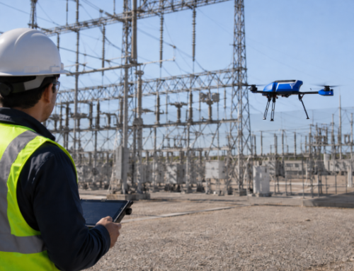
Pair the H850-RTK with payloads like the LaQuinta DB2 Vision camera for multispectral capabilities. The LaQuinta DB2 Vision captures four tightly-calibrated bands—blue, green, red, and near-infrared—making it perfect for generating NDVI, monitoring crop health, and detecting plant stress. It features an onboard irradiance sensor to ensure accurate reflectance measurements, even as sunlight changes. Full RTK geotagging ensures that every image is mapped with precision.
The lightweight payload integrates smoothly, and the drone’s triple-payload support means you can fly multispectral, thermal, and RGB sensors together, layering your data for deeper insights. The camera’s compatibility with major processing platforms (like Pix4D and Agisoft Metashape) makes turning aerial data into actionable maps a breeze.
Use Cases
In the field, the Yuneec H850-RTK is quickly earning fans among agronomists, conservationists, and environmental researchers. Its long endurance and payload flexibility let you scan huge farms, map stress across thousands of acres, or monitor forest recovery and riparian health all in one flight. Universities and agricultural service providers are using it to perform regular NDVI flights, scout for pest outbreaks, or even monitor livestock with thermal cameras. The open payload design means you can switch sensors as your research needs evolve, making the H850-RTK a future-proof investment.
What Users Are Saying
Operators praise the H850-RTK for its reliability, especially in tough weather and on large properties. They love the peace of mind that comes with six rotors and dual batteries—you’re covered even if something goes wrong mid-flight. Users also appreciate the flexible payload options and strong data privacy, which can be a game-changer for public agencies or research teams with strict requirements. Some note that, compared to DJI, the Yuneec platform is a little less “plug-and-play” and the accessory ecosystem is smaller, so a bit of technical know-how is helpful when setting up custom sensors or advanced workflows. Still, the majority of users feel that the extra flexibility and robust construction more than make up for these minor tradeoffs.
6. DJI Phantom 4 Multispectral – Older, Trusted Workhorse for NDVI
Note: While the DJI Phantom 4 series, including the Multispectral version, is no longer in production, it may still be available for purchase as new or used stock from third-party retailers or through open box sales. DJI itself has ended official support for the Phantom 4 series, including the Multispectral, as of June 1, 2025.
The Phantom 4 Multispectral (P4M) is the elder statesman of multispectral drones – and it’s still going strong on farms and research plots. Launched in 2019, this drone looks like the classic white Phantom but packs a 6-camera array (one RGB and five monochrome sensors for blue, green, red, red-edge, NIR) built into its belly. It was revolutionary for integrating multispectral imaging so seamlessly back then, and many professionals still rely on it for highly accurate crop health analysis.
Performance and Features
The Phantom 4M offers about 27 minutes of flight time and uses DJI’s older airframe – not foldable, a bit bulky by today’s standards. It does include an RTK module for centimeter-precision mapping, which is great for research and detailed surveys. The multispectral cameras are 2 MP each (lower resolution than the Mavic 3M’s sensors) and its visible camera is 2 MP as well. While those specs sound modest, it’s tuned for capturing NDVI and similar indices accurately. This drone can produce NDVI maps that professionals trust for pinpointing plant stress. It’s also easy to deploy – just power up and go, with DJI’s software handling the data capture.
Use Cases
The Phantom 4M has been a staple for farmers, agronomists, and researchers. It’s commonly used to analyze plant stress, optimize irrigation, and even count plants in field trials. Environmental scientists have flown it to monitor wetland vegetation and forest canopy changes, since the multispectral data helps differentiate species and health conditions. Its strength is definitely in vegetation indices (like NDVI) – in fact, it’s often called the reference platform for NDVI mapping due to its integrated design. An asset for professionals needing highly detailed crop data,” especially when paired with DJI’s ecosystem for processing.
What Users Are Saying
Many users still see the P4M as a great option for getting started with ag work, praising its decent sensor and the simple workflow for generating maps. It’s often recommended to newcomers in precision ag who want real NDVI without breaking the bank. On the flip side, some experienced flyers acknowledge that the Phantom 4M is showing its age in 2025. It’s larger to carry around and has shorter flight time compared to newer models.
For all its reliability, it’s not as efficient or high-resolution as the latest gear, and the price (~$6K–7K) is actually higher than the newer Mavic 3M. Still, if you value a proven platform and need that extra blue band data, the Phantom 4 Multispectral remains a trusted workhorse that “provides highly accurate crop health insights” as advertised.
Choosing the Right Drone with Multispectral Camera for You
As you can see, there’s no one-size-fits-all when it comes to drones with multispectral cameras – each of these top picks shines in different ways. For those needing portability and efficiency on moderate-sized farms, the DJI Mavic 3 Multispectral stands out as a sweet spot – it’s cutting-edge yet user-friendly, packing the latest tech into a compact drone.
On the other hand, if you’re managing huge acreage or conducting advanced research, the fixed-wing eBee X or VTOL WingtraOne will cover more ground in a single flight than any quadcopter, albeit with more investment and training. These are favored by agronomists and environmental scientists who value that expansive coverage and data quality. For maximum flexibility and mixed missions, consider the Matrice 350 RTK or Yuneec H850 RTK – they let you swap cameras and tackle multispectral mapping one day, then thermal inspection or photogrammetry the next. Just keep in mind they come with higher complexity (and cost) to match their versatility.
In choosing your drone, consider the size of your project, your budget, and how much technical complexity you’re comfortable with. A farmer with 50 acres might prioritize ease-of-use and price, whereas a researcher mapping an entire forest will prioritize flight endurance and sensor quality. All the drones in our list have proven their worth in 2025, from boosting crop yields with precise data to safeguarding natural habitats.
FAQs About Drones with Multispectral Camera
Why are multispectral cameras important in farming and environmental work?
Multispectral cameras matter because they let you spot plant stress, disease, or even pollution before it’s visible to the naked eye. By analyzing reflected light in bands like near-infrared and red-edge, you get maps and indices that guide smarter decisions—whether you’re optimizing crop yields or tracking forest health.
Which are the best drones with multispectral cameras in 2025?
Some of the best options in 2025 include:
- DJI Mavic 3 Multispectral
- DJI Matrice 350 RTK (with a multispectral payload)
- AgEagle (senseFly) eBee X
- WingtraOne Gen II
- Yuneec H850-RTK (with LaQuinta DB2 Vision Multispectral)
- DJI Phantom 4 Multispectral (still used, but no longer in production)
Each model suits different needs, from small farms to big research projects.
How does the DJI Mavic 3 Multispectral stand out?
The DJI Mavic 3 Multispectral stands out for its compact size, long flight time (up to 43 minutes), and ability to capture both standard and multispectral data in one flight. It’s very user-friendly, portable, and great for farmers or anyone needing professional data without a steep learning curve.
Who should consider the DJI Matrice 350 RTK for multispectral work?
You should consider the DJI Matrice 350 RTK if you’re managing large-scale operations or need to customize your drone with different sensors. It’s a heavy-duty platform popular with research institutions and big farms, offering long flight times and the flexibility to carry multiple cameras.
What makes the AgEagle (senseFly) eBee X ideal for large areas?
The AgEagle (senseFly) eBee X is ideal for huge fields because it’s a fixed-wing drone that flies for up to 90 minutes, covering hundreds of hectares in one go. It supports various sensors—including multispectral—so you can tailor it to your mapping or research needs.
Why might I pick the WingtraOne Gen II?
You might pick the WingtraOne Gen II if you want the range of a plane with the convenience of vertical takeoff and landing (VTOL). It’s perfect for precision surveys in tricky terrain or large-scale environmental projects, and it can carry top-tier multispectral sensors for highly detailed mapping.
How flexible is the Yuneec H850-RTK with LaQuinta DB2 Vision Multispectral?
The Yuneec H850-RTK is incredibly flexible, letting you fly multiple payloads—including multispectral, RGB, and thermal—at once. Its robust build, long endurance, and secure data storage make it popular for professionals who need reliability and customization.
Is the DJI Phantom 4 Multispectral still worth buying in 2025?
The DJI Phantom 4 Multispectral is still a solid choice if you want accurate NDVI maps and a straightforward workflow, especially for smaller farms or research plots. However, it’s a bit bulky and has shorter flight times compared to newer models, and it may only be available as used or leftover stock.
What should I consider when choosing a drone with multispectral camera?
When choosing your drone, you should think about your project size, budget, and how comfortable you are with technology. Small to mid-size farms might prefer user-friendly and affordable drones, while researchers with big areas need longer flight times and higher-end sensors. Flexibility and future-proofing (ability to swap cameras or expand features) are also good to keep in mind.
How does multispectral imaging help with crop management?
Multispectral imaging helps you monitor crop health, spot disease or drought stress early, and fine-tune fertilizer or irrigation. This leads to better yields and more efficient resource use.
Can multispectral drones be used outside agriculture?
Absolutely! Multispectral drones are widely used in environmental monitoring, forestry, wetland surveys, water quality checks, and even disaster management. Anywhere you need to see beyond the visible, these drones deliver.
What’s the difference between fixed-wing and quadcopter multispectral drones?
Fixed-wing drones like eBee X or WingtraOne cover more ground per flight and are best for very large areas. Quadcopters like the DJI Mavic 3M are easier to launch and land in tight spots, and are often more beginner-friendly.
Do I need special training to fly a drone with multispectral camera?
Yes, some models—especially fixed-wing and heavy-duty platforms—require training to operate safely and make the most of the technology. However, many newer quadcopters are designed for quick learning with automated flight planning.
How do I process and use the data from multispectral drones?
Most drones are compatible with popular mapping and analysis software. After your flight, you simply upload the images, process them into maps, and get actionable insights—like where to water, fertilize, or monitor further.
