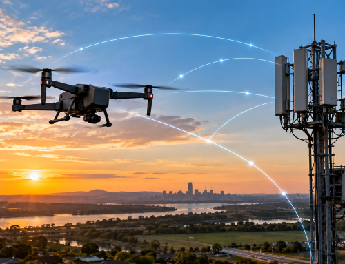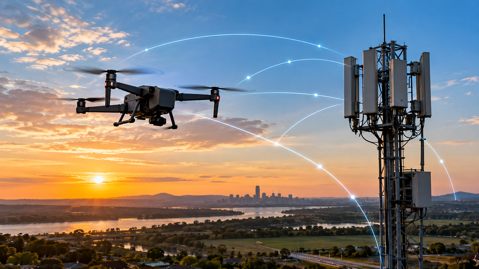
A drone can carry a sharp camera, bright lights and accurate sensors, yet still fail an inspection for a very simple reason. The pilot can no longer communicate with it.
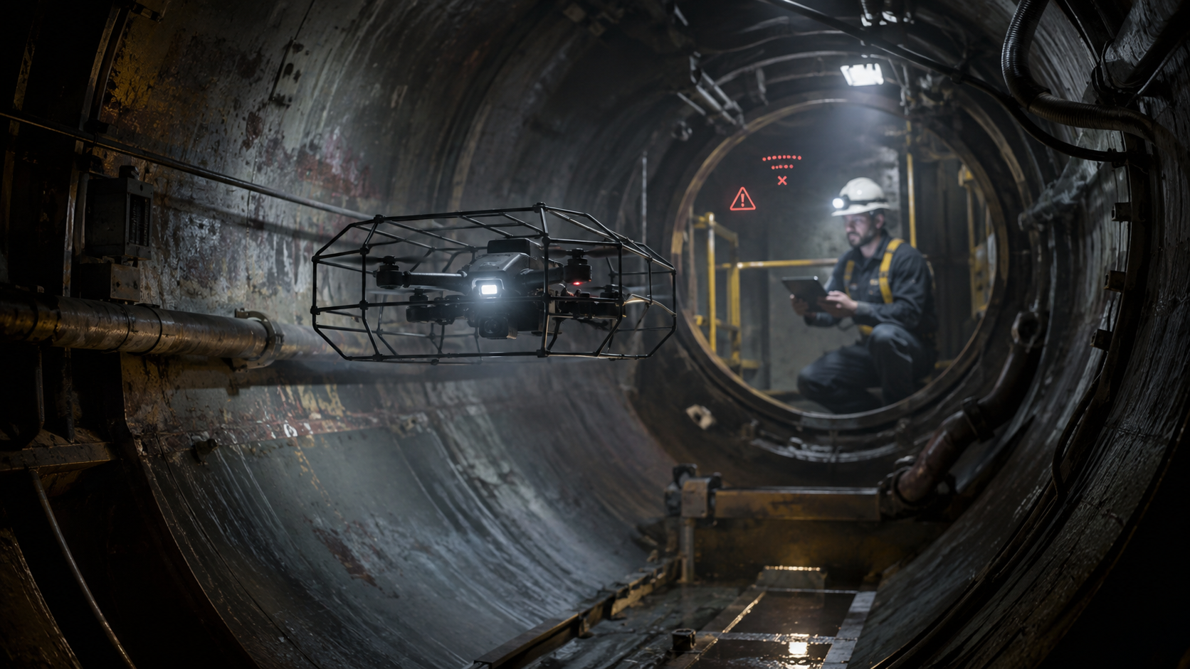
That problem becomes especially serious inside storage tanks, boilers, chimneys, mines, tunnels, ship compartments and other enclosed industrial assets. Walls block the direct radio path. Steel reflects the signal. Corners place the aircraft behind several layers of structure. Global navigation satellite signals are weak or absent. The pilot may lose the live video feed, control commands and telemetry at the same moment.
An outdoor consumer drone may respond by climbing and flying in a straight line to a recorded home point. Inside an asset, that action could send it into a roof, pipe, beam or wall. A safer response must be designed around the route the aircraft has already flown and the geometry around it.
On 4 August 2026, Terra Drone announced a Signal Recovery Feature for its Terra Xross 1 indoor inspection drone. The aircraft is designed to move back toward an area where the control connection was available after communication is lost. Terra Drone developed the function through the Nippon Foundation and DeepStar programme, using operational input from Chevron and Shell.
This points to a broader standard that inspection teams should expect. Good inspection hardware should not only collect useful data when everything works. It should behave in a clear, repeatable and safe way when something goes wrong.
Signal Loss Is A Safety Event
A lost signal is sometimes treated as a brief inconvenience. In an industrial inspection, it can affect the aircraft, the asset, the data and the people responsible for recovery.
The control link carries commands from the pilot to the aircraft. The return link carries video, position estimates, battery information, warnings and other telemetry. Some systems may lose video before command input. Others may lose both. Either case reduces the pilot’s awareness at the point where the aircraft may be furthest from the access opening.
The Drone May Become An Obstruction
A small aircraft stuck inside a vessel is not merely lost equipment. It may delay the inspection, block a process, contaminate a product area or create a foreign-object concern. The site may then need a separate retrieval plan. In the worst case, a person may have to enter the same area the drone was meant to inspect remotely.
That possibility matters because confined spaces can contain hazardous atmospheres, engulfment risks, trapping geometry, exposed machinery, electrical hazards and heat. OSHA’s confined-space guidance groups permit-required spaces around these types of serious conditions. A drone does not remove every site hazard, but it can reduce the need to place a worker inside solely to collect visual data.
The Inspection Record May Become Incomplete
Signal loss can also damage the value of the inspection without damaging the aircraft. Video may stop before a critical weld, corrosion patch or internal component is recorded. The team may not know whether the missing area was inspected but not transmitted, or never reached at all. If the route is not mapped against the captured footage, a reviewer can be left with a gap that is difficult to explain.
A useful recovery system therefore has two jobs. It should protect the aircraft, and it should preserve a traceable inspection record. The flight log should show when the connection weakened, when the automatic response started, how far the aircraft travelled during recovery and where the pilot regained control.
What Terra Drone Added To The Terra Xross 1
Terra Drone describes its new feature as an automated safety mechanism. When the aircraft disconnects from the controller, it moves back to recover the link rather than continuing deeper into the structure or waiting indefinitely.
The Aircraft Flies Back To Recover Communication
The key idea is local recovery, not a full return to the takeoff point. The drone moves back toward the part of the route where communication was last available. Once the link returns, the pilot can assess the aircraft’s position and decide whether to continue, withdraw or adjust the mission.
That approach fits indoor work because the last connected section is normally on a path the aircraft has already passed through. A known route is usually safer than a new straight-line command through an environment filled with obstacles.
The Feature Sits On An Indoor Inspection Platform
The recovery function is part of a platform built for dark and GPS-denied spaces. The Terra Xross 1 product information lists real-time 3D mapping, a 4K camera with 180-degree vertical tilt, LED lighting, cloud-based data management and a tethered power option.
When the drone launched in January 2025, Terra Drone said it used visual odometry and LiDAR to support stable indoor flight. The company listed a price below US$25,000 and said that was about one-third of the price of existing indoor inspection drones at the time. The tether module was presented as a way to provide continuous power and reduce the chance of a battery-depletion crash during long inspections. These are manufacturer figures, so a buyer should confirm current pricing, configuration and operating limits before purchase.
Terra Drone’s 2026 announcement also reports a portfolio of more than 3,000 projects worldwide. In a 2025 interview, a company director said the team had completed more than 1,500 inspection projects. That field exposure helps explain the focus on a problem that often appears only after operators start sending aircraft deeper into real assets.
What Causes Signal Loss Inside Industrial Assets
Indoor signal problems are rarely caused by distance alone. The route, materials, machinery and aircraft orientation can matter as much as the number of metres between the pilot and the drone.
Metal, Concrete And Corners Distort Radio Links
Radio energy can be absorbed, blocked or reflected. A tank wall may prevent a direct path between the antennas. Steel beams and machinery can create several reflected paths that arrive at slightly different times. Those copies of the same transmission may reinforce one another in one position and cancel one another a short distance away.
This effect is known as multipath. NIST measurements in large building structures documented both signal attenuation and multipath distortion in broadband wireless channels. In practical terms, a drone can move from a usable connection to a weak one after passing a corner, dropping behind a steel plate or changing its antenna angle, even when the extra travel distance is small.
Liquids can also affect radio propagation, while reinforced concrete places dense material and metal reinforcement between the operator and aircraft. In active plants, motors, drives, transmitters and other equipment may add electrical noise. The exact effect depends on frequency, output power, antenna design and the facility itself.
GPS Denial Removes A Familiar Backup
Most outdoor drones use satellite positioning for location, hovering and return functions. Inside a tank or below ground, satellite signals may not reach the aircraft. The drone must estimate its movement through other sensors such as LiDAR, cameras, inertial units and simultaneous localisation and mapping.
These systems can work well, but each has limits. Cameras may struggle in darkness, dust, steam or a surface with few visual features. LiDAR can provide geometry in poor light, though dust, reflective surfaces and tight structures may still complicate perception. Inertial estimates drift over time if they are not corrected by another reference.
A lost-link feature therefore depends on more than radio software. The aircraft must know where it has been well enough to move back along a safe route when the pilot cannot see the live feed.
Equipment Condition Can Reduce Range Before Takeoff
A damaged antenna, loose connector, worn cable or poor ground-station placement can reduce the link margin before the aircraft enters the asset. This is easy to miss because the system may appear normal at close range.
Manufacturer checks provide useful examples. Flyability’s transmission-system procedure places the aircraft and control equipment about 3 metres, or 10 feet, apart and compares received-signal-strength readings. For the system covered by that guidance, a difference greater than 20 dBm between paired readings is treated as a fault and the operation should stop. The exact thresholds vary by product, but the principle is universal. Test the complete transmission chain, not only the aircraft.
The Right Lost-Link Behaviour Depends On The Space
There is no single response that is safe in every setting. The best action depends on the mission route, nearby obstacles, available positioning data, battery state, air movement and the consequences of landing at the current point.
| Lost-Link Response | Potential Benefit | Main Indoor Limitation |
|---|---|---|
| Hold Position | Avoids an immediate movement into an unknown area. | The aircraft may drift, consume battery or remain beyond recovery range. |
| Land In Place | Ends the flight before the battery is depleted. | The landing surface may be unsafe, inaccessible or damaging to the asset. |
| Direct Return To Home | Works well in open air with reliable positioning. | A straight route may intersect walls, beams, pipes or ceilings. |
| Climb To Recover Signal | Can improve line of sight in some outdoor missions. | Vertical movement may cause an immediate collision indoors. |
| Retrace A Known Route | Uses a path that was already flown successfully. | Requires reliable route recording, positioning and obstacle awareness. |
| Move Back To The Last Connected Area | Targets the shortest practical recovery of communication. | The system must identify the connection point and control the return without pilot input. |
Predictable Behaviour Matters More Than A Clever Surprise
A recovery function should do what the operator expects every time. Transport Canada’s 2025 guidance on command-and-control reliability says lost-link behaviour should be predictable, understood by the operator and selected for the specific concept of operations. It gives examples such as returning home, landing at a designated location or increasing altitude, while making clear that the suitable choice depends on the operation.
The guidance also calls for the behaviour and any required preflight configuration to be documented in the operating instructions. That is a valuable principle for indoor work, even when the flight is taking place outside ordinary aviation airspace. Your team should know the trigger, delay, speed, path logic, battery requirement, stopping condition and point at which manual control returns.
A Good Recovery System Needs More Than One Feature
A product label can make signal recovery sound like a single software switch. In practice, several systems must work together.
Reliable Route Memory
The drone needs a usable record of its travelled path. A simple list of positions may be enough in a clear tunnel. A complex boiler or tank may require a richer 3D map that shows openings, beams and restricted passages. The recorded path also needs enough accuracy for the return flight, not only for drawing a map after landing.
Local Obstacle Awareness
The route that was clear five minutes ago may no longer be clear. A hanging cable can move. Dust can reduce perception. Workers may reposition equipment near the access point. A capable system should identify obstacles during recovery and either stop or make a controlled adjustment without abandoning the known route.
A Battery Margin Based On The Return Route
Battery percentage alone is not enough. The aircraft may show 30 per cent remaining but still be too far inside the asset to return safely after a signal interruption. The system should estimate the energy needed to retreat along the actual route, with a reserve for hovering, obstacle checks and more than one recovery attempt.
Flyability’s current Elios 3 software takes this approach through a flight-time management gauge that estimates the energy needed for a return path. Its indoor autonomy information also describes Return to Signal, which retraces a recorded trajectory until the video connection returns, and Smart Return-to-Home, which uses an accumulated 3D map to calculate a safe route to the takeoff area.
A Clear Handover Back To The Pilot
The operator should not have to guess whether the aircraft is still in automatic recovery. The control screen should show that signal loss was detected, identify the active mode, display the return progress when telemetry is available and confirm when manual control is restored.
The handover also needs sensible control blending. A sudden switch from automated movement to full manual input can surprise the pilot. A brief stabilisation pause after reconnection may provide time to review the camera feed, battery state and aircraft orientation.
Useful Logs For Review
Every lost-link event should produce data that can be reviewed. Useful fields include signal strength before disconnection, aircraft position estimate, recovery trigger time, recovery duration, distance travelled, minimum battery level, obstacle alerts and the point of reconnection.
These records help you separate a one-off obstruction from a repeatable weak-signal zone. They also support maintenance decisions. A gradual reduction in range across several missions may indicate antenna damage, cable wear, firmware issues or changes in the site.
How Inspection Teams Should Prepare For Signal Loss
Automated recovery is a safeguard, not a replacement for mission planning. A strong procedure starts before the drone enters the asset.
Map The Expected Radio Path
Review where the pilot, ground station and access opening will be placed. Identify thick walls, steel partitions, bends, long shafts and equipment that may block or reflect radio energy. When practical, choose a control position that keeps the largest possible opening between the operator and the aircraft.
For very long routes, a manufacturer-approved range extender, relay unit or repositioned ground station may provide better coverage. These additions need their own power, cable, environmental and trip-hazard checks. A relay that is badly placed can create another weak point rather than solving the first one.
Define The Mission Boundary
Do not use the point of complete disconnection as the normal turnaround marker. Set a minimum acceptable link quality and stop moving deeper when the signal approaches that threshold. The boundary may change after a door is closed, a machine starts or the ground station moves, so the pilot should watch the trend rather than one reading.
Test The Automatic Response In A Controlled Area
Your first experience of a lost-link mode should not be deep inside a live industrial asset. Review the manual, use a safe test area and confirm the aircraft’s behaviour under the manufacturer’s approved procedure. Check the delay before recovery, direction of movement, speed, stopping point and handover.
Testing should also cover interrupted recovery. The team needs to know what occurs if the link returns briefly and drops again, if the route is blocked, if positioning quality declines or if the battery reaches a critical level during the retreat.
Plan Retrieval Without Creating A New Exposure
A drone may still become stuck despite good planning. The inspection method statement should state how the site will isolate equipment, assess atmosphere, control energy sources and decide whether retrieval is necessary. The value of the aircraft should never become the reason for an unplanned entry into a hazardous space.
Where the asset allows it, a tether can provide power and a physical line, but it can also snag on internal structures. A collision-tolerant cage may protect the propellers, though it does not guarantee recovery from every obstruction. Each feature changes the risk in a different way.
Train For The Warning Phase
Signal loss is usually preceded by signs such as lower link quality, frozen video, delayed telemetry or dropped frames. Pilots should practise recognising those signs while still maintaining aircraft control. The aim is to retreat before the automatic system has to act.
Indoor flying also places a heavy mental load on the operator. The pilot may be watching the route, camera angle, lighting, battery, map and inspection target at the same time. A second team member can monitor link quality and mission coverage, leaving the pilot to focus on aircraft control.
What Signal Recovery Means For Inspection Quality
The clearest images are only valuable when you can show where they came from and confirm that the required area was covered. Signal recovery supports quality by keeping the aircraft available, preserving the route and reducing missing sections.
Coverage Becomes Easier To Prove
A 3D route linked to video can show which surfaces were viewed before and after the event. That makes it easier for an inspector to identify a gap and schedule a targeted second flight instead of repeating the entire mission.
Repeat Inspections Become More Consistent
Industrial teams often need to compare the same weld, crack, coating patch or corrosion area across several shutdowns. Route recording and assisted return make it more practical to revisit the same location and camera angle. That consistency helps reviewers separate a real change in the asset from a change in viewing position.
The Aircraft Can Support The Inspector Rather Than Distract Them
When the pilot trusts the recovery logic, more attention can remain on framing the inspection target and maintaining the correct distance. That trust must come from testing and transparent behaviour, not marketing claims. The system should reduce workload without hiding what it is doing.
Questions To Ask Before Buying An Indoor Inspection Drone
Signal recovery should be part of the procurement discussion, alongside camera resolution, lighting and flight time. Ask the supplier for direct answers to the following questions.
- What exactly triggers the lost-link response, and can the threshold be configured?
- Does the aircraft react to loss of command, loss of video or both?
- Does it hold, land, retrace its route, return to the last connected area or travel to the takeoff point?
- How does it estimate position without satellite signals?
- Can it detect a new obstacle during automatic recovery?
- What battery reserve is required before the feature can be used?
- Can the pilot interrupt the automatic response after the connection returns?
- What happens if connection drops again during recovery?
- Which event data is stored for the inspection report and technical review?
- How has the feature been tested in tanks, boilers, tunnels, mines or other assets similar to yours?
You should also ask for the limitations. A credible supplier will state where the feature may not work, such as poor localisation, heavy dust, moving obstacles, low battery, damaged sensors or a route that the aircraft cannot physically retrace.
The Industry Is Moving Toward Assisted Autonomy
Terra Drone is not the only company working on this problem. Flyability’s current Elios 3 package includes Return to Signal, along with route-based return, repeat-flight and resume-inspection functions. The company says one mining customer used Smart Return-to-Home more than 50 times in ore passes extending 1.2 kilometres below sea level. That is a vendor-published customer statement, but it shows the type of deep, repetitive mission where route-aware recovery becomes valuable.
Indoor inspection aircraft are clearly shifting from manually controlled cameras toward systems that maintain a map, estimate safe return energy, record repeatable routes and manage specific failures. The human remains responsible for the mission, but the aircraft is taking on more of the routine control work.
That change can bring more inspectors into drone operations, yet it also creates new requirements. Training must cover automatic modes. Software versions need control. Teams need records of configuration and test results. Buyers must understand whether a capability is included with the aircraft, sold through a software subscription or limited to certain payloads.
A Tethered System Can Reduce Reliance On Wireless Signals
Not every indoor inspection drone responds to signal risk by trying to recover a wireless connection. ScoutDI takes a different approach with the Scout 137 Drone System.
The aircraft is physically connected to its ground station by a tether that carries continuous power, control signals and inspection data. This creates a fully wired communication path that is not exposed to the same radio-frequency disruption that can affect wireless drones inside steel tanks, tunnels and other enclosed assets. The absence of an onboard flight battery also removes the normal pressure to land for battery changes.
Meanwhile, 3D LiDAR and SLAM help the aircraft estimate its position, maintain a stable hover and keep the pilot oriented in GPS-denied spaces. The live point cloud and mini-map can also support BVLOS movement through structures where the pilot cannot see the aircraft directly.
This changes the lost-link discussion. Instead of asking how the drone should react after a wireless connection disappears, you need to consider whether a tether can be routed safely through the asset. Pipes, ladders, beams, narrow openings and sharp corners may restrict movement or create snagging risks.
Therefore, a tethered system is not automatically the right choice for every inspection. However, where the asset geometry allows controlled cable movement, it can provide a dependable connection and extended inspection time without relying on wireless signal recovery.
What Comes Next For Lost-Link Protection
Predictive Radio Maps
Future systems may build a signal-strength map while the drone moves through an asset. The aircraft could warn the pilot that the next bend is likely to cross the recovery threshold, or suggest a relay position before the mission begins. Over repeated inspections, the map could show persistent weak zones and changes caused by new equipment.
Stronger Onboard Decision Making
More processing on the aircraft can reduce dependence on a continuous high-bandwidth link. The drone may keep recording full-quality data locally while sending a lower-bandwidth preview to the pilot. If video drops but command and telemetry remain, the aircraft could pause, turn or retreat under a defined rule.
Common Test Metrics
The sector also needs clearer ways to compare products. Buyers should be able to review test results for disconnection detection time, return-path accuracy, obstacle response, reconnection distance, repeat-link failure and performance at low battery. A statement that a drone has signal recovery is useful. Measured performance in a defined test is much more useful.
A Reliable Inspection Includes The Failure Case
An inspection drone should not become unpredictable at the exact moment the pilot loses contact with it.
For many enclosed assets, moving back along a known route until the connection returns is a sensible response. It avoids the hazards of a direct outdoor-style return and gives the pilot a chance to regain control before the battery is consumed. Still, the feature depends on accurate positioning, route memory, obstacle awareness, energy reserves, clear alerts and trained operators.
So when you assess an inspection drone, look beyond camera specifications. Ask what the aircraft does when radio conditions deteriorate, when the live feed disappears and when the operator cannot send another command.
Reliable flight is only one part of a successful inspection. You also need to understand the data your sensors capture and recognise when an apparent temperature difference represents a genuine condition.
ABJ Academy Specialist Training
Ready To Add Thermography To Your Drone Skill Set?
Build a strong foundation in infrared science, thermal camera operation and thermal image interpretation with ABJ Academy’s Drone Thermography Level 1 course. Learn how thermal data is captured and assessed across solar, wind, buildings and other inspection environments.
- Infrared and thermal science
- Thermal camera operation
- Image interpretation
- Inspection applications
Online specialist drone training from ABJ Academy
Frequently Asked Questions
What Should An Indoor Inspection Drone Do When It Loses Signal?
It should enter a documented automatic response that moves it toward a known safe area or holds or lands only when that action suits the specific space. In many tanks, tunnels and industrial structures, retracing a recorded route toward the last connected area is safer than travelling directly to the takeoff point.
Is Return To Home Safe Inside A Building Or Tank?
A conventional straight-line return-to-home function is usually not suitable inside a building or tank. The route may cross a wall, ceiling, pipe or beam, and the aircraft may not have reliable satellite positioning. Indoor return systems need route memory and local obstacle awareness.
Can A Drone Keep Flying Without GPS?
Yes, an indoor drone can fly without GPS by using sensors such as LiDAR, cameras, inertial measurement units and simultaneous localisation and mapping. Its performance still depends on lighting, dust, surface features, sensor condition and the quality of the positioning software.
What Is The Difference Between Signal Recovery And Return To Home?
Signal recovery aims to restore communication, while return to home aims to bring the aircraft back to its launch area. A signal-recovery mode may retreat only to the last point with a usable link, which can be shorter and more suitable for an enclosed inspection route.
Does Automated Signal Recovery Remove The Need For A Skilled Pilot?
No, automated signal recovery does not remove the need for a trained operator. The pilot still has to plan the route, recognise deteriorating link quality, set safe limits, understand the automatic mode and respond correctly when control returns.
Can Signal Recovery Prevent Every Indoor Drone Crash?
No, signal recovery cannot prevent every crash or aircraft loss. A blocked route, failed positioning sensor, severe dust, moving obstacle, depleted battery or mechanical fault can still prevent a safe retreat. It should be treated as one layer within a wider inspection and recovery plan.