A drone can look pretty impressive on paper. Long flight time, high-resolution camera….the whole works.
But how does it handle actual operations? Can it take on demanding inspection tasks? And what happens after it lands matters just as much. How is the data processed? Can the software work with your existing systems? What does maintenance look like six months down the line?
A new flagship UAV might turn heads. One that solves expensive operational problems is worth your attention. Will it make your job easier or simply give you another piece of equipment to worry about?
Those are the kinds of questions worth bringing to ElevateUAV Summit 2026, taking place on 17–18 November in South Florida.
Organised by Drone Nerds, the two-day event brings together commercial drone manufacturers, technology developers, industry experts and the people putting UAVs to work. We’re talking live flight demonstrations, practical workshops, expert discussions and plenty of opportunities to ask manufacturers the questions that don’t always make it into their marketing brochures.
The summit will primarily focus on four industries: agriculture, public safety, construction and energy. Whether you’re managing an inspection program, exploring drone technology for the first time or looking to upgrade an existing fleet, you’ll have plenty to investigate.
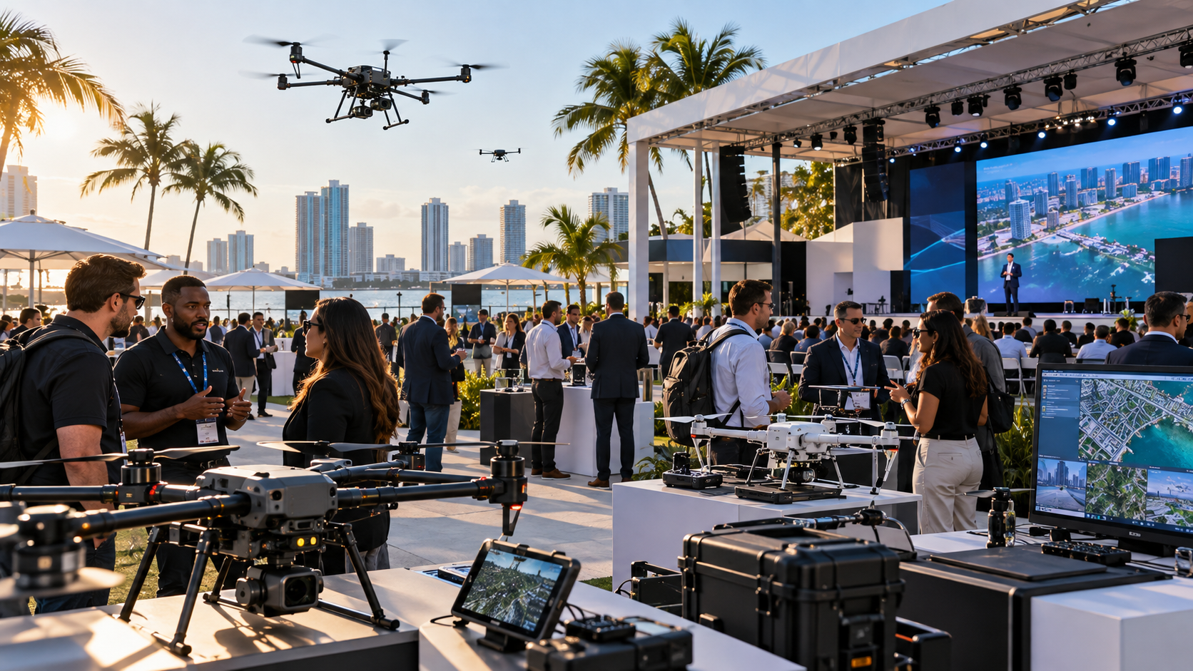
And there’s a change of scenery this year: The 2026 summit is moving to Gulfstream Park, 901 South Federal Highway, Hallandale Beach, in the greater Miami area. With outdoor demonstration spaces and indoor sessions close together, you can watch drones in action, explore the tech behind them (and have a chat with the teams involved).
Live Demonstrations That Put Specifications To The Test
You watch a drone demonstration video and think, “That looks easy enough” Well, there’s a difference between watching a perfectly edited flight and seeing how a drone performs when there’s every second take costs you. That’s one reason the live demonstrations at the summit are worth your time.
Manufacturers can promise impressive camera stability, responsive flight controls and seamless operations. But when you watch their equipment in action, you get to see what those claims look like outside a product brochure.
Pay attention to the little things. How long does the team take to prepare the aircraft? Can the operator switch between tasks without interrupting the mission? That also includes what happens when the drone needs to land, change batteries or swap payloads. It has a lot of weight when you’re working against tight inspection schedules or limited weather windows.
No question is “too awkward” to ask. What training does the system require? How much downtime should you expect between flights? Even safe operations around industrial structures, or what do do when the weather changes during field work. You’ll be counting on the UAVs over hundreds of missions, and they should be up to the task.
So grab the opportunity for hands-on technology evaluation and direct conversations with manufacturers. Rather than wandering from one impressive aircraft to the next, arrive with a few operational challenges you’d like to solve. Use the demonstrations to compare how different systems handle them.
ABZ Innovation Brings Agricultural Spraying And Industrial Cleaning Into View
Among the most tangible exhibits to watch is ABZ Innovation, announced as a Platinum Sponsor. Its product offering illustrates how specialised commercial drones are becoming: a platform built to distribute agricultural inputs faces very different loads, risks and cleaning requirements from an aircraft lifting a camera. Comparing them is useful precisely because “industrial drone” can describe radically different equipment.
You know of ABZ Innovation L50 for spraying and spreading and the C10 for high-pressure cleaning. Visitors will be able to see the company’s technology in action. (Those are examples of the announced focus, not proof that every configuration or accessory will fly during the event).
For agriculture, examine application consistency, coverage planning, refill logistics and how the team manages drift and sensitive areas. For cleaning, pay attention to water supply, tethering or hose handling, surface distance and the risks of working around buildings or energized assets. Both applications make business sense only if the full workflow—including transport, site assessment, crew time and post-job inspection—works.
Cleaning demonstrations should also prompt a safety discussion. Removing personnel from elevated positions may reduce exposure to some hazards, but the aircraft introduces other controls around spray direction, people below, weather and site access. The relevant comparison is a complete operating method, not just flight time against an imagined manual task.
Vantage Robotics And The Challenge Of Scaling Secure Drone Operations
Vantage Robotics is another company worth following closely, particularly for public safety and organisations working under strict equipment-procurement requirements. The company is associated with US-made systems such as Vesper and Trace, and its announced appearance promises a discussion that extends beyond individual aircraft performance.
Vantage Robotics has plans for live demonstrations of Vesper and Trace and identifies Vladimir Goforth as a guest speaker. It discusses fleet expansion and secure, compliant systems for demanding public safety operations. Buyers should still verify current procurement eligibility, approved configurations and the rules that apply to their specific agency; “compliant” is not a substitute for checking the relevant requirement.
Goforth is also promoting a session called “Discover New Ways to Scale.” He argues that the difficult part of UAV adoption is turning one successful mission into a repeatable programme across users, sites and departments. That is a particularly valuable theme for teams buying their second fleet, not their first drone.
Listen for details on standard operating procedures, approval chains, fleet maintenance, data security and training consistency. A programme does not truly scale merely because it acquires more aircraft. It scales when different qualified crews can produce comparable outputs safely and when supervisors can review performance without reinventing processes at each location.
Autel Robotics And A Wider Conversation About Enterprise Platforms
Autel Robotics is a Gold Sponsor of the summit. Its presence gives enterprise buyers a reason to examine alternatives within a market where procurement choices increasingly involve support arrangements, software, security expectations and long-term platform availability as well as sensors or flight characteristics.
Expect conversations at Autel exhibits to cover mission planning, thermal or zoom requirements where relevant, documentation formats, firmware management and replacement-part support. Ask whether the capability being demonstrated is standard, optional or dependent on a particular controller, payload or software plan. For inspection work, the compatibility of captured data with reporting tools may be more consequential than a single headline specification.
Aerial Data And Mapping (From Capturing Images To Making Decisions)
A drone program doesn’t succeeds on aircraft hardware alone. Data processing, positioning, fleet records and safe coordination can determine whether a flight creates operational value.
The exhibit floor also lists companies representing other parts of the workflow, including Pix4D, Sentera, Airdata, Dronetag and XGRIDS.
Pix4D has a history with the event. Previous presentations and demonstrations involved Pix4Dcloud, Gaussian splatting and Pix4Dcatch. This points to the questions mapping professionals can take to the current exhibitor floor: how are results georeferenced, verified and kept consistent over time?
For construction and surveying, look beyond attractive 3D models. Examine ground-control strategy, coordinate reference systems, accuracy-check reporting, processing time and whether outputs can be used by engineers who do not fly drones. Ask how the provider handles poorly textured surfaces, reflective materials, vegetation and changing light. The strongest demonstrations make data quality visible, including uncertainty and limitations.
Sentera, also named on the 2026 exhibitor page, featured in a previous event, with multispectral sensing and analytics. At this year’s event, agriculture teams can ask how sensors are calibrated, how vegetation indices relate to field observations and how results translate into defensible treatment decisions.
Agriculture And Conservation: Mark Hastings On Turning Observations Into Action
Drones can tell you plenty about what’s happening across a farm or conservation area. But collecting beautiful aerial images is one thing. Knowing what to do with them is another. Plus agriculture involves much more than spraying crops.
Farmers and land managers use drones to assess crop health, monitor environmental changes and identify areas that need attention. Changes in colour could indicate crop stress, but it might also reflect different lighting conditions, soil backgrounds or the stage of crop growth. There’s also the value in knowing when exactly when to fly, what to measure and when the findings warrant action.
Mark Hastings, CEO of Aero Velocity, will be discussing how drone-based data collection supports agriculture and conservation, including crop assessments, environmental monitoring and land management decisions. So check in here if you’re collating such UAV data for your farm, or are involved with contracts where farmers, conservation teams or other stakeholders rely on similar recommendations.
Energy And Industrial Inspection: Watch The Whole Inspection Chain
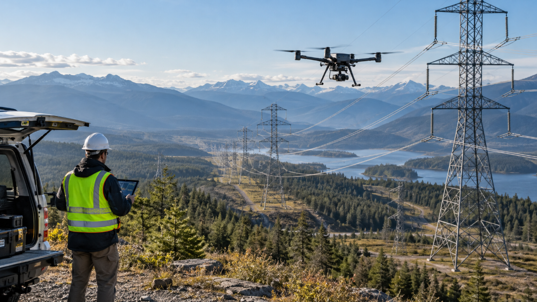
Inspecting a wind turbine hundreds of feet above the ground or checking a power line stretching across difficult terrain isn’t exactly a walk in the park. If you work in renewable energy, utilities or industrial asset management, you’ll want to pay close attention to the energy inspection technologies featured here.
Say your drone captures a suspicious mark near the leading edge on a wind turbine blade. Is it surface erosion, a crack or an old repair? How serious is it? And can you find that exact location again during the next inspection? It’s all involved when managing an asset’s condition.
As you explore the exhibits, look at how different technologies handle the entire inspection process. Can the drone capture sufficient detail from a safe distance? How do wind, lighting and surface conditions affect the results? Can inspection software map findings to their exact locations on an asset?
Thermal imaging deserves a closer look, too. It can reveal temperature differences and patterns that suggest something unusual beneath a surface. However, an interesting thermal image isn’t automatically proof of a particular defect. Interpretation, operating conditions and sometimes further testing are needed.
Then comes the part that rarely gets as much attention as the flying: managing the inspection data.
Can your team compare findings from previous inspections? Track whether a crack has grown? Check if an earlier repair is holding up? Prioritise maintenance based on documented defect assessments? For operators managing hundreds of assets, these capabilities matter just as much as the aircraft itself.
After all, you’re not inspecting the same turbine year after year just to build an impressive photo collection. You want to know what’s changed, what needs attention and what can safely wait.
Public Safety, Practical Reliability And Procurement Questions
Search-and-rescue, emergency response and law enforcement involve unusually demanding operating conditions. Equipment may be deployed under time pressure, in poor visibility or by rotating crews. The summit’s public safety track offers a setting to question suppliers about real response times, operator training and the limitations of proposed payloads.
Thermal cameras, optical zoom and mapping tools each have legitimate uses, but none removes the need for human judgement. A thermal signature may deserve a closer look; it is not automatically a person. A high-magnification view can add detail while narrowing situational awareness. Ask demonstrators what they do when sensors produce ambiguous results, connections degrade or a mission cannot proceed.
Procurement deserves equal attention. Blue UAS status, domestic sourcing, NDAA-related restrictions and agency-specific rules are distinct topics, and product eligibility can depend on configuration and timing. Attendees should seek documentation rather than rely on sweeping booth claims. They should also discuss evidence retention, access permissions and cybersecurity practices wherever recorded imagery has operational or legal sensitivity.
Remote ID, Airspace Awareness And Fleet Oversight
Flying one drone is relatively straightforward. Keeping track of an entire fleet, its pilots, maintenance schedules and flight records brings a different set of a different challenge on your hands.
Keep an eye out for Dronetag during the 2026 summit, a listed exhibitor and Bronze Sponsor specialising in drone identification and airspace awareness technology.
If you’ve heard of Remote ID, you’ know it’s basically a digital licence plate for drones (allows certain information about an aircraft and its operation to be broadcast electronically, helping authorised parties identify drones operating in an area). But there’s more to discuss than simply ticking a regulatory box.
Dronetag attended the 2024 summit, where it highlighted the importance of making aircraft digitally visible. With the company returning in 2026, there’s an opportunity to explore how identification and tracking technologies fit into professional drone operations.
Learn how you can you monitor multiple aircraft from one interface. See what do to when connectivity becomes unreliable. Go over how the system helps operators understand other drone activity nearby. Remember, Remote ID requirements vary between countries, and having identification equipment doesn’t automatically grant permission to fly in restricted airspace.
Then there’s Airdata, which approaches drone operations from a different angle: fleet management.
Running a drone program with multiple pilots, dozens of aircraft and hundreds of flights every month?Somewhere in that mountain of activity are maintenance records, battery performance trends, flight histories and information your safety manager might need at short notice.
Keeping everything in scattered spreadsheets can easily become a full-time job of its own.
Airdata’s fleet management tools are designed to help organisations organise flight records, monitor aircraft activity and manage operational information.
If you’re exploring these solutions, look into compatibility with your existing drones, automatic flight-log uploads, maintenance tracking and exporting records.
What To Expect From Speakers, Workshops And Networking
There will be keynotes, panels, breakout sessions and live demo-plus-talk presentations. Topics will span compliance, industrial inspection, public safety and programme development. Speaker applications are still being invited, so the programme may continue to change.
How To Plan Two Productive Days At ElevateUAV 2026
Start with three outcomes: one operational problem to solve, one technology category to compare and one partnership to explore. Book the most important exhibitor conversations early, leaving room for demonstrations and unplanned introductions. Bring realistic mission examples, including an asset type, expected deliverable and any compliance constraints that affect the work.
There will be general admission access to the exhibit hall, keynotes, sessions and networking, while VIP admission adds benefits such as reserved seating and workshop-related access. Ticket pricing and inclusions can change, so verify the current booking details before arranging travel. The venue is in Hallandale Beach rather than central Miami, which matters when planning ground transport.
After the event, avoid judging success by the number of brochures collected. Rank the options by suitability, implementation effort, total operating cost and what evidence remains to be requested. A useful next step is a controlled trial with agreed success criteria—not an equipment purchase based solely on a strong stage demonstration.
What Will Change After The Summit?
Commercial drones are no longer interesting simply because they can reach a location from the air. The more consequential developments concern how reliably they can perform repeatable work, how teams manage fleets and how the resulting information supports decisions. ElevateUAV 2026 offers a concentrated view of those changes, from specialised cleaning aircraft to secure public safety systems and analytical software.
The summit should be especially useful to visitors who are willing to look beyond product launches. Compare what each supplier can demonstrate now with what still depends on future integrations, approvals or ideal conditions. Ask what a system saves, what it costs to operate and what it requires from the people responsible for it. The result is a clearer picture of drone technology that is ready for work rather than merely ready for display.
ElevateUAV Summit 2026 FAQs
When And Where Is ElevateUAV Summit 2026?
The summit is scheduled for 17–18 November 2026 at Gulfstream Park, 901 South Federal Highway, Hallandale Beach, Florida, in the Miami area.
Who Should Attend?
The programme targets commercial drone operators, enterprise fleet managers, technology buyers, public safety organisations and professionals working in agriculture, construction, energy and industrial inspection.
Will There Be Live Drone Demonstrations?
Yes. Outdoor flight demonstrations are part of the advertised programme, although individual aircraft, weather-dependent flights and demonstration times should be confirmed with the organiser.
Which Companies Are Exhibiting?
The published 2026 exhibitor list includes ABZ Innovation, Vantage Robotics, Autel Robotics, Pix4D, Sentera, Dronetag, Airdata, Parrot, Inspired Flight and others. The list may change before the event.
Is The Full Speaker Schedule Final?
The published speaker information and recent announcements identify individual participants, including Vladimir Goforth and Mark Hastings, but the lineup was still being developed as of this preview. Check the organiser’s updates before finalising a personal agenda.
Can Attendees Compare Drones For Inspection Work?
Yes. The combination of energy and construction themes, participating hardware providers and aerial-data specialists creates opportunities to compare inspection platforms and workflows. Attendees should request sample deliverables and discuss application-specific limitations.