

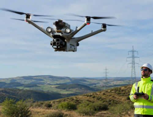
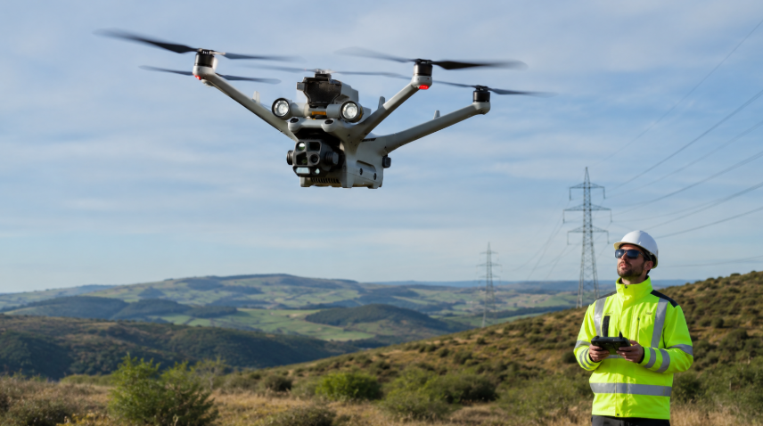
Commercial drones are all over. They’re mapping cities, inspecting infrastructure, and capturing data faster than ever. But raw data isn’t useful by itself. It needs to be stored, sorted, and analyzed. That’s where things get messy.
Every drone flight generates gigabytes of footage, images, and sensor readings. Multiply that by hundreds of flights a month, and you have a digital avalanche. Sorting through it manually? A nightmare. Data gets misplaced, lost, or buried under outdated files. Worse, weak security can turn sensitive information into a ticking time bomb.
Drone Harmony, a Swiss flight management software, comes on as a solution for this. Let’s look at how it works, and the problems it solves.
The Hidden Costs of Bad Drone Data Management
Drone operations are only as good as their data management. If files are lost, unorganized, or insecure, the entire workflow falls apart.
Yet, many companies still rely on old-school methods—USB transfers, manual uploads, disorganized folders. These slow things down. They introduce human error. Que the frustration of sifting through mislabeled files when reports are due. It’s chaos. And the bigger the operation, the worse it gets.
Security Risks: Who’s Protecting Your Drone Data?
Drone inspections cover a broad range of tasks. Industrial sites, power grids, private property—such data that should never fall into the wrong hands. But weak security puts that data at risk.
Cyberattacks expose sensitive mapping data in multiple industries. Unauthorized access, unencrypted storage, and poor security controls are common problems. If data is stolen or leaked, the consequences can be massive—financial losses, legal trouble, even national security threats.
Many companies lack encryption, user access controls, and secure cloud storage, leaving their data exposed.
Manual Workflows: Slow, Tedious, and Full of Errors
Transferring drone data should be instant. But for many, it’s a slow, hands-on process.
Pilots remove SD cards, plug them into a computer, drag files into folders, rename them, and sort them manually. Every extra step wastes time and increases the risk of human error. A mislabeled file. A forgotten upload. A corrupted transfer.
Some companies manage hundreds of drone flights per month. If each flight takes an extra 15 minutes just to transfer data, that’s 25 lost hours per week—just moving files.
Disorganized Data: The Search for Missing Files
Drone-generated content piles up fast. Images, video, 3D scans, LiDAR data, flight logs. If it’s not properly labeled and stored, it becomes useless.
A single 30-minute drone flight can generate 20GB of data. Without automation, that data gets dumped into folders without structure.
Then the real headache begins.
Where’s last month’s bridge inspection video? Who has the topographical scans from last year? Which dataset belongs to which client?
If you’ve ever dug through hundreds of unnamed files, you know how painful this can be.
The Risk of Data Loss: When Information Disappears
Data isn’t just misplaced—it’s lost.
Hard drives crash. USBs fail. Files get deleted by mistake. A single corrupted SD card can erase an entire mission’s worth of footage.
Cloud storage helps, but if it’s not automated, files still get lost in unstructured folders. And if the system doesn’t have proper backup procedures, those files are gone forever.
Tracking Multiple Flights: The Scaling Nightmare
A small drone operation can get by with basic data handling. But when a company scales—hundreds of flights, multiple locations, multiple pilots—manual processes collapse.
If teams aren’t working within a structured system, project tracking becomes chaotic. Data from different flights overlaps. Inspectors pull reports with missing or outdated information.
Decisions slow down. Mistakes pile up. Productivity takes a hit.
A better system is necessary.
UAV Data Security Checklist: The Drone Harmony Way
Drone data is a strategic asset that needs protection from the moment it’s captured. Here’s what you should consider:
Cloud or On-Premises: Where Should Your Data Live?
Some companies prefer cloud storage because it’s accessible and scalable. Others need on-premises storage for compliance reasons.
Drone Harmony gives you both.
If you choose Amazon S3, your data is encrypted, backed up, and accessible from anywhere. If you need a private, in-house solution, you can keep everything on your servers and stay in full control.
Not all industries have a choice. Energy companies, government agencies, and critical infrastructure firms often face strict regulations. They can’t store sensitive data on third-party servers. On-premises storage solves that.
Encryption: Protecting Data at Every Stage
Every time drone data moves—from the SD card, through the cloud, to your desktop—it’s at risk. Without encryption, hackers, rogue employees, or even simple mistakes can expose it.
Drone Harmony encrypts every step. Data is scrambled during transfers and storage, making it useless to anyone without permission. Even if someone intercepts it, they can’t read it.
That’s non-negotiable.
Controlled Access: Not Everyone Needs Every File
If a company has 20 pilots, 5 analysts, and 3 project managers, should they all have the same access? Absolutely not.
Without user access controls, data gets misused, misplaced, or stolen. A single mistake—accidentally deleting an entire project folder—can set a team back weeks.
Drone Harmony lets you assign roles and permissions. Pilots can upload but not delete. Analysts can access data but not move files. Managers can see everything without risking mistakes.
And with Single Sign-On (SSO) integration, you don’t have to create a new login system. If your company uses Active Directory, Google Workspace, or Okta, Drone Harmony connects seamlessly.
No extra passwords. No unnecessary access.
Compliance: Are You Meeting Industry Standards?
Certain industries can’t afford to cut corners on security.
ISO 27001, GDPR, and NIST standards exist to push companies to handle sensitive data responsibly. If you work in oil and gas, construction, telecom, or defense, you already know how strict compliance can be.
Fines can reach millions. Legal trouble can last years.
Drone Harmony is built to meet these standards, helping businesses stay compliant without hiring an army of security experts.
Automated Drone Data: A Smarter Alternative for your Workflow
Manual data handling is killing your workflow. If you’re still transferring images, videos, 3D scans, and sensor readings by hand, sorting them into folders, and uploading them manually, you’re wasting hours every week.
Automation changes everything. With the right system, data moves instantly, files organize themselves, and human error disappears.
No More Manual SD Card Transfers
Pulling out an SD card. Plugging it into a laptop. Dragging files into folders. It’s 2025. That shouldn’t be happening.
Drone Harmony automates the entire transfer process. The moment a flight ends, data moves—without pilots touching a single button.
Here’s how it works:
- DJI drones automatically upload data through the controller. No SD cards needed.
- Files go straight to secure cloud storage or on-premises servers.
- Data is sorted, labeled, and linked to the right project.
Get instant access to everything. And no missing files
DJI Dock: Hands-Free Drone Operations
DJI Dock integration takes automation even further. Drones land, recharge, and upload data automatically.
No need for a human operator or time spent plugging in cables.
For companies running large-scale drone operations, this is a big deal. It means:
- Faster project turnarounds. No waiting for pilots to transfer data.
- Fewer errors. No one forgets to upload files or renames them incorrectly.
- Better efficiency. Data is instantly ready for analysis.
Automatic Sorting: Every File in Its Place
Unorganized drone data is a nightmare. Files get lost. Videos end up in the wrong folders. Teams waste hours searching for the right dataset.
With Drone Harmony every file is automatically named, tagged, and stored in the right place. You won’t need to come in and do it yourself. Or struggle renaming files one by one. If you’re managing multiple projects, this is particularly beneficial. You can pull up a specific inspection, a certain date, or a particular asset in seconds.
Productivity Boost: Let Pilots Fly, Not Manage Files
Pilots shouldn’t be IT staff. They shouldn’t be spending time transferring, organizing, and uploading files.
With automation, they don’t have to.
- Data moves instantly from drone to storage.
- Files are sorted and labeled automatically.
- Teams can focus on analysis, not file management.
That means faster decision-making, fewer mistakes, and more time spent on actual work.
Also Read: Drone School Guide: Become A Certified UAV Pilot
From One Drone to an Entire Fleet: Managing Data at Any Scale
Scaling drone inspections means handling more flights, more footage, and more complexity. If your system can’t keep up, you lose time, lose data, and lose control.
Georeferenced Data: Stop Losing Track of Files
Every drone flight captures thousands of data points—but without location tagging, it’s just a pile of files.
Drone Harmony automatically georeferences every image, video, and dataset.
- Every file is linked to an exact GPS location.
- Inspections sync with site maps, GIS platforms, and 3D models.
- Teams can instantly pull up the right data for any asset.
No more sifting through folders trying to find last month’s bridge inspection or last year’s turbine scan.
Click on a map. Find the file. Get the insights.
Consistent Naming & Folder Structure: For Cleaner Data
When pilots manually name files, mistakes happen. Duplicate names. Random labels. Missed details. A small error today becomes a massive headache later.
Drone Harmony organizes everything the moment data is uploaded.
- Standardized file names match the project, flight date, and location.
- Automated folders group data by mission, asset, and inspection type.
No more manual sorting. No more lost files. And when teams need data, they find it in seconds. Not hours.
Automated Data Pipelines: Stop Wasting IT Resources
Most companies don’t have the time or staff to manually process drone data.
And they shouldn’t have to.
Drone Harmony automates the entire data pipeline.
- Files move from drone to storage instantly.
- Data is structured, labeled, and indexed automatically.
- Teams access live mission data—without waiting on manual uploads.
If you’re managing dozens or hundreds of drone flights per week, such a system is crucial. Otherwise you would need to hire more people just to move files around. That’s inefficient, expensive, and completely avoidable.
How This Supports Large-Scale Inspections
When you scale, your workflow needs to stay smooth.
- Utility companies monitor thousands of power lines and pipelines.
- Construction firms track progress across multiple sites.
- Surveyors handle massive land assessments with complex datasets.
If data isn’t structured from day one, it collapses under its own weight.
Drone Harmony keeps inspections running at full speed—without the data bottlenecks.
- Larger drone fleets don’t create larger file management problems.
- Teams spend time analyzing, not searching for missing files.
- Operations scale up without increasing IT headaches.
If your drone program is growing, your data system needs to grow with it.
Integration with GIS, Photogrammetry, and Other Systems
Drone inspection data doesn’t live in a vacuum. It needs to connect, sync, and integrate with the tools you already use.
Inspections, infrastructure monitoring, environmental studies—they all depend on accuracy. If your data is even slightly off, your models, maps, and measurements become unreliable.
Drone Harmony keeps everything aligned, so when you compare drone-captured data to GIS layers, it matches. This is integral in areas like:
- Survey-grade accuracy for land development and urban planning.
- Consistent flight replication for construction monitoring.
- Precise overlays for vegetation analysis, flood mapping, and asset tracking.
If your drone platform doesn’t work with GIS, photogrammetry, or mapping software, you’re stuck with raw data that doesn’t translate into insights.
That’s not an option.
3D Flight Planning for Precision Data Collection
Bad data leads to bad results. If your drone missions aren’t precisely planned, your maps, models, and analytics fall apart.
Drone Harmony prepares flights with GIS and photogrammetry in mind.
- Every flight is mapped in 3D before takeoff. Work with precise angles and altitudes.
- Waypoints, overlaps, and coverage are automatically calculated. No more missing data points.
- Flights match terrain and existing maps. Avoid distortions or alignment issues.
That means fewer re-flights, fewer errors, and more accurate outputs.
Integration with GIS and Mapping Tools
Drone Harmony works with the platforms you already use, so data flows directly into your GIS and mapping software.
- LiDAR, orthomosaic, and photogrammetry files are correctly formatted from the start.
- Data moves without manual conversions—no wasted time fixing file types.
- Every image, scan, and coordinate syncs with external analysis tools.
That means faster post-processing, cleaner data, and more reliable reports.
Learn how interpret different kinds of data with Online Drone Training Courses.
Case Study: How Sky Nomads Scaled Operations With Drone Harmony
Sky Nomads, a drone service provider in Zagreb, Croatia, needed a better way to manage flights, collect data, and process results. They specialize in LiDAR mapping, ortho-photo mapping, and infrastructure inspections—all tasks that demand precision.
Flight Planning Used to Be a Time Sink
LiDAR mapping requires precise flight paths. Every altitude, overlap, and angle matters. A single mistake can throw off an entire project.
Before automation, planning flights took hours. Pilots had to manually define waypoints, adjust settings, and double-check coverage. Rework was common. A slight miscalculation meant returning to the site for another flight.
With Drone Harmony, that changed.
Now, flight paths autogenerate based on mission parameters. Pilots upload a project, select the area, and the system calculates everything. The result? Faster planning. Fewer errors. No wasted flights.
Construction Inspections Became More Reliable
Sky Nomads also worked on pre- and post-construction facade inspections. Before a project started, they needed to scan building exteriors to document existing conditions. After construction, they had to compare fresh scans to the originals. As you can tell, manually flying identical flight paths weeks or months later is nearly impossible.
Drone Harmony solved this by storing and replicating flight paths. The second scan matched the first exactly, down to the camera angle.
Clients got crystal-clear comparisons. Contractors spotted issues instantly. Reports were accurate.
Agriculture Mapping Became Faster and More Detailed
Precision agriculture depends on data. Farmers and agronomists need high-resolution maps to track soil health, irrigation needs, and crop growth.
Sky Nomads used Drone Harmony to automate aerial data collection for agricultural clients. Their drones covered vast areas in record time, following flight paths optimized for maximum coverage and efficiency.
The impact?
- Fewer flights to collect the same amount of data.
- Higher accuracy, with no gaps or missed sections.
- Easier post-processing, since data was already organized.
A Smarter, Faster, and More Scalable Operation
Sky Nomads transformed their entire workflow.
- Faster flight planning meant more missions per day.
- Automated flight replication improved inspection accuracy.
- Seamless data handling reduced manual uploads and errors.
They could take on bigger projects, serve more clients, and deliver results faster with Drone Harmony. Read more about them here.


