Mobile Networks Are Moving Into The Aviation Sphere
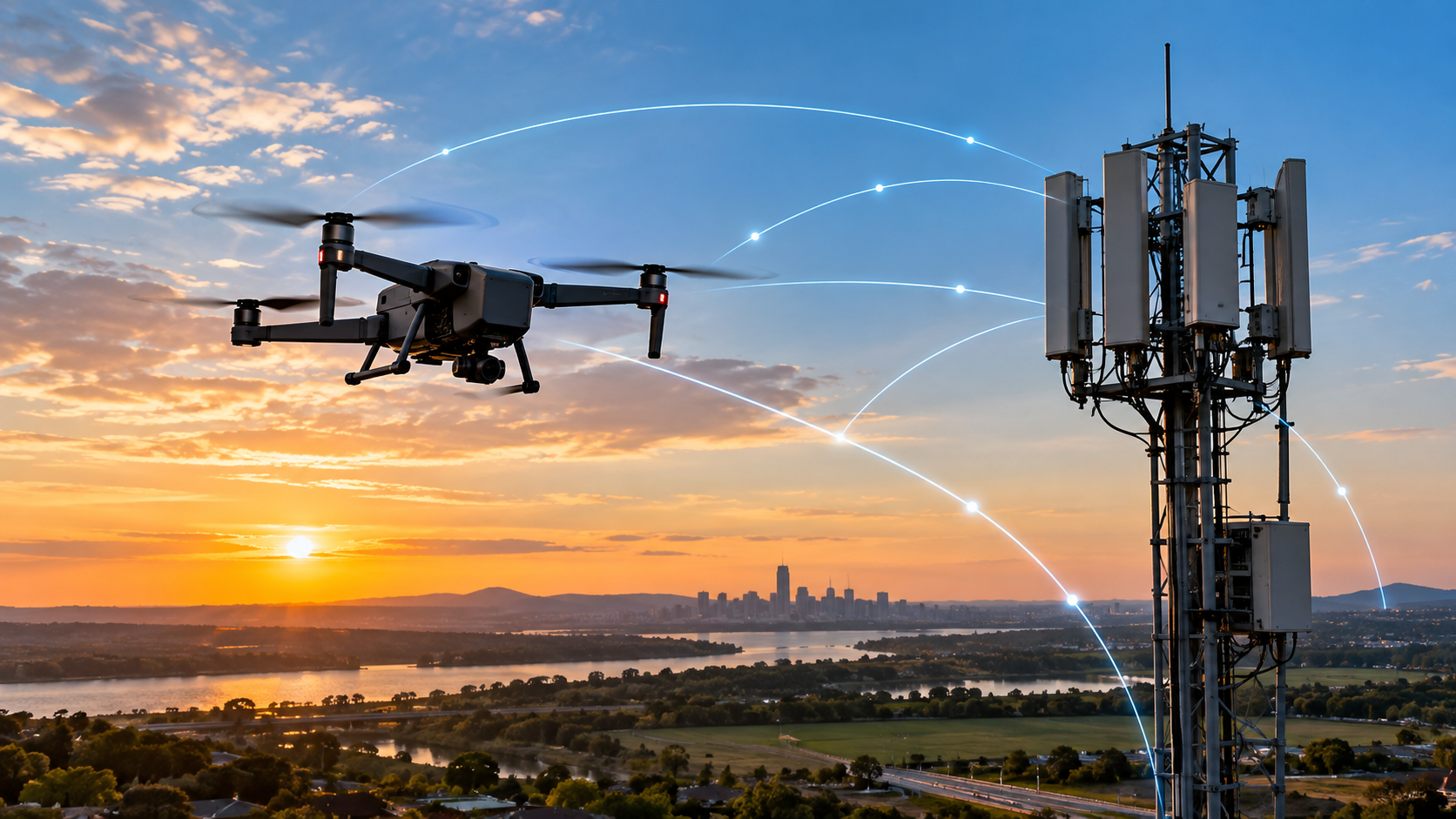
A mobile phone network was built for people and devices on the ground. Yet the same 4G and 5G infrastructure is increasingly being examined as a communications layer for aircraft flying beyond the remote pilot’s visual line of sight. In September 2026, the U.S. Federal Communications Commission granted a temporary waiver supporting the Department of Transportation’s Mobile Network Aviation Assessment Program. The programme is designed to measure commercial wireless performance aboard aircraft across the contiguous United States and test whether those networks can contribute to aviation safety services.
The scale makes the programme particularly useful. Up to 2,000 authorised general aviation pilots can use the programme’s mobile application at the same time, and up to 200 unmanned aircraft can carry dedicated test modules. The waiver took effect on 11 September 2026 and runs until 1 October 2029. The tests can examine commercial mobile networks alongside satellite direct-to-device and sidelink technologies for applications such as electronic conspicuity, Remote ID, UAS command and control and autonomous detect-and-avoid.
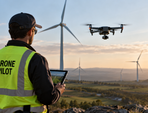
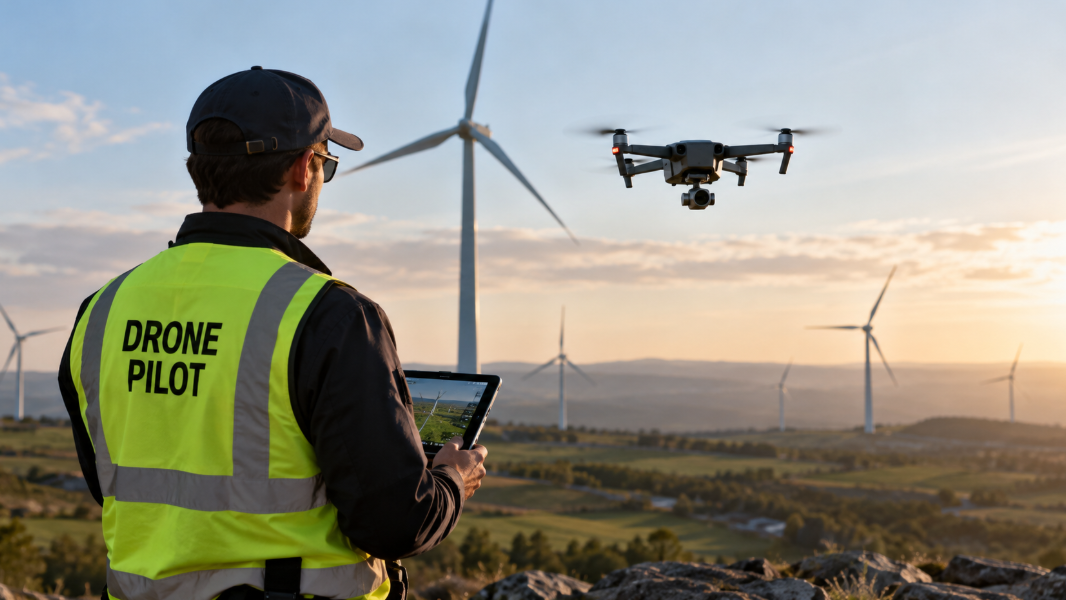
That does not turn an ordinary phone connection into an aviation-certified control link. It does show where the industry is heading. As BVLOS operations move from isolated approvals toward repeatable commercial operations, the communications problem becomes harder. A pilot standing a few hundred metres from a drone can use a direct radio link. A drone inspecting a pipeline, transmission corridor, railway, wind farm or delivery route tens of kilometres away needs a communications architecture that can remain available as the aircraft moves.
Cellular networks are attractive because much of the infrastructure already exists. Towers, fibre backhaul, authentication systems, network operations centres and nationwide mobile coverage have been built at enormous scale. 5G adds tools that can make the network more useful to aviation, including lower-latency service options, network slicing, edge computing, improved positioning capabilities and programmable network interfaces. The engineering question is how those capabilities perform in the air, where radio conditions differ sharply from the conditions network planners normally optimise for.
What A BVLOS Drone Needs From Its Communications Link
BVLOS changes the role of connectivity. Once the aircraft leaves the pilot’s direct view, the communications system becomes part of the chain that carries aircraft status, flight commands, contingency instructions and operational information between the drone and the people or software supervising it.
Command And Control
Command and control, usually shortened to C2, covers the communications used to manage the aircraft. Depending on the UAS, that can include flight-plan updates, mode changes, mission commands, position and health telemetry, return-to-home instructions and contingency actions. The data rate for basic C2 can be modest compared with live video. Reliability, continuity and predictable delay are far more significant.
The FAA’s current waiver and authorisation material explicitly asks operators to identify the C2 link type and lost-link latency threshold, with examples that include Wi-Fi, radio, satellite and cellular networks. It also asks for the procedure the aircraft will follow after a lost link, such as hovering, returning to the launch point, entering a holding pattern or landing at a designated location.
This is a useful way to frame cellular C2. The relevant question is not simply whether a drone shows four or five signal bars. Operators need to know how long the connection can degrade before the mission reaches an unacceptable state, what the aircraft does during that interval, how quickly a secondary path can take over and how the system records the event.
Payload Data And C2 Are Different Traffic
An inspection drone can generate far more payload data than it needs for aircraft control. High-resolution RGB imagery, radiometric thermal data, LiDAR, multispectral imagery and live video can place very different demands on a network. A well-designed architecture can separate safety-relevant C2 traffic from payload traffic so a large video upload cannot crowd out an urgent aircraft command.
For industrial work, this separation is practical as well as technical. You may want a lower-bandwidth link with strong availability for aircraft control and a higher-throughput link for inspection imagery. Large datasets can also remain onboard and upload after landing. Sending every captured image in real time is rarely necessary.
How 4G Can Already Support Drone Operations
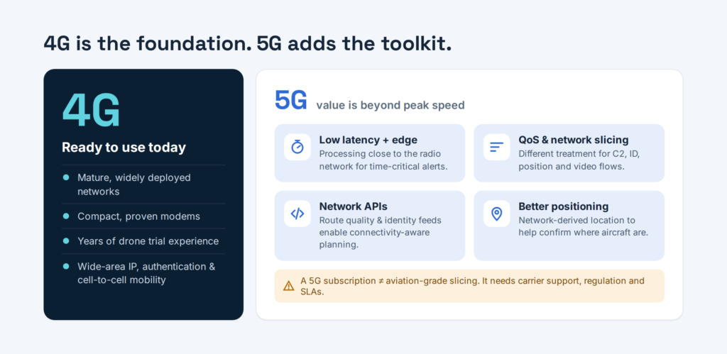
4G LTE remains relevant even as 5G coverage expands. LTE networks are mature, widely deployed and supported by compact modems and established carrier infrastructure. Drone connectivity trials using LTE have been running for years, giving operators and telecom companies a substantial body of practical experience.
3GPP’s work on aerial user equipment began with LTE. Its technical work identified the unusual radio behaviour of airborne devices and introduced features aimed at managing aerial connectivity. 3GPP’s later work moved UAV support into 5G-Advanced, with attention to radio measurements, mobility, identification, authentication, authorisation and interference mitigation.
LTE can provide wide-area IP connectivity, authenticated subscriber access and mobility between cells. For a drone operator, those characteristics can support telemetry, remote supervision, mission updates and selected payload streams across routes that extend beyond a single local radio site.
Coverage on a road map still needs to be treated cautiously. Mobile networks are planned primarily for users near ground level. Base-station antennas are commonly tilted toward terrestrial coverage areas. A drone climbing above rooftops can gain line of sight to many cells at once. That can produce strong received signals from several sites and more interference than a handset experiences on the street.
What 5G Adds To The Architecture
5G is more interesting for BVLOS when you look beyond peak download speed. Its value comes from the network functions around the radio link.
Lower And More Predictable Latency
Some drone applications need rapid exchange of information. A routine telemetry update may tolerate more delay than an alert used by a detect-and-avoid system. 5G architecture can support lower latency than earlier generations under suitable network conditions, particularly when processing is moved closer to the radio access network through edge computing.
Latency should still be measured end to end. A fast air interface cannot compensate for a congested application server, slow cloud routing or poorly designed control software. For aviation, teams need a budget covering the complete path from aircraft to network, application and operator, then back again.
Quality Of Service And Traffic Separation
5G gives operators more control over how different traffic classes are handled. A drone may carry safety-relevant C2, identification messages, position updates, sensor data and video at the same time. Quality-of-service mechanisms can assign different treatment to those flows according to the operational requirement.
Network slicing extends the concept by creating logical network resources for particular service requirements. In aviation, a future implementation could reserve defined characteristics for approved drone traffic rather than treating every airborne modem exactly like a consumer handset. Commercial deployment still depends on carrier support, regulation and service-level agreements, so operators should not assume that a 5G subscription includes aviation-grade slicing by default.
Network APIs And Real Time Network Information
A growing part of the discussion is the use of network application programming interfaces. In June 2026, the GSMA Aviation Vertical Convergence Report reported repeated demand from aviation stakeholders for cellular capabilities that can support drone integration. GSMA’s related electronic-conspicuity work points to standardised Open Gateway and CAMARA APIs as a route for exposing network functions to aviation applications.
For a BVLOS operator, an API could eventually provide more useful information than a simple connected-or-disconnected status. Mission software could receive an indication of network quality along a route, identity information, device location services or other authorised network intelligence. That opens the door to connectivity-aware flight planning, where a mission system treats communications performance as one of the conditions used to approve or adjust a route.
The Hard Part Is Radio Performance In The Air
Altitude Changes The RF Environment
A terrestrial handset is surrounded by buildings, terrain and other objects that limit how many base stations it can see. A drone at altitude can have line of sight to a much larger number of sites. That wider radio view can help coverage and create interference at the same time.
The aircraft may receive usable signals from several cells, yet the SINR can fall because many cells are transmitting on the same or neighbouring resources. The drone can also transmit toward several sites, raising the possibility of uplink interference for terrestrial users. Network configuration, antenna patterns, power control, frequency choice and aerial-device identification all become relevant.
3GPP has addressed this problem through aerial-UE features. Its work includes height-specific configurations and measurement reporting designed for aircraft that can see multiple cells. Release 18 includes further UAV and UAM architecture work as part of 5G-Advanced.
Handover Performance Becomes A Flight Issue
A moving drone crosses cell boundaries just as a car does, although its altitude can make the sequence less predictable. The modem may see distant cells that a ground device would never encounter. Frequent or poorly timed handovers can create short interruptions, packet loss or changes in latency.
For consumer data, a brief interruption may go unnoticed. A BVLOS system needs to know how the interruption affects the safety case. The aircraft may be designed to tolerate several seconds without an external command, continue on an approved path and reconnect automatically. A different operation may require a secondary communications link to take over almost immediately.
Coverage Maps Need An Aviation Dimension
Ground-level coverage maps tell you where a phone is expected to work. They do not describe network behaviour at 60, 120 or 300 metres above ground level, nor do they show how interference changes along a flight corridor.
This is where the 2026 U.S. MNAAP work becomes relevant. The FCC order authorises measurement across a broad range of commercial spectrum, from 600 MHz and 700 MHz through mid-band allocations and millimetre-wave bands. The programme is intended to build evidence on signal quality at altitude and across locations rather than relying on terrestrial assumptions.
A Cellular Link Still Needs A Lost Link Plan
No communications technology provides uninterrupted service everywhere. Cellular networks have dead zones, maintenance events, congestion, backhaul failures and local interference. A safe BVLOS concept therefore starts with the aircraft’s behaviour after communications degrade.
A lost-link procedure can be simple for a small, low-risk mission and much more sophisticated for a long corridor inspection. The aircraft might continue to a pre-approved recovery point, hold at a defined location, return along the route, switch to another carrier, move to satellite communications or land. The selected action depends on airspace, terrain, population exposure, remaining energy, weather and the aircraft’s level of autonomy.
Multi Carrier Connectivity
Using two mobile operators can reduce dependence on a single network footprint. Dual-SIM and multi-modem architectures can maintain access to separate networks, although redundancy only helps when the underlying infrastructure is sufficiently independent. Two subscriptions can still share towers, fibre routes, power supplies or regional core-network dependencies.
Hybrid Terrestrial And Satellite Links
Satellite connectivity can cover areas where terrestrial networks are sparse. The trade-offs include antenna requirements, cost, power consumption, throughput and latency. New direct-to-device and non-terrestrial-network services are narrowing some of those gaps.
The current U.S. assessment explicitly includes satellite direct-to-device services alongside commercial wireless networks. That points toward hybrid architectures in which the aircraft or mission system selects from several communications paths according to availability and operational priority.
Dedicated Aviation Spectrum Still Has A Role
Cellular is one option in a broader communications toolbox. Aviation regulators and spectrum authorities are also creating resources specifically for UAS control.
In 2024, the FCC adopted service rules giving UAS operators access to direct frequency assignments in part of the 5030–5091 MHz band for control operations where safety is significant. The FCC noted that many drone operators had relied on unlicensed spectrum and that interference could disrupt those links.
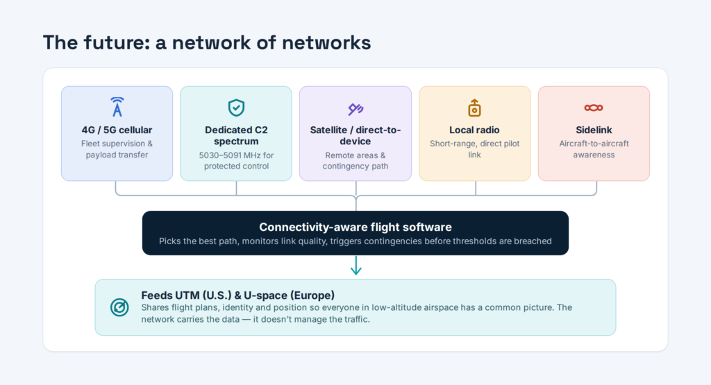
Dedicated spectrum and commercial mobile networks solve different parts of the problem. A mission may use aviation-specific spectrum for a protected control function, cellular for fleet supervision and payload transfer, and satellite as a contingency path. The right mix depends on aircraft class, mission risk, geography and the regulatory framework.
Cellular Connectivity Can Feed UTM And U Space Services
Scaling BVLOS involves more than maintaining contact with one aircraft. Operators also need shared awareness of planned flights, restrictions and nearby traffic. That is where UAS Traffic Management in the United States and U-space in Europe enter the picture.
NASA’s UTM work uses digital sharing of planned flight information so participating operators have a common view of low-altitude activity. In Dallas, commercial operators have used NASA-originated UTM capabilities to share routes and operational data during BVLOS package-delivery activity in shared airspace below 400 feet.
Europe is developing a comparable service framework through U-space. SESAR’s U-space model progresses from registration, identification and geo-awareness through flight planning, tracking, traffic information, conflict support and higher levels of automation.
Mobile connectivity can carry data between aircraft, operators and these digital traffic services. It can also contribute network-derived information that helps confirm identity or location. The cellular network does not become the air traffic manager by itself. It acts as one communications layer connecting the systems that coordinate the airspace.
What Cellular BVLOS Could Change For Industrial Inspection
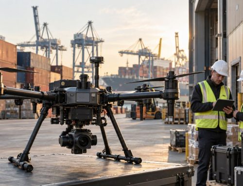
Industrial inspection is a strong use case because routes are often long, repeatable and data-heavy. Transmission lines, pipelines, rail corridors, solar assets and large wind sites can extend far beyond the distance a pilot can directly observe.
Longer Routes With Central Supervision
A connected aircraft can report position, battery state, navigation status and system health to a remote operations centre throughout a mission. The same centre can supervise several sites, subject to the operational rules and the level of automation approved for the operation.
For an inspection company, this can change how field teams are organised. Local personnel may handle launch, recovery and site safety, while specialised staff supervise aircraft and review data from a central location. The commercial value comes from reducing repeated travel and making high-frequency inspections practical across distributed assets.
Faster Access To Inspection Findings
Cellular connectivity can also move selected inspection data during flight. A thermal anomaly, damaged component or suspected defect can be transmitted to an engineer before the aircraft returns. Teams can request another pass over the area during the same mission if the first capture is unclear.
Bandwidth should be allocated intelligently. A drone collecting thousands of high-resolution photographs may store the full dataset onboard and transmit thumbnails, alerts or selected files during flight. That keeps communications resources available for aircraft control and urgent operational information.
More Automated Fleets
Dock-based drones already automate charging, data transfer and mission launch at fixed sites. Wide-area connectivity extends that model. A dock can receive a mission from a remote platform, launch the aircraft, maintain network contact during the flight and upload results after recovery.
At scale, the communications service becomes part of fleet infrastructure. Operators need network monitoring, device identity management, cyber controls, carrier agreements, logs and clear service thresholds. A consumer data plan is a very small part of that architecture.
Security And Identity Need Equal Attention
Moving C2 over a public mobile network creates a different security model from a short-range private radio. Cellular systems already provide subscriber authentication and encrypted radio access, yet the full drone system includes cloud services, APIs, operator accounts, ground-control software and aircraft firmware.
Security work should cover device identity, credential storage, software updates, access control, API authentication, telemetry integrity, logging and incident response. A compromised cloud account can be as serious as a compromised radio link.
The telecom industry is also examining cellular identity as part of broader airspace visibility. GSMA’s 2026 work calls for trusted and interoperable electronic conspicuity using standardised network capabilities. Its published material cites a global drone market valued at about $73 billion in 2024 and projected above $163 billion by 2030, with annual drone shipments expected to rise from roughly 1.5 million units in 2024 to more than 3.3 million by 2030.
Regulation Is Catching Up With The Technology
The United States proposed a major BVLOS framework in August 2025. The FAA proposal covers operational authorisations, aircraft, separation from other aircraft, security, reporting and third-party services. The proposal is intended to create a repeatable regulatory route for operations that have often depended on waivers or exemptions.
Connectivity standards will need to fit inside that wider safety framework. Regulators care about the performance of the complete system, including what happens during degradation or failure. A carrier may advertise broad 5G coverage, yet an aviation approval can require evidence tied to the exact route, altitude, aircraft, modem, antennas, network configuration and contingency procedures.
3GPP standardisation is progressing at the same time. Current Release 19 specifications continue work built on earlier UAV and UAM support, while Release 18 brought UAV architecture further into 5G-Advanced. Standards give equipment makers and mobile operators a common technical base, although operational approval remains the responsibility of aviation authorities.
What Operators Should Evaluate Before Depending On Cellular
A practical assessment starts with the mission rather than the modem. Define which data flows are safety-relevant, the maximum tolerable interruption for each one and the aircraft behaviour after a threshold is exceeded.
- Measure coverage at the planned flight altitude and along the actual route, not only at launch and recovery points.
- Record signal quality, packet loss, latency, jitter and handover behaviour across repeated flights and different network-load conditions.
- Separate C2 requirements from payload bandwidth so inspection imagery cannot interfere with aircraft supervision.
- Test lost-link behaviour deliberately in a controlled environment before relying on it during routine BVLOS work.
- Assess carrier diversity and infrastructure dependencies before describing a second SIM or modem as redundant.
- Protect credentials, APIs, cloud accounts and aircraft software as part of the same communications security plan.
- Keep logs detailed enough to reconstruct network and aircraft behaviour after an abnormal event.
- Review the aviation and spectrum rules in every jurisdiction where the system will operate.
For larger programmes, connectivity should become a monitored operational parameter. Network performance can be fed into mission planning, dispatch decisions and post-flight analysis. A route with recurring degradation can then be changed, assigned another carrier or supported by a different communications path.
The Likely Future Is A Network Of Networks
The most credible direction for BVLOS communications is not a single universal link. Cellular, dedicated aviation spectrum, satellite, local radio and direct aircraft-to-aircraft technologies each have different strengths.
4G will remain useful because it is mature and widely available. 5G adds better tools for differentiated traffic, low-latency services, edge processing, positioning and programmable network functions. Non-terrestrial networks can extend service beyond tower coverage. Dedicated C2 spectrum can provide a communications path designed around aviation requirements.
Software can sit above those links and select the best available path, monitor service quality and trigger contingency logic before communications deteriorate beyond an approved threshold. The aircraft can become connectivity-aware in much the same way modern systems are battery-aware and geofence-aware.
The current direction of research supports that view. The U.S. MNAAP programme is testing cellular, satellite direct-to-device and sidelink technologies together. European U-space deployment work is building the digital services needed for routine BVLOS activity. Telecom standards are adding aerial-user features rather than treating a drone as an ordinary handset.
For commercial drone operators, that changes the connectivity conversation. Asking whether 5G can fly a drone is too narrow. The more useful question is how several communications technologies can be combined, measured and managed so a BVLOS aircraft remains observable, controllable and predictable throughout its mission.
Frequently Asked Questions
Can A Drone Use 4G Or 5G For BVLOS Command And Control
Yes, cellular networks can support BVLOS C2 in suitably designed and authorised systems. The operator still needs evidence that the link meets the performance required for the operation, along with defined lost-link behaviour and any redundancy required by the safety case.
Is 5G Required For BVLOS Drone Operations
No, 5G is not a universal requirement for BVLOS flight. LTE, dedicated radio, aviation-specific spectrum, satellite and hybrid systems can all form part of a BVLOS communications architecture. The appropriate link depends on the aircraft, route, risk and regulatory approval.
Does A Strong 5G Signal Mean The Link Is Safe Enough For Aviation
No, signal strength alone is not sufficient evidence of aviation-grade communications performance. Operators also need to examine interference, latency, packet loss, handovers, network availability, end-to-end application performance and aircraft behaviour during an outage.
What Happens If A Cellular Connected Drone Loses Coverage
The aircraft should execute a predefined contingency procedure appropriate to the mission. Depending on the system, it may continue along an approved route, hold, return, land, or switch to another carrier or communications technology.
Can A Drone Use Two Mobile Networks At The Same Time
Yes, multi-SIM and multi-modem designs can use more than one carrier and can improve communications resilience. Operators still need to check whether the networks share infrastructure or regional failure points that reduce the independence of the backup path.
How Does Cellular Connectivity Connect With UTM Or U Space
Cellular networks can carry information between the aircraft, operator and digital traffic-management services. That can include position, identification, flight-plan and operational data used by UTM or U-space systems to support shared awareness and coordination.
Will Cellular Networks Replace Dedicated Drone C2 Spectrum
No single technology is positioned to replace every other C2 option. Dedicated aviation spectrum, commercial cellular, satellite and local radio can serve different operational needs, and high-reliability BVLOS systems are likely to combine several paths.