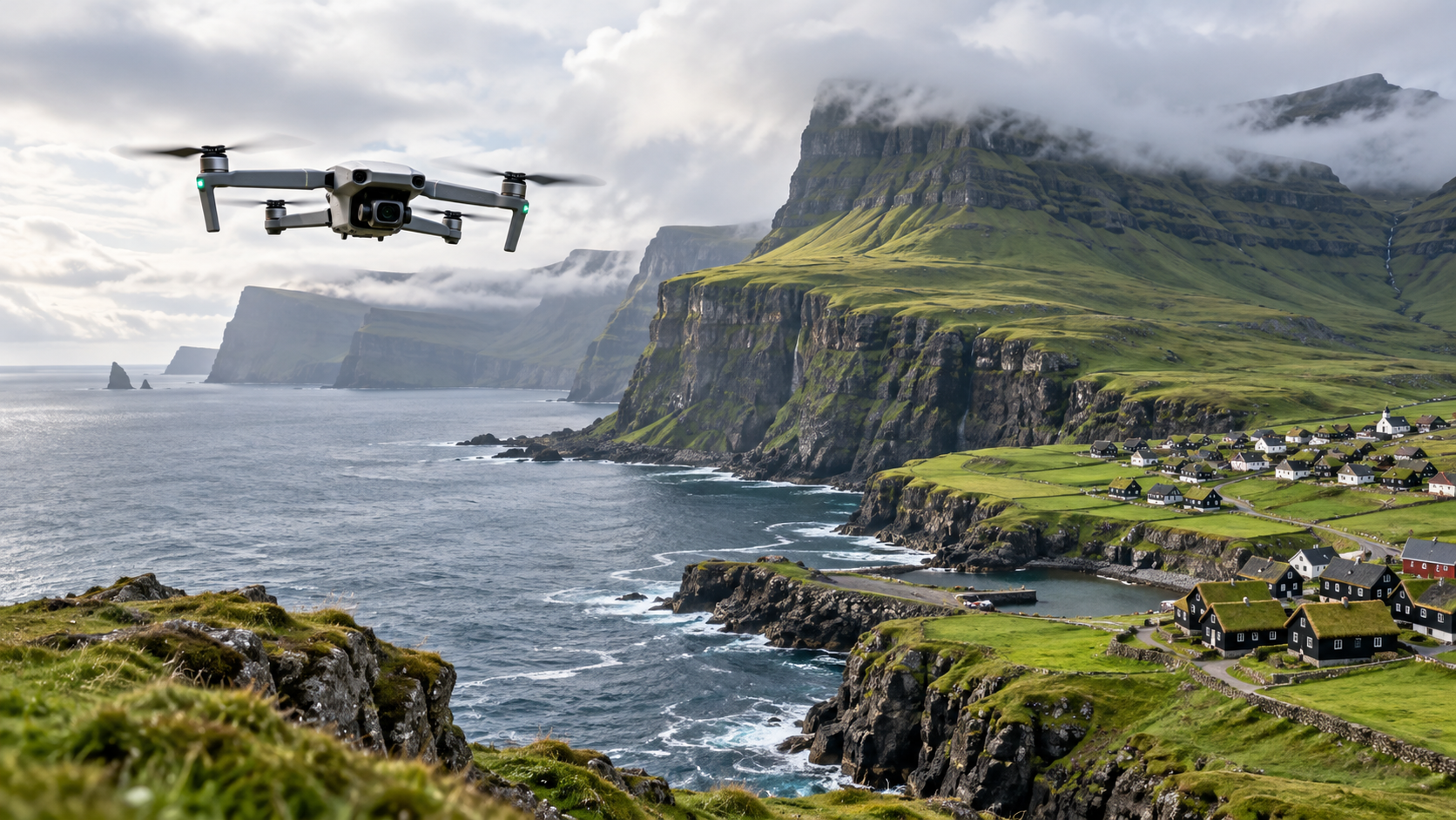
Few places look as though they were designed for aerial photography quite like the Faroe Islands. Sea cliffs rise almost vertically from the North Atlantic, waterfalls drop directly into the ocean, roads snake between tiny settlements, and grass-roofed villages sit beneath steep mountains.
Naturally, many drone pilots arrive wanting to put a drone in the air.
But the drone laws in the Faroe Islands deserve careful attention before you launch. The rules changed significantly in 2024, and some information still circulating online describes an older regulatory system.
Drone flying in the Faroe Islands follows European-style drone regulations alongside specific Faroese rules. The main legal framework is Order No. 113 of 31 January 2024, amended in October 2024, together with Supplementary Order No. 114 of 31 January 2024.
That combination gives you familiar concepts such as the Open, Specific and Certified categories, but it also creates local restrictions around airports, helicopter sites, wildlife, private homes, emergency operations and other sensitive locations.
Here is what you need to know before flying.
Are Drones Legal In The Faroe Islands
Yes. You can legally fly a drone in the Faroe Islands provided your operation complies with the applicable European-style drone rules and the additional Faroese requirements. European drone certificates are also recognised in the Faroe Islands.
The Faroese framework divides drone flights into the familiar three operating categories:
- Open Category for lower-risk flights
- Specific Category for operations requiring additional risk controls or authorisation
- Certified Category for the highest-risk operations
For most tourists, photographers and recreational pilots, the Open Category will be the relevant one.
However, qualifying for the Open Category does not give you permission to fly everywhere. Faroese geographic restrictions apply on top of the category rules.
That is one of the easiest details to miss.
The Basic Drone Rules In The Faroe Islands
If you are flying in the Open Category, several core requirements will look familiar if you have flown elsewhere in Europe.
Keep Your Drone Below 120 Metres
The normal maximum operating height is 120 metres from the nearest point of the earth’s surface.
That wording is particularly relevant in the Faroe Islands because you may be flying around steep mountains, valleys and cliffs. The limit is not simply 120 metres above your take-off point.
The legislation specifically requires the measurement to account for changing terrain.
For example, taking off from a low valley does not mean you can climb hundreds of metres above the surrounding terrain simply because your controller reports your altitude relative to the launch point.
You need to consider the ground beneath and around the aircraft.
Keep The Drone Within Visual Line Of Sight
Open Category flights normally require Visual Line of Sight or VLOS.
This means you must maintain continuous visual contact with the aircraft so that you can monitor its path in relation to other aircraft, obstacles and people. Watching the live camera feed on your controller is not a substitute for maintaining VLOS.
The Faroe Islands can make this more challenging than it sounds.
Cliffs, ridges and rapidly changing weather can hide a drone surprisingly quickly. Flying around the back of a mountain, behind a sea stack or beyond a ridge can take the aircraft outside your direct visual view even if the video connection remains strong.
Do Not Fly Over Crowds
You cannot fly over assemblies of people in normal Open Category operations.
The A1 rules permit certain drones to operate near or, in limited circumstances, over individual uninvolved people, but assemblies of people remain off limits.
That can affect flights near festivals, busy viewpoints, organised events and heavily visited tourist locations.
Drone Categories And Weight Limits
Drone weight and class affect where you can fly and which pilot competency you need.
Drones Under 250 Grams
A drone below 250 grams receives some of the least restrictive treatment.
You generally do not need a drone certificate for a drone weighing less than 250 grams. However, the other flight restrictions still apply.
That means a DJI Mini-sized aircraft does not give you a free pass to ignore:
- airport restrictions
- protected areas
- private property
- VLOS requirements
- the 120-metre height limit
- wildlife restrictions
- emergency-response zones
Operator registration can also still be required if the drone contains a sensor capable of recording personal data, such as a camera, unless the applicable toy exemption applies. The Faroese regulations require registration when operating a drone weighing 250 grams or more and also when operating certain lighter aircraft equipped with such sensors.
A1 Operations
A1 covers lighter aircraft including C0 and C1 drones under the relevant conditions.
Flights over assemblies of people are prohibited. With a C1 aircraft, you should not plan to fly over uninvolved people and should minimise the duration of any unexpected overflight.
A2 Operations
A2 allows C2 drones to operate closer to people than A3 permits.
The normal minimum horizontal distance from uninvolved people is 30 metres, which may be reduced to 5 metres when the aircraft is operating in the applicable low-speed mode and the relevant requirements are met.
A2 competency can also become important around some Faroese helicopter landing sites, as we will cover below.
A3 Operations
A3 is designed for operations well away from uninvolved people and built-up areas.
If you are using a heavier legacy drone that does not qualify for A1 or A2, A3 restrictions may significantly reduce the number of practical locations where you can fly.
Before travelling, identify exactly which class and category your aircraft falls into rather than relying solely on its advertised weight.
You Must Check The Faroese Drone Zone Map
Checking a map should be part of your pre-flight routine for every flight.
Faroese legislation allows geographic drone zones to be created for reasons including aviation safety, security, privacy and environmental protection. The zones can be permanent or temporary.
Vágar Airport directs pilots to the dedicated Faroese drone-zone map before operating.
The map does not remove your responsibility to understand the underlying rules. Some restrictions may not appear as obvious permanent map zones.
Private residential properties are a good example. Supplementary Order No. 114 specifically notes that private occupied properties may not appear on the drone-zone map even though overflight can still require consent. Emergency sites may also arise with little warning.
So a blank-looking map area should never be interpreted automatically as permission to launch.
Check Where You Can Fly in the Faroe Islands
Use the official Dronezoner interactive map to check geographical drone zones and restrictions around your planned flight location before takeoff.
Stay At Least 5 Kilometres From Vágar Airport
Vágar Airport is the Faroe Islands’ main airport, and the local rules establish a significant protection area around it.
Drone operations must not take place within 5 kilometres horizontally of the runway of a publicly approved aerodrome without the relevant authorisation.
This is particularly relevant for visitors because many well-known landscapes are on Vágar.
A location may appear remote when you are standing beside cliffs or a waterfall, yet still sit inside aviation-sensitive airspace.
Check the actual drone map rather than estimating five kilometres visually or assuming that a scenic location must be far enough from the airport.
Watch For Helicopter Landing Sites
Helicopters are an important part of Faroese transport and emergency services, creating another issue drone pilots need to plan around.
Drone operations normally must remain at least 2 kilometres horizontally from a private helicopter landing site used for Helicopter Emergency Medical Services.
There is an exception for pilots with the relevant competency certificate.
Such pilots may operate as close as 1 kilometre under the conditions set by the legislation. Between 1 and 2 kilometres, the drone must not exceed 40 metres above the landing site’s runway elevation.
You should never rely solely on seeing or hearing a helicopter before deciding whether the airspace is clear.
Know where the landing areas are before launch.
Private Homes Require Extra Care
Some of the most photogenic Faroese landscapes include villages, grass-roofed homes and traditional settlements. That does not mean those buildings become part of the scenery you are automatically permitted to overfly.
The rules specifically protect residential properties.
Flying over houses and associated gardens, courtyards or similar areas bounded by a fence, hedge, wall or comparable boundary generally requires consent from the owner or resident.
There are also restrictions on operating very close to residential buildings.
For certain residential operations, flights within 5 metres of a residential property require the relevant consent or fall under specific exceptions, and residents must be informed in situations covered by the regulation.
This is especially important if you are filming a village.
A cinematic tracking shot over rooftops may look harmless from your controller, but it can create both aviation-law and privacy issues.
Position yourself and frame the shot so that the aircraft does not unnecessarily enter residential property.
Protected Nature Has Seasonal Restrictions
The Faroe Islands’ dramatic landscapes are also important habitats.
The drone rules include specific restrictions for environmentally sensitive areas, including locations protected under Faroese nature law and Ramsar-related protections.
Between 15 April and 30 August, drone operations over these areas are heavily restricted. Flights are generally reserved for necessary tasks carried out for authorities or the relevant landowner, unless the Danish Civil Aviation and Railway Authority grants permission.
The regulation also requires the remote pilot carrying out qualifying operations in these areas to hold the appropriate competency certificate.
Those dates overlap with the main tourism season and an important period for nesting birds.
For a visiting photographer, that makes checking environmental restrictions before planning a location essential.
A spectacular bird cliff is not automatically an appropriate drone launch site simply because the aircraft can physically reach it.
Do Not Disturb Birds Or Livestock
The restrictions go beyond designated conservation zones.
Faroese supplementary rules state that flying over animals or herds in enclosed agricultural land generally requires the owner’s consent. Operations over or near animal populations, including birds, are restricted to specified necessary activities unless permission is granted.
This is highly relevant in the Faroe Islands, where sheep are widespread and large seabird colonies occupy cliffs that photographers naturally want to film.
If wildlife reacts to your aircraft, climbing higher or moving slightly farther away should not be your first assumption. The location itself may be unsuitable or restricted.
Check the legal status before launch.
Whale Hunts And Fisheries Inspections Have Specific Restrictions
The Faroese drone rules also address activities that you may not encounter elsewhere.
Drone operations must remain at least 150 metres horizontally from an area where a grind whale hunt is taking place. The restriction applies while the activity is underway.
A similar 150-metre restriction applies when the Fisheries Inspection is conducting an inspection.
If one of these activities begins near your operating area, the sensible response is to end the flight rather than trying to capture closer footage.
Emergency Sites Have A 1 Kilometre Protection Area
Do not use a drone to get a better view of an accident, rescue operation or police response.
The Faroese rules establish a 1,000-metre horizontal restriction around emergency-response sites where police or other emergency authorities are operating, subject to specified exceptions.
Another 1,000-metre restriction applies around certain Fisheries Inspection operations involving wreck cleanup or searches for missing people following accidents or shipwrecks.
Emergency aircraft may be operating at low altitude and can appear quickly.
If an emergency operation develops near you and your drone could interfere with responders, land immediately.
Military And Security Areas Have Larger Buffers
Several additional geographic restrictions may affect professional or recreational operations.
Drone operations generally cannot take place within 150 metres of certain security-sensitive locations such as diplomatic representations, police property, correctional institutions and specified sensitive businesses without the required permission.
Military areas receive even larger protection zones.
The standard restriction is 1,000 metres from military areas, including training and temporary military areas, unless prior consent has been obtained from the Danish Defence Command. Different provisions apply in certain urban military locations.
There are also restrictions around military aircraft, military convoys and naval vessels.
Always check the drone-zone information immediately before flight because security restrictions can be temporary.
There Are Rules For Roads And Power Lines
Roads and infrastructure can create restrictions even when you are nowhere near an airport.
Under the Faroese supplementary order, you generally cannot fly over a public road with a speed limit above 70 km/h without permission from the responsible infrastructure manager. The remote pilot must also have the relevant competency certificate.
You must also remain at least 5 metres from live overhead power lines unless you have permission from the responsible infrastructure manager and meet the applicable competency requirements.
This can affect landscape photography because many convenient take-off points are beside roads.
Do not launch from a roadside and immediately cross traffic without first checking whether your planned route is legal.
You May Need Drone Insurance
Liability insurance is part of the Faroese regulatory framework.
Supplementary Order No. 114 states that drone operations must generally be covered by valid liability insurance, while providing defined exemptions including certain toy drones.
Official Faroese visitor guidance states that where insurance is required, drones generally need liability coverage of at least 0.75 million SDR, approximately DKK 7 million.
Do not automatically assume that every sub-250-gram drone is exempt.
The exact exemptions depend on factors such as whether the aircraft qualifies as a toy and its classification. Check the current insurance requirement for your aircraft before travelling.
Also confirm that your policy actually covers drone operations in the Faroe Islands. A policy valid in your home country may have geographic exclusions.
Keep A Flight Log Where Required
The Faroese rules contain specific flight-record requirements.
Drone operators generally need to maintain a digital log based on automatically recorded flight information. Where automatic logging is unavailable, the log needs to include information such as:
- date
- start and end time
- aircraft used
- flight location or route
- maximum height above terrain
- remote pilot
- applicable certificate
Records generally need to be retained for five years.
There is an exemption from these logging requirements for private individuals flying recreationally with drones under 250 grams or toy drones.
For commercial teams, keeping structured logs should therefore be built into the operation rather than treated as an afterthought.
Commercial Drone Flights Do Not Automatically Require A Different Category
Flying for money does not by itself turn an operation into a Specific Category flight.
The European-style system used in the Faroe Islands is primarily risk-based.
A photographer, surveyor or other commercial operator may still conduct an operation in the Open Category if the aircraft, environment and operation meet all Open Category conditions.
However, a professional purpose does not remove the local Faroese restrictions.
If your assignment requires flying somewhere prohibited by the standard rules, closer to protected infrastructure or under conditions outside the Open Category, you may need an authorisation from the Danish Civil Aviation and Railway Authority.
The authority processes operational permissions and permissions for flights in geographic drone zones covering Denmark and the Faroe Islands.
When A Specific Category Authorisation May Be Needed
Your operation can move into the Specific Category when it exceeds the limits of the Open Category.
Common examples include:
- flying beyond visual line of sight
- operating above normal Open Category altitude limits
- conducting operations whose ground or air risk cannot meet Open Category requirements
- performing certain flights in controlled or restricted environments
Specific Category operations normally require an appropriate operational authorisation, declaration under an applicable standard scenario or another recognised regulatory route.
If you are travelling for a commercial inspection, survey, infrastructure project or complex filming assignment, work out the regulatory category well before arriving on the islands.
Do not plan the mission first and investigate permission once you reach the launch site.
Do European Drone Certificates Work In The Faroe Islands?
Yes. Current Vágar Airport guidance explicitly states that European drone certificates are valid in the Faroe Islands.
That is an important change from the older Faroese regulatory system.
However, recognising your certificate does not cancel local rules. You still need to comply with Faroese geographic restrictions, privacy rules, environmental protections and any required permissions.
It is therefore possible to hold a perfectly valid A1/A3 or A2 certificate and still be prohibited from flying at a particular location.
Do You Need To Register Your Drone?
The requirement is primarily operator registration rather than simply registering every ordinary drone as an individual aircraft.
Under the Faroese framework, UAS operators must register when operating:
- an Open Category drone with a maximum take-off mass of 250 grams or more
- a drone capable of transferring more than 80 joules of kinetic energy in an impact
- a drone equipped with a sensor capable of capturing personal data, unless the applicable toy exemption applies
- any drone in the Specific Category regardless of mass
Operators based in the Faroe Islands register in the Danish Civil Aviation and Railway Authority’s register and must place their operator registration number on relevant aircraft.
If you are visiting from abroad, verify your operator-registration position with the authority before travelling rather than assuming that possession of a pilot certificate alone is sufficient.
A Small Drone Still Has To Follow The Faroese Rules
A sub-250-gram drone can make travel easier, but it does not remove the geographical restrictions.
Even with a lightweight drone, you still need to think about:
- the 120-metre limit
- VLOS
- crowds
- Vágar Airport
- helicopter landing sites
- private homes
- wildlife
- protected nature
- military areas
- emergency operations
- fisheries inspections
- active whale hunts
- temporary drone zones
The Faroese rules apply even to drones weighing less than 250 grams.
That is worth remembering if you chose a Mini-class drone specifically because you expected unrestricted travel flying.
Weather Can Turn A Legal Flight Into A Bad Flight
The law tells you where and how you may operate. It does not guarantee that conditions are suitable.
The Faroe Islands combine mountains, cliffs, ocean exposure and rapidly changing weather. Wind conditions at your launch point can be very different from those several hundred metres away near a cliff edge or above a ridge.
Low cloud can also remove visual contact quickly.
Before every flight, check:
- wind speed and gusts
- wind direction
- precipitation
- cloud and visibility
- battery performance in the current temperature
- your return route
- terrain between you and the aircraft
Set conservative operational limits.
A drone technically capable of handling a certain wind speed does not mean you should operate continuously at that limit above the North Atlantic.
Pre-Flight Checklist For The Faroe Islands
Before launching, run through this sequence.
Confirm your aircraft category. Know its weight, C-class and which Open Category subcategory applies.
Confirm your pilot competency. Check whether your aircraft requires A1/A3, A2 or another qualification.
Check operator registration. A camera-equipped drone may create registration requirements even below 250 grams.
Check your insurance. Confirm both the required level and geographical coverage.
Open the current Faroese drone-zone map. Do this shortly before every flight rather than relying on a screenshot saved days earlier.
Measure your distance from Vágar Airport and helicopter sites.
Look for private homes and property boundaries.
Check whether the location is environmentally protected.
Look for birds, sheep and other animals.
Check for roads, power lines and sensitive infrastructure.
Look for police, rescue, fisheries or military activity.
Check the weather.
Maintain VLOS throughout the flight.
It may seem like a lot for a short scenic flight, but once you build the checks into your normal planning routine, they become quick.
Learning The Rules Before Travelling Saves You Trouble
The Faroe Islands offer extraordinary opportunities for aerial photography and professional drone work, but the operating environment demands more preparation than simply finding an attractive viewpoint.
The key is to think in layers.
First, determine which European-style operating category applies to your aircraft and mission. Then apply the Faroese restrictions to the exact location. Finally, check the live drone-zone information and conditions immediately before launch.
If you want to strengthen your flight-planning, photography, inspection or advanced drone-operation skills before taking on more demanding missions, you can explore the specialist training available through ABJ Drone Academy online drone courses.
Frequently Asked Questions
Can You Fly A Drone In The Faroe Islands?
Yes, you can legally fly a drone in the Faroe Islands. You must comply with the European-style drone regulations used there as well as the additional Faroese rules governing airports, helicopter sites, protected nature, property, wildlife and sensitive areas.
What Is The Maximum Drone Altitude In The Faroe Islands?
The normal Open Category maximum is 120 metres from the nearest point of the earth’s surface. In mountainous terrain, this means you need to account for the terrain beneath the aircraft rather than measuring everything solely from your take-off point.
Can I Fly A DJI Mini In The Faroe Islands?
Yes, you can fly a sub-250-gram DJI Mini in the Faroe Islands if you comply with the applicable rules. You normally do not need a drone pilot certificate for an aircraft below 250 grams, but airport zones, VLOS, altitude limits, privacy rules, environmental restrictions and other Faroese requirements still apply.
Do I Need A Drone Licence In The Faroe Islands?
It depends on your drone and operation. Drones below 250 grams generally do not require a pilot certificate, while larger or differently classified aircraft may require A1/A3, A2 or other qualifications. European drone certificates are recognised in the Faroe Islands.
How Close Can I Fly To Vágar Airport?
You normally need to remain at least 5 kilometres from Vágar Airport. Faroese regulations prohibit ordinary drone operations within 5 kilometres horizontally of a runway at a publicly approved aerodrome unless the relevant permission applies.
Can I Fly A Drone Over Faroese Villages?
You cannot simply assume that flying over a village is allowed. Residential buildings, enclosed gardens and similar private areas are protected by specific consent requirements, while your drone category may create additional separation requirements from built-up areas and uninvolved people.
Can I Fly Near Birds In The Faroe Islands?
No, you should not assume that flights near bird populations are permitted. Faroese rules restrict operations over or near animal populations including birds, while additional seasonal rules apply in environmentally sensitive areas.
Can I Fly A Drone In Protected Areas?
Drone flying in protected areas can be heavily restricted. In designated environmentally sensitive areas, especially between 15 April and 30 August, operations are generally limited to specified necessary activities unless permission is granted.
Do I Need Drone Insurance In The Faroe Islands?
Liability insurance is generally required unless your aircraft falls within a specified exemption. Faroese rules contain exemptions for certain toy drones, while applicable insured operations may require substantial third-party liability coverage.
Can I Fly Beyond Visual Line Of Sight In The Faroe Islands?
Not as an ordinary Open Category flight. Open Category operations normally require you to keep the drone within visual line of sight, while BVLOS operations generally move into regulatory arrangements requiring additional authorisation or Specific Category compliance.
Are EU Drone Certificates Valid In The Faroe Islands?
Yes, European drone certificates are recognised in the Faroe Islands. You still need to comply with all additional Faroese operating and geographic restrictions.
Where Can I Check Where Drone Flying Is Allowed?
Use the official Faroese geographic drone-zone map before every flight. The map identifies relevant geographic drone zones, although some restrictions such as private residential properties or newly established emergency sites may not always appear as permanent mapped areas.