

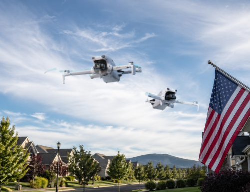
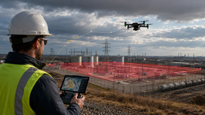
You’ve probably relied on visual map boundaries to avoid no-fly zones or sensitive areas during drone operations. But what happens when you switch to manual mode or your drone auto-returns during an emergency?
Drone Harmony’s latest update for DJI Dock now actively enforces geofences and no-fly zones at the drone firmware level. Whether you’re on an automated mission, manually piloting, or triggering a Return-to-Home (RTH), your drone won’t breach these predefined zones. The change is a complete overhaul of how restrictions are handled across all flight types.
Mandatory Geofence Sync
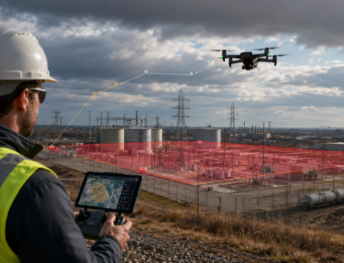
The feature enables you to synchronise your no-fly zones and geofences to the drone’s firmware directly. This means that even when network connectivity is lost or if the mission deviates from its path, the drone independently upholds the rules set on the ground. These boundaries are enforced uniformly — whether the drone is flying autonomously, controlled manually, or responding to a system-triggered RTH procedure.
This system-wide enforcement is particularly valuable in unpredictable operational environments where multiple variables — like wind speed, GPS interference, or battery anomalies — can alter flight patterns.
Value to DJI Dock Users
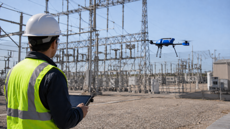
If you’re managing BVLOS flights, inspecting industrial assets, or operating near sensitive zones like airports or power substations, this change gives you real confidence that the drone will not cross into prohibited areas. Regulatory compliance is no longer left to chance.
Operators gain legal assurance, which is crucial in jurisdictions where drone violations carry severe penalties. From a planning perspective, it reduces the time spent recalculating mission routes and mitigates the administrative burden of constant pilot oversight.
This also strengthens your case when applying for flight permits. Authorities prefer systems that minimise human error and automate airspace discipline. Now, your operation meets those expectations with minimal manual intervention.
Related Reading: Geofencing Update: DJI Removes Automatic No-Fly Zones
How to Enable Geofence Sync for DJI Dock
Activating this feature requires minimal setup:
- Access the Telemetry Tab in your DJI Dock control interface.
- Switch into Debug Mode, accessible with a few simple clicks.
- Toggle the Geozone Sync setting to ON.
- Wait up to one minute for confirmation that syncing is complete.
After this setup, the drone’s firmware will acknowledge geofences and no-fly zones just as it does GPS coordinates and altitude restrictions. You won’t need to repeat this process unless you change the defined zones.
A Closer Look at Field Impact
Say you’re on an oil and gas inspection site with multiple hazards: pipelines, antennas, and temporary scaffolding. You’ve set no-fly zones around these obstacles. Mid-mission, wind changes direction and you trigger RTH. Prior to this update, the drone could’ve tried to fly through those hazards to get back quickly. Now, it recalculates a safe return route, avoiding all danger zones.
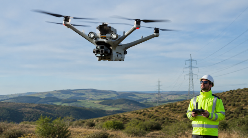
Or it could be a drone team manually navigating near a telecom tower in a semi-urban environment. The geofence is set to 500 metres in radius from the dock. A pilot veers slightly due to distraction or sudden interference. Instead of breaching the boundary, the drone halts within a safety buffer, giving the operator time to adjust and redirect without a compliance breach.
This kind of enforcement builds operational consistency. Team members can trust that system-level controls have their backs, even when conditions on the ground vary.
New Standards in Operational Safety
This update creates new industry standards for:
- Airspace discipline
- Risk mitigation
- Legal compliance
- Operational consistency
- Automation safety
Geozone enforcement across all flight modes eliminates the weakest link — human oversight during critical manoeuvres. That’s particularly useful during large-scale inspections, environmental surveys, or any situation where a team is juggling multiple drones or operating in a cluttered environment.
Now, rather than needing constant real-time monitoring of every pilot’s movements, your system builds discipline into the drone’s DNA. This shift enables better crew coordination, especially in operations where multiple roles (pilot, observer, analyst) must work in sync.
Solving the Pain Points You Know Too Well
Manual Flight Gaps
You’ve experienced it — manual mode grants more freedom but often introduces risk. A moment of delay, a false signal, or human error can lead to violations. This update applies the same discipline to manual flight as it does to automated ones. Your drone stops short of boundaries even if the pilot tries otherwise.
Inconsistent RTH Behaviour
Until now, RTH calculations often prioritised speed over safety. Drones took the shortest path, even through restricted airspace. Now, the path is recalculated intelligently, always honouring no-fly zones. This reduces your reliance on pilot intervention during emergencies.
Multi-Operator Confusion
In teams, not every pilot has the same experience or training. If one member forgets a restriction or flies too close to a sensitive structure, consequences follow. With synced geofences, the drone becomes a backup system that enforces rules autonomously. Your whole team benefits, regardless of individual skill level.
Regulatory Uncertainty
Some jurisdictions require proof that drones won’t enter sensitive areas under any condition. Syncing geozones to the drone creates a clear compliance mechanism. It simplifies documentation and strengthens your position when applying for high-risk flight approvals.
Mission Disruptions
An inspection drone interrupted by sudden interference or rerouted by weather no longer risks accidentally entering restricted airspace. This builds redundancy into your flight operations, adding an extra layer of assurance for mission-critical tasks.
Software Watch: How Drone Harmony Fixes UAV Data Chaos
Strategic Advantages of the Drone Harmony Geofencing Update for Your Organisation
By integrating geozone sync into your workflow, you:
- Reduce training time for new pilots
- Strengthen safety protocols across departments
- Lower operational insurance premiums due to fewer violations
- Boost your eligibility for sensitive, high-reward contracts
Investors and regulatory bodies alike favour operators who demonstrate proactive safety planning. This update signals your commitment to excellence, precision, and compliance.
It also prepares your fleet for integration with larger systems — like air traffic management networks or inter-agency coordination platforms — where automated discipline is a requirement, not a luxury.
Preparing for the Next Generation of Missions
The airspace of tomorrow will be crowded. Drone deliveries, automated infrastructure repairs, AI-based surveillance — these operations require strict, embedded rules. Systems that can self-enforce geo-boundaries without constant human input will rise above the rest.
By adopting geofence sync now, you’re getting ahead of this shift. You’re making your fleet future-ready. And you’re gaining the ability to scale without scaling risk.
This is particularly valuable if you plan to transition into urban environments or cross-border drone corridors where airspace is highly regulated.
Your Action Plan
Here’s what you should do next:
- Update your Drone Harmony software to the latest version.
- Define and refine your geofences and no-fly zones. Don’t just rely on old maps — consult local regulations and operational risks.
- Test the sync feature. Run trial flights in varied conditions. Observe how the drone behaves near boundaries.
- Train your team. Familiarise everyone with the new enforcement system so they understand what to expect.
Frequently Asked Questions About Drone Harmony Geofencing for DJI Dock
- What is geofence sync in Drone Harmony?
Geofence sync is the process of transferring geofence and no-fly zone data directly into the drone’s firmware. This ensures the drone automatically respects these boundaries during all flight modes, including manual and emergency RTH.
- Does geofence sync work during manual flights?
Yes, it does. Even if a pilot manually controls the drone toward a boundary, the firmware will prevent the drone from crossing into restricted zones.
- Will the drone always obey geofences during Return-to-Home?
Yes, it will. The drone recalculates its RTH path in real time to avoid all synced no-fly zones and geofences.
- How long does it take to enable geofence sync?
It takes less than a minute. After enabling the feature in Debug Mode, syncing typically completes within 60 seconds.
- Can I modify the geofences after syncing?
Yes, you can. However, any changes must be resynced to the drone through the interface for them to take effect.
- Do I need an internet connection for geofence sync to work?
You need connectivity to initiate the sync, but once zones are synced to the drone, it enforces them independently of a live connection.
- Will syncing geofences affect my flight performance?
No, it won’t. The drone will perform as usual, but it will stop or reroute when approaching restricted areas.
- Is this update mandatory to continue using Drone Harmony?
No, but it’s highly recommended. Not using geofence sync means manual and RTH flights remain vulnerable to breaching sensitive zones.
- Does this update help with compliance?
Yes, significantly. Synced geofences provide an auditable safety layer that supports compliance with local airspace regulations.
- Can multiple drones in a fleet share the same geofence data?
Yes, once the data is defined and synced, it can be applied across multiple drones operating from the same DJI Dock interface.