

Firmatek’s Kespry Cloud is a cloud-based drone data and analytics platform designed for industries like mining, aggregates, construction, solid waste, and even pulp & paper. It combines field data capture with powerful cloud processing to transform raw aerial data into dynamic 3D models, accurate measurements, and actionable insights. The platform is easy to deploy in the field and accessible from anywhere, breaking down traditional barriers to confident decision-making in industrial operations.
By putting intuitive geospatial analytics in the hands of more people across an organization, Kespry Cloud helps democratize data and eliminate guesswork, so teams can make better-informed decisions that protect the bottom line.
How does Kespry Cloud deliver value?
It provides a “field-to-finish” solution that handles everything from drone-based data collection to cloud-based processing, analysis, and reporting.
Firmatek, with 30+ years in drone mapping and millions of stockpiles measured, has integrated its service expertise with Kespry’s industry-leading software to create a single platform.

This combined offering gives users the flexibility to either capture and process data themselves or leverage Firmatek’s team for data processing and advanced analysis – all while using the same cloud interface for results.
As a result, companies can choose a DIY approach, full-service support, or a hybrid, knowing that all their site data and reports will reside in one secure cloud system accessible to the entire team.
Step-by-Step Workflow: From Data Collection to Insight
The Kespry Cloud workflow can be summarized in a few key steps, whether users fly their own drones or use Firmatek’s services:
-
Drone Data Capture
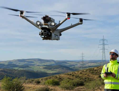
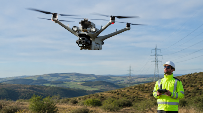
A drone (e.g. DJI’s Mavic 3 Enterprise, Phantom 4 RTK, etc.) is flown over the site to collect high-resolution aerial imagery or LiDAR scans. Firmatek’s integration with the latest drones like the Mavic 3 Enterprise means users benefit from longer flight times, a 4K mechanical-shutter camera, obstacle avoidance, and RTK/PPK GNSS precision for accurate mapping. Because these drones capture geo-referenced data with survey-grade accuracy, extensive ground control points aren’t always needed – an entire site can be surveyed in as little as 30 minutes without laying multiple targets.
-
Data Upload & Cloud Processing
After the flight, the raw data (images or point clouds) is uploaded to the Kespry Cloud platform. Users are prompted to choose between “Self Service” (the system will automatically process the data) and “Firmatek Service” (Firmatek’s team will handle processing and analysis). If self-serving, the platform uses an integrated photogrammetry engine (Pix4D) to stitch aerial images into orthomosaics and 3D terrain models automatically.
In either case, standard datasets – such as orthophotos, digital surface models (DSMs), point clouds, and 3D meshes – are generated and stored in the cloud. For projects requiring extra precision or custom outputs, Firmatek’s processing engineers can incorporate additional data (e.g. surveyed ground control, LiDAR data, CAD files) and deliver “premium” GIS data products via the cloud. Data is typically processed and quality-checked within 24–48 hours, so results appear quickly in the cloud interface.
-
Automated Modeling & Analysis
Once processing is complete, users can log into Kespry Cloud from anywhere (office, jobsite, or home) to view and analyze their site in detail. The platform automatically produces a high-resolution 3D model of the site that can be viewed in different forms – as an interactive textured mesh, as a colorized point cloud, or even as a classified point cloud where non-ground features (like machines or vegetation) are algorithmically filtered out. This allows users to switch layers and see, for example, a raw point cloud with RGB values or a cleaned ground surface for volume calculations. The 3D viewer is web-based and recently got a major upgrade (using CesiumJS) to provide smoother navigation, touchscreen support, and easy tools for perspective control. Users can zoom, pan, tilt, or instantly jump to points of interest – for instance, double-clicking a stockpile in 2D will zoom the 3D view to that pile.
-
Measurements & Interactive Tools
With the model loaded, Kespry Cloud offers a rich suite of measurement and analysis tools. Site mapping and calculation features include: area and distance measurements, spot elevations, slope gradients, and more. Critically, the platform excels at volumetric analysis for stockpiles and earthworks. Users can draw polygonal boundaries around piles or regions of interest in the 2D/3D view; the software then calculates volumes, applying either a best-fit base plane or a custom base (e.g. previous ground surface). The system even supports advanced volume options like selecting a specific base reference (ground, lowest point, design surface, etc.) and toggling on “Use Extracted” to calculate volume from the feature-extracted ground surface (i.e. after removing vegetation/machinery for higher accuracy).
Stockpile inventory management is further streamlined by the ability to assign each polygon a Pile ID and material density. In fact, users can now rename pile IDs to meaningful names (e.g. “North Sand Pile”) as they draw the polygon, ensuring consistency of pile identifiers across repeated surveys. All these measurement tools help convert raw data into the metrics that operations and finance teams care about – volumes in tons or cubic yards (with support for industry-specific units like “cords” for timber inventories).
-
Comparisons & Change Detection
Kespry Cloud makes it easy to compare data over time or against design targets. Users can overlay multiple mission datasets to visualize changes – for example, generating a cut/fill map that highlights where material was removed or added between two dates. There is also a dedicated Cross-Section tool: users draw a line across any area of the site, and the platform will slice the 3D model along that line to show a profile view (elevation vs distance).
In April 2023, Firmatek introduced a Cross-Section Report feature that exports PDF reports containing cross-sectional diagrams and measurementsfirmatek.comfirmatek.com. These reports can include multiple cross-sections, each with detailed metrics (length, grade, min/max heights) and even comparisons to a design surface or previous surface if providedfirmatek.comfirmatek.com. Such tools are invaluable for tracking progress (e.g. how a slope is being cut/filled over time) and for ensuring compliance with design specs or safety regulations (e.g. verifying that a haul road grade does not exceed allowable slope).
-
Reporting & Collaboration
After analysis, Kespry Cloud enables users to generate comprehensive reports and share data with stakeholders. The platform’s reporting module is highly customizable – users can select which piles or data points to include, choose whether to include an overview site map, and even add specific outputs like DSM images or cross-section visuals. The resulting reports (often PDF) compile all chosen measurements, tables (e.g. volumes per pile, material tonnages), and maps into a professional format that can be downloaded or forwarded. A June 2023 update let users tailor the report content and sorting order, and include a digital surface model snapshot for context. And since all project data is in the cloud, team members can access the latest information anytime, anywhere – whether in the field on a tablet or at headquarters – simply by logging into the Kespry Cloud web portal. Role-based access allows broader collaboration across departments (operations, engineering, survey, accounting) while maintaining control.
The system can also send out notifications when new data or reports are added. Users have granular control over these notifications (after a mid-2023 upgrade) – they can centrally manage which sites and events trigger email alerts, avoiding notification overload. In short, Kespry Cloud serves as a single source of truth for site data, where everyone from site managers to executives can quickly get the answers they need.

Kespry Cloud’s 3D viewer now supports full point cloud visualization and automatic classification. In this example, non-ground points like vegetation and equipment (in red) are filtered out, leaving clean ground surfaces (blue) for precise volume calculations. Users can toggle between the raw point cloud, mesh, or classified view, enhancing their understanding of site conditions.
Source: Firmatek
Advanced Features and Technologies in Kespry Cloud
Below are some of the standout features and components that power the platform:
-
Automated Photogrammetry
At its core, Kespry Cloud uses photogrammetry algorithms to convert 2D aerial images into accurate 3D models. The cloud platform handles image upload and stitching automatically, so users get quicker access to maps and models without manual intervention. By partnering with Pix4D for processing, Firmatek ensures that drone imagery yields high-fidelity orthomosaic maps and elevation models every time. This automation saves time and doesn’t require users to be experts in photogrammetry – they simply fly the drone and upload data, and the system returns survey-grade outputs. Even complex topography can be captured with sub-meter accuracy, and recent improvements allow users to input local geoid offsets (NAVD88, NGVD29, or custom) to enhance vertical accuracy of their datasets. Supporting different geoids means the elevation data and contours align with official survey datums, which is critical for engineering and compliance.
-
High-Precision GNSS & PPK Integration
One key to Kespry Cloud’s accuracy is its support for high-precision GNSS data. The platform fully leverages drones equipped with RTK/PPK GPS to geo-tag imagery with centimeter accuracy. For example, the DJI Mavic 3 Enterprise integration brings an RTK module that, when paired with a base station or network, drastically reduces the need for ground control while maintaining accuracy. Firmatek has documented that using drones like the Phantom 4 RTK or Mavic 3E, an entire site can be captured accurately in a single short flight. PPK (Post-Processed Kinematic) workflows are also compatible – users can upload RINEX GNSS logs to refine drone positions after the flight if needed. By embracing these technologies, Kespry Cloud delivers survey-grade results (within a few centimeters) for volume and distance measurements, even on large sites, giving clients confidence to replace or augment traditional ground surveys.
-
LiDAR Data Support
In addition to photogrammetry, Firmatek recognizes the value of LiDAR for certain applications (like dense vegetation or night surveys). While photogrammetric processing is automated in Kespry Cloud, the platform and Firmatek’s team can also integrate LiDAR point clouds into deliverables. Firmatek’s engineering team often combines data from various sources (drone photogrammetry, terrestrial or aerial LiDAR, GPS surveys, etc.) into a common format for clients. They can process and merge LiDAR scans to produce detailed topographic maps, digital elevation models, and contour lines for a site. The cloud platform’s new 3D Point Cloud viewer (introduced in late 2024) in fact allows visualization of any point cloud data in the browser – including photogrammetric point clouds or imported LiDAR datasets. This is especially useful in landfill and mining sites where LiDAR can penetrate brush or measure ground under stockpiles. By handling LiDAR and imagery, Kespry Cloud offers a versatile solution no matter the sensor used.
- Stockpile Inventory Management
Given Firmatek’s legacy in stockpile measurement, it’s no surprise that Kespry Cloud has robust tools for inventory tracking. The platform can autonomously detect and calculate stockpile volumes with a high degree of accuracy. Users can manage dozens or even hundreds of piles across a site: each stockpile’s polygon can store metadata like material type, density (to convert volume to tonnage), and custom IDs/names. New features let users save these volume polygons in a folder structure and reuse them for subsequent missions, enabling direct comparisons of the same pile over time. This is incredibly useful for tracking inventory change – e.g., seeing how a coal pile’s volume fluctuates week to week.
Large aggregates and mining companies have moved from doing annual or quarterly physical inventories to performing frequent drone flyovers and using Kespry Cloud to monitor stockpiles continuously. The result is better accounting (minimal surprises in end-of-year reconciliation) and operational agility (adjusting production or sales based on up-to-date inventory data). One case study in the pulp & paper sector showed that a mill was able to perform volumetric surveys of its woodchip piles every 3–5 days, directly in Kespry Cloud. By combining the aerial volume data with inputs like wood density (affected by species and moisture content), the system gave near-real-time insight into how many tons of material were on hand and how long they would last. This feedback loop allowed the client to optimize procurement and avoid costly shutdowns due to running out of raw material.

Kespry Cloud’s inventory tools allow users to outline stockpiles and instantly compute volumes. Piles can be color-coded in the 3D view for easy identification by material or status Each pile polygon carries its ID and properties, and volumes can be compared across multiple surveys to track changes over time.
-
Advanced Analytics (Cut/Fill, Cross-Sections, Haul Roads)
Beyond stockpiles, Kespry Cloud supports a range of site analysis needs. The Cut/Fill tool can overlay two surfaces (e.g., last month vs. today, or design grade vs. current grade) and highlight volume differences, giving a color-coded cut-and-fill map of earthmoving progress. This is invaluable for mine planning and construction earthworks to see where extra material is being removed or where fills are ahead/behind, and quantify those volumes. The Haul Road Analysis feature is another unique tool: it evaluates the slope and curvature of haul roads on site to ensure they meet safety and design standards. For example, a mine can automatically check that road grades stay below a certain percentage and that switchbacks have proper turning radius. If any segment is too steep, managers get alerted and can take corrective action (grading the road or revising the route) to prevent accidents. The Cross-Section capability, as described earlier, lets users draw any line and instantly see the elevation profile along it – useful for checking highwalls in a quarry or the depth of a trench. The fact that the platform can include design files in these analyses is a big plus: users can import a planned design surface (for a pit, landfill cell, construction site, etc.) and then view cross-sections or comparisons between the as-built vs. as-designed right in Kespry Cloudfirmatek.com. This helps catch deviations early and document that work is within spec.
- 3D Visualization and Virtual Inspection
Working with geospatial data is far more intuitive when you can see it in 3D, and Kespry Cloud’s viewer makes that possible on any standard laptop or tablet. The recent 2024 upgrades introduced a more modern 3D interface with smooth rendering and interactive controls. Users can navigate the virtual site as if flying around it. There are tools to extract a particular pile into its own 3D space (essentially isolating a stockpile model for closer examination of its shape). Cross-section lines and even point annotations placed on the 2D map are now visible in 3D as well, providing full context of their location on the terrain. These capabilities turn Kespry Cloud into a kind of “virtual jobsite” where remote stakeholders can perform inspections and measurements that previously required walking the site. For example, landfill managers can inspect a 3D model of the fill progression to ensure proper slopes, or construction project owners can virtually tour the site to see progress in excavations and fills. The benefit is not just cool visuals – it’s about situational awareness. A 3D view of a mine or construction site makes it easier to spot issues like wall instability, flooding in a pit, or an overlooked stockpile, and thus improves decision-making.
-
Custom Deliverables and Data Export
While many insights can be gained within the Kespry Cloud UI, the platform also supports exporting data for external use. All the GIS data is stored centrally and can be downloaded in common formats – e.g., orthophotos (GeoTIFF), 3D point clouds (LAS/LAZ files), contour maps (DXF/SHP), volumetric reports (CSV/PDF), etc. This means companies can easily pull data from Kespry Cloud into their other systems: for instance, importing a DSM into civil engineering software (AutoCAD Civil 3D or MicroStation) for design updates, or feeding volume results into an inventory management or ERP system. In fact, the Kespry Cloud page notes that data “can also easily be used in their operational systems,” highlighting interoperability as a priorityf.
Moreover, for clients who engage Firmatek’s team for value-added services, the platform now has a “Premium Deliverables” section in the interface: any custom products that Firmatek creates (such as cleaned point clouds, tailored engineering reports, CAD models, or even methane emission maps from specialized sensors) are delivered through the cloud portal for easy access. This hub keeps everything organized – standard automated outputs in one place and special request deliverables in another – but all within the same application.

Source: Firmatek
Kespry Cloud Industry Applications
One of the strengths of Kespry Cloud is that it’s been refined with direct input from professionals in mining, aggregates, waste management, construction, and other sectors. Let’s look at how the platform is applied in these industries and some real examples of benefits:
Mining & Aggregates
Mining and aggregate companies were early adopters of Kespry’s drone technology, and today many have standardized company-wide on Kespry Cloud for inventory and mine planningf. The platform is considered a “leading site software solution” in this space, because it handles the core needs of a mine: stockpile measurements, pit mapping, highwall monitoring, blast analysis, and reconciliation of extracted volumes. In practice, mines using Kespry Cloud can conduct frequent aerial surveys (even weekly or daily) to capture up-to-date snapshots of their operations. The data is used for:
- Inventory Management: Instead of waiting for year-end or quarter-end to walk stockpiles with GPS or hire surveyors, mines can fly drones and get precise volumes of materials like ore, waste rock, or aggregates. This frequency drastically reduces uncertainty. Using Firmatek + Kespry Cloud leads to low year-end variances because surprises are eliminated and any discrepancies are caught early. It promotes collaboration between operations and accounting – everyone trusts the live inventory numbers, which builds confidence and prevents write-downs.
- Mine Planning & Progress Tracking: With each aerial survey, engineers and managers get an on-demand visual history of site changes. For example, they can see how a pit is expanding over time, how a waste dump is progressing, or how much reserve is left in a quarry section. Using the cut/fill and comparison tools, they know exactly how much dirt was moved and can update mine plans accordingly. If a mine plan calls for extracting a certain volume in a month, the drone data will show if they met that target or if adjustments are needed. This ties into contractor billing as well – companies like Turner Mining Group (a large mining contractor) use Firmatek’s drone solutions for billing reconciliation, comparing the volumes they mined vs. what was expected.
- Safety and Compliance: Drone surveys also improve safety by reducing the need for employees to physically climb stockpiles or pit walls to take measurements. In addition, the aerial perspective helps identify hazards: for instance, Kespry Cloud’s models can reveal wall steepness, catch bench widths, or areas of erosion in a mine, allowing proactive mitigation. Mines also utilize the platform for pre- and post-blast analysis. By capturing imagery before a blast and after, they can calculate blast rock yield and ensure that the blast stayed within the planned boundaries. Haul road analyses improve safety by checking road grades, as mentioned, ensuring that ramps are at safe inclines for heavy trucks.
Solid Waste Landfills & Waste Management
Landfills present a dynamic environment where airspace (capacity) is money, and regulatory compliance is paramount. Firmatek serves over 30% of U.S. landfills with its drone solutions, and Kespry Cloud plays a central role in turning frequent aerial data into actionable landfill metrics. Key applications in this sector include:
- Fill Volume & Airspace Management: Landfill operators need to track how quickly they are consuming their permitted airspace (the volume available for waste). Traditionally, this might be done by annual surveys. But as one case study showed, relying on only annual surveys carried significant risks – the landfill could inadvertently overfill beyond permit limits or misjudge when to construct a new cell, leading to either lost revenue or unnecessary capital expense. By switching to quarterly or monthly drone surveys, the landfill in the case study was able to closely monitor remaining airspace. Kespry Cloud provided timely compaction and volume measurements, so the team knew the remaining capacity with much greater certainty. This allowed them to forecast cell construction needs far more accurately, avoiding both premature builds and last-minute scrambles. It also helped catch any overfill situations early, so if trash started to exceed a boundary, it could be regraded immediately to stay compliant.
- Compaction Density Tracking: Compaction (how tightly waste is packed) directly affects landfill profitability – better compaction = more waste in the same space = more revenue. The drone surveys enabled by Kespry Cloud let the landfill calculate density (tons per cubic yard) of the placed waste regularly. If the density numbers started to drop, operations could respond by adjusting compaction effort or techniques. In the case study, having these numbers every month meant the landfill could quickly correct any negative trends and continually improve their compaction efficiency. Over time, this translates to significantly higher capacity utilization and revenue, with the data to prove it.
- Regulatory Compliance & Reporting: Landfills must report volumes and remaining life to regulators. With Kespry Cloud, generating these reports becomes much easier. The platform’s survey outputs can be used to create contour maps and isopach (cut/fill) maps that document exactly how much was filled in a period. Additionally, environmental monitoring can be enhanced – for example, some landfills have used drones with thermal cameras to detect methane leaks or hot spots.
While methane detection is a specialized service outside of Kespry Cloud’s standard tools, they have mapping services to detect methane and improve compliance (indicative of how drone data is expanding in this field). The key is that all this data (whether volume or gas readings) can be aggregated into one platform that decision-makers can access anytime. Firmatek emphasizes empowering landfill teams with dashboard metrics that track trends over time. For instance, a landfill manager can log in and see a dashboard of airspace used this quarter vs last, compaction efficiency, and so forth – enabling a proactive management approach.
Construction and Earthworks
On construction sites, especially large earthwork projects, keeping projects on schedule and on budget requires constant situational awareness. Kespry Cloud provides construction managers and civil engineers with real-time insight into site progress. Some key uses in construction include:
- Site Surveys & As-Builts: Rather than periodic manual surveys, construction teams can fly drones to quickly map current site conditions. Kespry Cloud’s fast turnaround of orthomosaics and DSMs (often same-day or next-day) means project managers have up-to-date maps to compare against design plans. For example, after a grading subcontractor has moved dirt for a week, a drone flight can reveal whether the grades and elevations achieved match the engineering plan. Any deviations can be caught and corrected before they become costly rework. The platform allows overlaying design surfaces or CAD contours on the 3D model, highlighting differences visually.
- Progress Tracking & Reporting: Construction firms use Kespry Cloud to track stockpile volumes of materials like sand, gravel, or soil on the jobsite. This ensures they know if they have enough material for upcoming work or if more needs to be ordered. It also helps prevent material theft or loss because the volumes are independently verified. Additionally, by capturing periodic models, they can measure how much earth has been excavated or filled in a foundation, roadbed, or other feature. Some projects require weekly progress reports – using the platform, teams can generate those reports with figures for volume moved, areas graded, etc., complete with visual maps. The ability to share these with stakeholders (owners, contractors, investors) as high-quality PDFs or via cloud login improves transparency. In fact, Firmatek mentions that using aerial data and sharing it helps project managers and superintendents stay on schedule and avoid costly overruns by identifying issues early.
- Collaboration & Reduced Site Visits: With Kespry Cloud, a construction team can reduce the number of in-person site walks for certain stakeholders. For example, an off-site project executive can review the latest drone map instead of asking the team to send updates. Firmatek’s construction solution is aimed at giving companies “supreme confidence” through data – by frequently capturing reality and overlaying plans, everyone from owners to contractors sees the same picture. This common operating picture fosters collaboration and minimizes disputes. It also saves time on routine measurements: one testimonial is that using Firmatek Cloud for measuring, annotating, and reporting can make weekly/monthly reports much less time-consuming for the project team. Instead of manually measuring and writing reports, they extract what they need from the cloud system.
Example: Consider a large earthmoving project where a contractor must move 500,000 cubic yards of soil. Using Kespry Cloud, they fly a drone every week to ensure the volume moved is on track. If by week 4 they’ve only moved 80,000 cubic yards and should have moved 100,000, they know to add resources or shifts. Conversely, if they’re ahead, they can potentially reduce equipment to save cost. This kind of insight prevents “expensive rework” and schedule delays.
Pulp & Paper (Forestry) and Other Sectors
Interestingly, Kespry Cloud has also been applied in the pulp & paper industry for managing raw material inventories. Wood products companies deal with large stockpiles of wood chips, logs, or fiber. As mentioned in this case study, a paper mill used Kespry Cloud to get a handle on their wood chip pile volumes, which were previously estimated with very crude methods. By implementing a drone-based volumetric program, measuring piles every few days, they greatly improved accuracy and avoided running out of chips that feed the mill. The platform’s ability to incorporate material density factors (like moisture content affecting wood weight) allowed the mill to translate volume to tonnage and make better purchasing decisions (knowing when they’d need to reorder wood, avoiding costly emergency buys). This DIY drone solution gave the client total control and more confidence in their business planning.
Additionally, electric utilities have used Kespry Cloud for infrastructure inspections (there’s even a separate login for Kespry Cloud for Electric Utilitiese). In one case, an electric utility leveraged drones and Kespry Cloud to survey transmission lines for wildfire prevention, identifying hazard trees and equipment issues faster and safer than traditional methods. The data was used to prioritize vegetation clearing and infrastructure fixes, helping the utility reduce wildfire risk at a fraction of the cost of manned aerial patrols. This speaks to the extensibility of the platform – while mining and construction are core, the same data collection and analytics principles apply to powerlines, disaster response mapping, and more.
Across all these sectors, some common themes emerge: increased data frequency, better accuracy, improved safety, and collaborative access to information. Whether it’s a mine, a landfill, or a construction project, Kespry Cloud is enabling a move from sporadic, labor-intensive measurements to routine, automated data collection and analysis. The result is that decisions are driven by up-to-date field data and trends, not by outdated surveys or gut feel.
Data Security, Compliance, and Cloud Infrastructure with Firmatek
Given the sensitive nature of the data (operational metrics, potentially proprietary site details), Firmatek places heavy emphasis on data security and reliability in Kespry Cloud. In November 2024, Firmatek announced it achieved SOC 1 Type I and SOC 2 compliance for its systems – a significant credential demonstrating strong internal controls for data security, privacy, availability, and integrity.
In practical terms, this means the Kespry Cloud platform and Firmatek’s processes have been audited by third parties and found to follow industry best practices for safeguarding client data. SOC 2 compliance, in particular, signals that data is handled with strict oversight on who can access it, how it’s stored, and how it’s protected from unauthorized access. For clients in industries like mining or waste who are often large corporations or publicly traded companies, this level of compliance provides assurance that using Kespry Cloud won’t introduce security risks. It also gives Firmatek a competitive edge when data security is a deciding factor.
On the cloud infrastructure side, Kespry Cloud is as a scalable system accessible worldwide. Users can log in via a web browser (with dedicated URLs for general and utility versions of the cloud) and access all their projects. The platform likely leverages a reputable cloud provider (historically Kespry used AWS for its services) to store data in the cloud and deliver it quickly. Indeed, the firm mentioned that it has been upgrading back-end infrastructure to be more secure and performant, ensuring the user experience remains “safe and snappy” as more features roll out. Data in transit is certainly encrypted (HTTPS web interface), and data at rest is presumably encrypted in the cloud storage as well – standard practice for a platform aiming for SOC 2.
Firmatek’s commitment to data protection also extends to redundancy and reliability. By centralizing all GIS data in one cloud application, they take on the responsibility of backups and version control, so clients don’t have to worry about losing survey data. And because everything is cloud-based, there’s no hassle of installing software updates – new features just appear in the web app, and users always have the latest tools.
Finally, client trust is a big part of Firmatek’s branding. Achieving SOC compliance was one piece of that; another is transparency and support. Firmatek provides support resources (there’s a support portal and training available) and emphasizes that its team is available to answer questions and explain the data. In other words, clients not only get a secure platform but also a partner to ensure they understand and trust the outputs. This is crucial in industries where an “audit trail” of inventory numbers might be scrutinized – knowing that the platform and processes meet high standards gives confidence that, say, the volume numbers in Kespry Cloud can be taken to the bank (or the auditors).
Integration and Extensibility: APIs and Hardware Compatibility
Firmatek’s Kespry Cloud has been expanding its integration capabilities on multiple fronts:
- Drone Hardware Integration: After acquiring Kespry in 2021, one of Firmatek’s moves was to open up the platform to more drone hardware. Originally, Kespry had its own proprietary drone; now the solution is drone-agnostic and particularly friendly with DJI drones. We saw the integration with DJI’s Mavic 3 Enterprise in 2023, which Firmatek touted as bringing efficiency and accuracy gains to the Kespry solution. Firmatek also has experience with drones like the DJI Phantom 4 RTK, Mavic 2 Pro, and others. This means clients can use readily available, high-quality drones (which many companies already own) and still tap into Kespry Cloud for data processing. It lowers the barrier to entry and gives flexibility – for example, a mining client might use a DJI Matrice 300 with a photogrammetry camera for one site and a smaller Mavic 3E for another; both datasets can flow into the same cloud system. By keeping up with new drone releases, Firmatek ensures that clients are not locked into one piece of hardware – they can choose the tool that fits their budget and project, and Kespry Cloud will integrate the data. This includes supporting different camera sensors and geotag formats, and leveraging drone RTK info when available for smoother processing.
- Third-Party Software and Data Integration: We’ve touched on how outputs from Kespry Cloud can be exported to other software (CAD, GIS, etc.). Conversely, the platform can ingest design files (DXF/DWG surfaces) and potentially point clouds from other sources. Firmatek’s engineers often bring in 3D data from ground surveys or other LiDAR scans to combine with the aerial data. This ability to merge various geospatial datasets means Kespry Cloud can serve as a central hub even if the data wasn’t all captured by drone. For instance, an engineering firm could upload a CAD model of a proposed road to the platform and then use the drone-derived DSM to compare current vs. proposed – all within Kespry Cloud’s interface. It streamlines collaboration between survey teams, engineers, and project managers.
- APIs and Data Access: Recognizing that large enterprise clients might want to integrate Kespry Cloud data into their own workflows, Firmatek has been developing a set of APIs (Application Programming Interfaces). In the Q3 2024 feature update, they gave a sneak preview that customers will be able to programmatically pull their stockpile and other data directly from Kespry servers via secure APIs. In essence, the Kespry API will provide a single endpoint to access all your site data – volumes, models, images, etc. – which can then be plugged into other business systems. For example, a company could write a script to automatically retrieve the latest inventory report from Kespry Cloud and upload the numbers into an internal database or dashboard. Or integration partners could use the API to build custom apps on top of Kespry data. This move is significant as it positions Kespry Cloud as a true platform in the SaaS sense, not just a standalone application. It also future-proofs clients’ investments; they know they can get their data out and do more with it if needed. At the same time, Firmatek ensures this is done securely (likely using token-based authentication and adhering to the SOC 2 guidelines for data transfer). Clients interested in the API beta can even sign up to be part of testing, showing Firmatek’s collaborative approach to new feature development.
- Enterprise Systems Integration: GIS data is stored in one central cloud, accessible by the entire team for analysis. This means that Kespry Cloud is designed to feed into enterprise resource planning (ERP), business intelligence (BI) and other operational systems. Some large mining companies, for example, might integrate Kespry data with their inventory management software so that drone-measured stockpile volumes automatically update the inventory values in accounting. We can infer that with the advent of APIs, such integrations will become more straightforward. Even without APIs, firms have likely been doing manual data transfers – e.g., downloading a CSV of volumes from Kespry and uploading to Excel or SAP. The upcoming connectivity will simply automate that.
- Support for Utility Workflows: A notable integration is the Kespry Cloud for Electric Utilities variant of the platform (accessible via a different URL). This suggests customized features for utility inspections – possibly integration with asset management systems or the ability to handle infra-specific data like transmission tower models, etc. It underscores that the platform is adaptable to niche needs by integrating with industry-specific processes (like utility outage management or vegetation management databases).
So Kespry Cloud is not a closed ecosystem. Far from it. It’s becoming an open platform that plays well with others. Firmatek + Kespry’s vision is described as a “vertical SaaS platform with field-to-finish capabilities”, which they mentioned when the acquisition took place. This vision includes providing all pieces (field data capture, cloud analytics) but also connecting to whatever systems clients use to run their business. The integrations with leading drones, the use of best-in-class processing software under the hood, and the development of APIs all support that vision.
Ongoing Enhancements from Firmatek (2024–2025) and Future Outlook
Here is a summary of some of the latest enhancements we’ve covered and opinions on what to look forward to:
- Q3 2024 Release – Point Clouds & Performance: In October 2024, Firmatek rolled out a major update allowing users to view 3D point clouds directly within Kespry Cloud’s 3D viewer. This addition means users are no longer limited to mesh or contour views – they can inspect the raw point cloud data (with color) and even a classified ground-only point cloud for more accurate volume calculations. Alongside this, they introduced backend infrastructure upgrades for security and speed, making the system more responsive even as data volumes grow. This update not only improved visualization but also reinforced the theme of giving users deeper insight into their data (e.g., being able to ensure that volume calcs exclude trees by using the classified ground layer). It shows Firmatek’s commitment to bringing advanced survey-grade analysis (like feature extraction algorithms) into the hands of everyday users on the platform.
- Early 2024 – New 3D Tools: In April 2024, a set of 3D interface improvements and tools was released. These included a revamped navigation control (with touchscreen support and easy reset view), the ability to color-code piles by attribute as mentioned, and an “extract individual pile” mode that creates a virtual space to closely examine a single stockpile in 3D. Also, the ability to see cross-section lines and point annotations within the 3D view was added. These enhancements were in direct response to user requests and aimed at making the 3D experience more interactive and informative. Going forward, we can expect even more AR/VR-style capabilities, possibly the ability to measure directly in the 3D view or overlay multiple 3D models (e.g., design vs. actual) in one view.
- Mid 2023 – Reporting and UX Enhancements: In 2023, several features were introduced to streamline user experience: a Cross-Section Report generator (April), customizable inventory reports with selective content (June), and a notifications center and premium deliverables tab (July). Each of these filled gaps that users had identified, making the platform more self-sufficient. For example, the ability for a user to produce a polished cross-section analysis report with comparisons – something that previously might have required manual work in CAD – is now a couple of clicks in Kespry Cloud. The trajectory here is clear: more push-button analyses and one-stop reporting, reducing the need to export data to other tools.
- Integration with More Drones: As new drone hardware comes to market, we expect Firmatek to validate and integrate them. Drones are constantly evolving (e.g., newer models with better cameras or multispectral sensors). Given Firmatek’s partnership mentality (they had a longstanding one with DJI and even early ties with Kespry’s own drone tech), they’ll likely integrate whatever tools make data capture easier. This could include fixed-wing drones for larger site coverage or even autonomous drone-in-a-box systems for automated, regular flights. The platform would stand to benefit from scheduled data feeds in the future – imagine a drone that flies every Monday and automatically uploads to Kespry Cloud, triggering a fresh set of analytics without human intervention.
- AI and Machine Learning: While NOT explicitly detailed in recent updates, the groundwork is there for more AI-driven features. The “feature extraction engine” mentioned in classifying point clouds can factor in machine learning to identify ground vs non-ground. Future AI applications might include automatic detection of stockpiles (outlining them without manual drawing), detecting changes or anomalies between missions, or analyzing imagery for things like equipment counts or compliance issues (e.g., spotting an oil spill or a hazard). Firmatek’s focus on simplifying decision making suggests they will continue to embed intelligence that proactively alerts users to noteworthy findings (for instance, “Pile X’s volume has dropped 20% since last week” or “Highwall section Y has become 5ft taller compared to design”). In fact, notifications could evolve from just “data added” to smart alerts about the data itself.
- Greater Personalization and Vertical Solutions: The existence of a separate utility login and mentions of industry-specific uses imply that Kespry Cloud might branch into more specialized versions or modules. We might see, for example, a module for methane detection mapping (tying in with Firmatek’s methane services for landfills), or a module for power line corridor analysis (identifying vegetation encroachment). These would still use the core platform but add specific analytics for those use cases. The flexibility in architecture, especially with APIs coming, means third parties or clients could even build custom analytics on top of Kespry Cloud data.
- User Feedback Loop: Firmatek has actively solicited user feedback (they provide contact links for feature suggestions) and even beta-testing opportunities for new API. This agile, customer-centric development approach means the platform will continue to evolve exactly in the directions users need. We’ve seen this with the pile renaming feature, notifications improvement, etc., all coming directly from user input. Therefore, one can foresee enhancements like multi-factor authentication (if not already in place) for security, more languages support, or UI improvements for large enterprise use (like single sign-on integration) if clients request them.
Firmatek’s Kespry Cloud has proven its value in real-world operations by saving time, cutting costs, and improving safety for clients. The platform’s ongoing updates demonstrate a commitment to innovation – from advanced 3D visualization to integrations and security enhancements – ensuring that it remains an industry-leading choice. As businesses increasingly digitize their field operations and seek actionable intelligence, Kespry Cloud stands out as an end-to-end system that can take them from “fly a drone” to “see the big picture” in a matter of hours.
FAQs About Firmatek’s Kespry Cloud System
What is Kespry Cloud?
Kespry Cloud is Firmatek’s cloud-based drone data processing and analysis platform. You use it to turn drone imagery or LiDAR scans into actionable site insights—like volumes, surface maps, and 3D models. It’s built for industries that deal with earth, assets, and infrastructure: mining, construction, landfills, and more.
How does Kespry Cloud work?
It takes drone data and processes it into ready-to-use reports and models. After you fly a drone and upload your data, Kespry Cloud automatically processes it into 2D and 3D visuals. You can then measure volumes, compare surveys, check slopes, generate reports, and share findings—all from your browser.
Can I use my own drone with Kespry Cloud?
Yes, you can use compatible third-party drones like DJI’s Mavic 3E. The system is no longer tied to Kespry-branded drones. You can use your own drone—especially RTK/PPK models like the Phantom 4 RTK—and upload data directly into the cloud platform for processing.
What kind of data can I upload to Kespry Cloud?
You can upload aerial imagery, LiDAR point clouds, and ground control files. It accepts standard drone mapping data, including RINEX logs, ground control CSVs, and design surfaces (like DXF files). Whether you’re flying photogrammetry or LiDAR missions, the cloud platform can process and visualize the results.
Do I need to be a GIS or survey expert to use it?
No, Kespry Cloud is designed to be user-friendly—even for non-technical users. All measurements, reports, and 3D models are point-and-click. If you’re comfortable using Google Maps or SketchUp, you’ll find this system intuitive. Still, advanced users can dig into point clouds, contour lines, and export formats if needed.
How accurate is Kespry Cloud?
It delivers survey-grade accuracy—usually within 2–10 centimeters. If you use RTK-enabled drones and good GPS correction workflows, the volume and elevation data are precise enough for engineering-grade calculations, stockpile accounting, and compliance reporting.
How long does it take to get results after uploading data?
You’ll usually get processed results within 24–48 hours—or faster. For small sites or when you process the data yourself, you might get results the same day. If Firmatek’s team is doing the analysis, expect a one-to-two-day turnaround depending on project complexity.
Can I compare two surveys over time?
Yes, the platform makes it easy to compare changes between datasets. You can generate cut/fill maps, track progress, and even overlay design surfaces to see where a site is over- or under-grade. These tools help you monitor excavation, material movement, and structural development over time.
What kinds of measurements can I take inside Kespry Cloud?
You can measure volume, distance, slope, area, and elevation. You simply draw lines or polygons on the map or 3D model, and the system does the math. For stockpiles, you can assign densities to get tonnage and name the pile to track it across surveys.
Can I generate reports for inventory or compliance?
Absolutely. Kespry Cloud has built-in tools for automated and custom reports. You can export PDF reports with tables, site maps, pile IDs, volumes, and even cross-section diagrams. You choose what to include—just click and go. These reports are widely used for inventory audits, billing, and regulatory filings.
Does it work with LiDAR data?
Yes, Kespry Cloud supports LiDAR processing and viewing. If your drone or ground scanner collects LiDAR data, you can upload it to the platform. It now includes a 3D point cloud viewer and even classifies points to separate ground from non-ground objects like trees or equipment.
Can I see 3D models of my site?
Yes, you can explore interactive 3D models in your browser. The built-in viewer lets you rotate, zoom, and tilt your site model in high detail. You can toggle layers, isolate specific stockpiles, see slope angles, or view ground-classified surfaces for accurate analysis.
Is my data safe in Kespry Cloud?
Yes, your data is protected under SOC 2-compliant security protocols. Firmatek has passed independent audits to prove it follows strict data security and access control practices. You control who can view your data, and it’s stored on secure cloud infrastructure with encrypted transmission.
Can multiple team members use the system?
Yes, Kespry Cloud supports multi-user access with role controls. You can invite teammates and give them different access levels—like view-only, full edit, or admin. It’s designed to keep operations, engineering, and finance teams working from the same data without stepping on each other.
Can I export data to use in other software?
Yes, you can export your data in standard formats like LAS, DXF, SHP, and GeoTIFF. Whether you’re working in AutoCAD, ArcGIS, Civil 3D, or Excel, the system gives you the files you need. You can also export CSVs with measurement tables or reports for upload into accounting systems.
Can Kespry Cloud connect to my existing systems?
Yes, APIs are available for pulling your data into other tools. You’ll be able to use a secure API to automatically extract measurement data, reports, and metadata from the cloud into your own dashboards or management software. This feature is currently rolling out and open for early access.
What industries use Kespry Cloud?
It’s built for mining, aggregates, construction, landfills, and more. If your business involves tracking earth movement, measuring stockpiles, or keeping an eye on site progress, this platform fits. Users include quarry managers, landfill engineers, contractors, and plant supervisors.
Can I use the platform without flying drones myself?
Yes, Firmatek can handle drone flights and processing for you. You don’t need to be a licensed pilot. Firmatek offers full-service options where certified field techs collect your data, process it, and upload results to your cloud dashboard. You just log in and see the insights.
Is it worth switching from traditional ground surveys?
Yes, in most cases it saves time, improves safety, and increases accuracy. Compared to walking piles or booking outside surveyors, flying a drone and using Kespry Cloud is faster, safer, and more consistent. Many clients have replaced quarterly or annual GPS surveys with weekly drone updates.
Can I track stockpile changes over time?
Yes, Kespry Cloud tracks individual piles across multiple flights. You can reuse the same pile ID and polygon to monitor volume changes from one survey to the next. This is essential for production tracking, material reconciliation, or spotting theft and loss.
What if I want more custom analysis or help?
Firmatek’s engineering team can deliver advanced analytics and support. You can request premium deliverables—like cleaned point clouds, CAD files, or methane maps—right through the platform. It’s a hybrid system: you can DIY or tap into Firmatek’s expertise anytime.


