
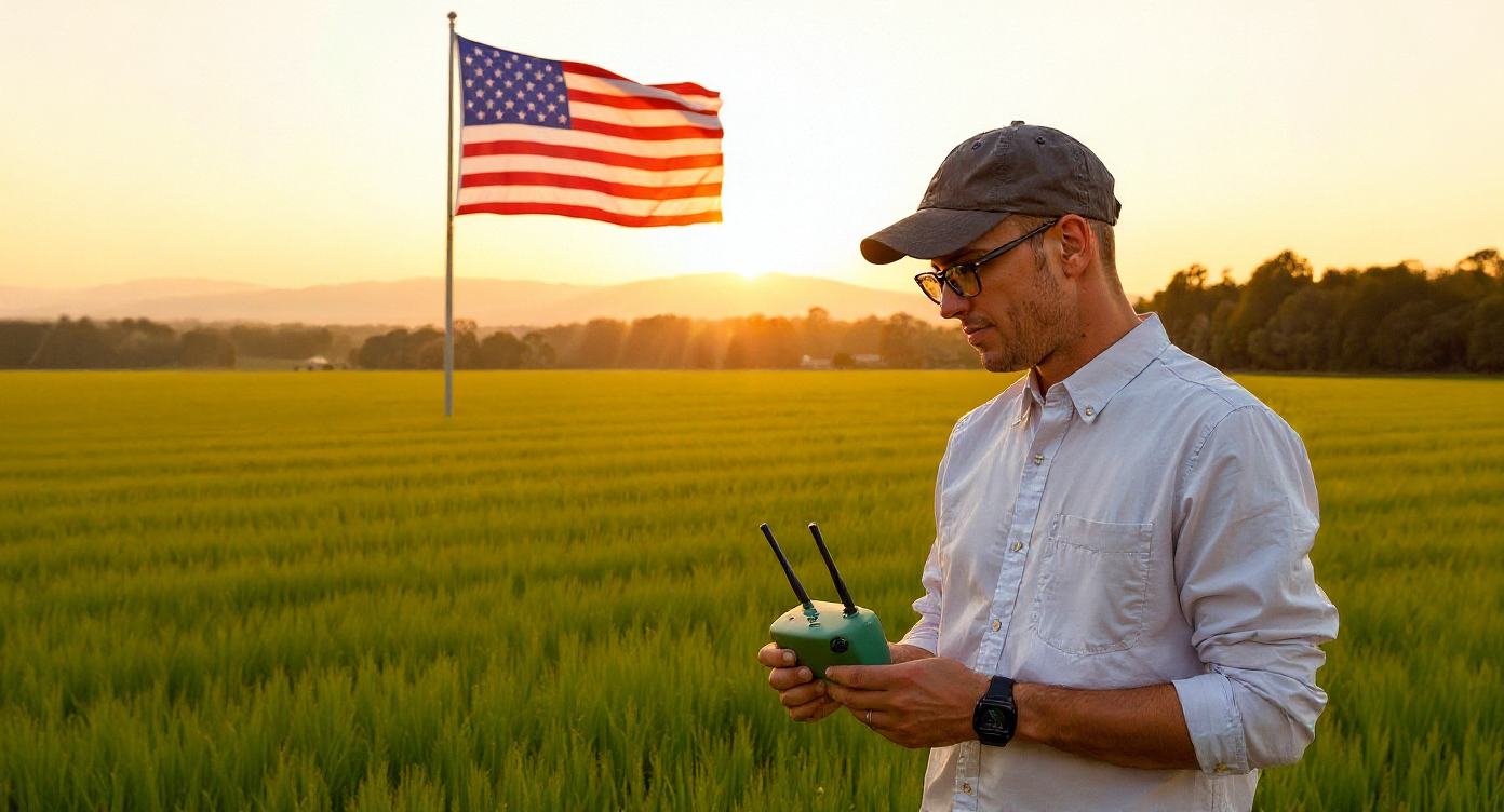
As new U.S. laws phase out Chinese-made UAVs, American farmers and agronomists are looking for alternatives to DJI drones. By the end of 2025 the FAA/FCC may ban Chinese drones (DJI, XAG, Autel, etc.) under the NDAA. Since around 80–90% of U.S. spray and mapping flights used Chinese drones, growers need trusted Western-made replacements. The good news is many U.S. or allied-country drones now cover every farm task – from precision crop imaging to spray application and even herd monitoring.
Our focus here will be drones made by American or allied companies. We include ready-to-fly systems and open/modular platforms, with flight specs, sensors, autonomy, and price tiers.
Our roundup is grouped by use case: crop monitoring (mapping), spraying, irrigation management, and livestock monitoring. Complete with comparisons to help growers and consultants weigh flight time, payload, sensors (multispectral, thermal, etc.), autonomy features (RTK/GPS, obstacle avoidance, automation), and cost level.
Why Choose Non-Chinese Drones?
Recent U.S. policy is pushing agriculture away from Chinese UAVs. Federal law now requires an FCC security review of Chinese drone firms, and if DJI is not cleared by Dec. 23, 2025 it will join a “covered list” and essentially be banned.
Farmers risk losing support and parts. Non-Chinese drones avoid these issues, offer U.S.-based support, and often have NDAA compliance built in. This means security of data, easier certification (FAA Part 107/137) and funding, and support from domestic service networks.
Quick Overview Of Top Agricultural Drones for American Farmers
| Use Case | Drone (Maker, Country) |
Flight time (approx.) | Payload capacity (approx.) | Sensors | Autonomy / key features | Price tier* |
|---|---|---|---|---|---|---|
| Crop Monitoring & Mapping | ||||||
| Crop monitoring & mapping (NDVI, stand counts, stress detection) | WingtraOne Gen II (Wingtra, Switzerland) |
Up to ~59 min per flight (mapping battery) | Up to ~0.8 kg (supports full-frame RGB or multispectral payloads) | Interchangeable RGB and multispectral payloads (e.g. Sony RX1R II, MicaSense RedEdge/Altum) with PPK/RTK positioning | VTOL fixed-wing (vertical takeoff, fixed-wing cruise), PPK on all payloads, automated survey missions with high-overlap mapping workflows | $$$ |
| Same as above for large fields; cross-field comparisons, large farms/co-ops | AgEagle eBee X (AgEagle, USA) |
Up to ~90 min with endurance battery (standard packs ~60 min) | ~1.6 kg take-off weight including payload | Swappable payloads: RGB, multispectral and thermal camera options for crop health and stress mapping | Lightweight fixed-wing platform with RTK/PPK, large-area coverage (up to ~5 km² per flight), automated mission planning via eMotion | $$$ |
| Same as above, but with longer lines, corridor mapping | Trinity Pro (Quantum Systems, Germany) |
Up to ~90+ min (depending on payload and batteries) | MTOW ~5.75 kg (supports multiple professional payloads) | Modular payload bay for RGB, oblique, multispectral (RedEdge-P, Altum-PT) and LiDAR payloads (Qube series), plus onboard IMU/GNSS | eVTOL fixed-wing, QBase 3D mission planning, RTK, multi-payload support (RGB, multispectral, LiDAR) for long-range mapping of fields and corridors | $$$ |
| Entry-level crop scouting & mapping (NDVI, basic vigour maps) |
Parrot Bluegrass / Bluegrass Fields (Parrot, France) Note: Parrot Bluegrass has been discontinued and is best treated as a legacy / used-market option. |
~20–25 min per battery; up to ~30 ha per flight at ~70 m AGL | ~1.8–2.0 kg take-off weight; designed for front RGB + multispectral payload, not heavy spray loads | Front-facing RGB camera plus Parrot Sequoia multispectral (Green, Red, Red-Edge, NIR) for NDVI and crop vigour indices | Automated field-mapping workflows via Parrot agriculture apps; stitched vigour maps and zone export for variable-rate application planning | $ |
| Spraying & Application | ||||||
| Row crops, specialty crops, precise liquid application, research plots | Hylio AG-110 (Hylio, USA) |
~14–16 min typical spray mission at or near max 9.5 L payload (shorter at heavy load, longer with light loads) | Standard 9.5 L (~9.5 kg / 21 lb) liquid tank; spray width ~3–6 m depending on nozzles | RTK-enabled GNSS, precise flowmeter, front and rear obstacle-avoidance radars, multi-sensor altitude (radar, barometer, GPS) and HD FPV camera | Fully autonomous spray missions planned in AgroSol GCS (row and block patterns), geofenced operations, auto return-to-land on low battery or empty tank, detailed flight logs for compliance | $$$ |
| Broad-acre crops, orchards, high-volume broadcast spraying | Hylio AG-272 (Hylio, USA) |
~8–10 min at full 18 gal payload; longer with partial load (very high hourly acres because of large swath) | Up to ~18 gal / 68 L liquid (max payload ~223 lb / 101 kg; up to 50 ac/h at 2 gal/ac) | Multiple wide-angle obstacle-avoidance radars (lateral, upward, downward), RTK-ready GNSS, precise flowmeter and optional granular spreader attachment | Modular high-capacity spray/spreader system, autonomous mission planning via AgroSol with geofencing, wide 30–40 ft swath, Part 137-friendly for commercial operators | $$$$ |
| Mid-large farms needing European manufacturer; compliance-sensitive buyers | ABZ Innovation L30 (ABZ Innovation, Hungary/EU) |
Up to ~17.5 min unloaded; ~9 min at full 30 L tank | 30 L liquid tank; max take-off weight ~70 kg (29 kg empty) | Multi-constellation GNSS (GPS, GLONASS, Galileo, BeiDou) with RTK support, high-flow spray system, optional terrain-following radar/LiDAR and flow monitoring | CE-certified agricultural spray platform with autonomous flight-planning and route optimisation, optional terrain-follow for consistent spray height, up to ~21 ha/h coverage | $$$$ |
| Irrigation Management & Water Assets | ||||||
| Irrigation canal & ditch inspection, crop stress from leaks/blocked emitters, quick checks after storms | WingtraOne Gen II (Wingtra, Switzerland) |
Up to ~59 min per flight | Up to ~0.8 kg payload (mapping-grade RGB or multispectral cameras) | High-resolution RGB and multispectral payload options (e.g. Sony, MicaSense) for NDVI and moisture proxies, with PPK/RTK geotagging | VTOL fixed-wing, long swath lines over canals and ditches, high-precision terrain mapping to spot leaks, erosion and pooling in irrigation networks | $$$ |
| Same, but closer-range, tree-level thermal stress, pivots, ponds, animals in fields | Skydio X10 (Skydio, USA) |
Up to ~40 min max flight time (typical 35–40 min) | ~0.7 kg aircraft weight (no external payload; integrated multi-sensor gimbal) | Multi-sensor payload: 64 MP narrow, 50 MP wide, 48 MP telephoto RGB cameras plus FLIR Boson+ 640×512 radiometric thermal; 360° vision sensors for navigation | Fully autonomous AI navigation with true 360° obstacle avoidance, GPS-denied flight modes, 5G and Wi-Fi connectivity, automated structure and field-edge inspections for irrigation assets | $$$ |
| Same, plus mapping pond/reservoir levels & soil moisture proxies; public-safety/irrigation cross-use | Anzu Raptor T (Anzu Robotics, USA) |
Up to ~45 min max flight time; ~38 min hover | ~0.9–1.0 kg aircraft weight; no heavy external payloads (integrated EO/thermal camera stack) | 48 MP wide-angle camera with 56x hybrid zoom plus 640×512 LWIR thermal sensor, 4K video, GNSS (GPS, GLONASS, BeiDou, Galileo), RTK-ready for precise mapping | Omnidirectional obstacle sensing, RTK, long-range link (up to ~9–10 km), mission planning via Aloft-based software; good for cross-use in irrigation surveys, livestock checks and public-safety response | $$ |
| Livestock & Small-Farm Monitoring | ||||||
| Thermal sweeps over herds and paddocks; locate missing or downed animals at night | Anzu Raptor T (Anzu Robotics, USA) |
Up to ~45 min max flight time; ~38 min hover | ~0.9–1.0 kg aircraft weight; integrated EO/thermal camera stack (no heavy external payloads) | 48 MP wide-angle camera with 56x hybrid zoom plus 640×512 LWIR thermal sensor, 4K video, GNSS (GPS, GLONASS, BeiDou, Galileo), RTK-ready | Long-range link (up to ~9–10 km), omnidirectional obstacle sensing, mission planning via Aloft-based software; ideal for large grazing blocks and night searches | $$ |
| Close-range herd checks, fence-line inspection, watering points and shade structures | Skydio X10 (Skydio, USA) |
Up to ~40 min max flight time (typical 35–40 min) | ~0.7 kg aircraft weight (integrated multi-sensor gimbal) | Multi-sensor payload: 64 MP narrow, 50 MP wide, 48 MP telephoto RGB plus FLIR Boson+ 640×512 radiometric thermal; 360° vision sensors | Fully autonomous AI navigation with 360° obstacle avoidance, GPS-denied flight modes, automated patrol paths along fences, tanks and troughs | $$$ |
| Small-farm EO/IR checks; co-ops and NGOs monitoring herd condition and grazing impact | Parrot Anafi USA (Parrot, built in USA for enterprise) |
Up to ~32 min per battery | ~0.5 kg drone mass (MTOM ~0.64 kg) with integrated triple-sensor EO/IR gimbal | Triple-sensor gimbal: two 21 MP RGB cameras (wide + zoom) with 32x zoom plus FLIR Boson 320×256 thermal; GNSS (GPS/GLONASS/Galileo) | IP53-rated, Blue sUAS/NDAA-compliant, quick <1-minute deployment; open ecosystem (Pix4D, DroneSense, etc.) for teams needing secure livestock and pasture surveys | $$ |
*Price Tier (new-system cost, USD): $ ≈ < US$7k, $$ ≈ US$7k–12k, $$$ ≈ US$12k–30k, $$$$ ≈ > US$30k.
Best 2026 Farming Drones in the U.S. by Application
Crop Monitoring Drones (Mapping and Scouting)
Fixed-wing mapping drones cover large fields quickly with high-resolution imagers (RGB, NIR, NDVI) for crop health and moisture. Three top picks are WingtraOne Gen II (Switzerland), AgEagle eBee X (USA), and Trinity Pro (Germany). These offer long flights and swap-in sensors for multispectral or thermal surveys. For example, the WingtraOne Gen II VTOL drone flies ~59 min and can carry up to 800 g of sensors. Its efficiency (fixed-wing range plus vertical takeoff) makes it ideal for large fields.
The AgEagle eBee X (US-made, NDAA-compliant) flies up to 90 min and can cover ~1,200 acres per flight, with modules for RGB, multispectral (NDVI) or thermal cameras. The Trinity Pro (German EVTOL) also offers ~90 min endurance covering ~700 ha in one mission, with quick-swap payloads (3D, multispectral, LiDAR). All three use precise GPS/RTK guidance, automated flight planning software, and return-to-home.
For shorter-range scouting or high-detail mapping, rotary drones work well. The Parrot Bluegrass quadcopter (France/Spain) is built for ag: it has a FullHD camera plus a Parrot Sequoia multispectral sensor (capturing green, red, red-edge, NIR bands). A single battery flight (~30 ha at 70 m altitude) gathers RGB video and multispectral images, which cloud software then turns into NDVI maps. Its autonomous Pix4D-based flight app makes it easy for farmers to plan coverage. While the drone’s flight time (~20–25 min) and payload (about 2.5 gal tank for liquids or map-sensor weight) are much smaller than fixed-wing, it’s very user-friendly for daily crop checks and stress mapping.
However, the Parrot Bluegrass is generally discontinued as a new, primary product, with many retailers listing it as unavailable or sold out. You might still find used or refurbished models on sites like eBay. Look for “used,” “refurbished,” or “open box” units on marketplaces with agricultural drones for sale.
A more recent choice for 2026 is the Anzu Raptor T (USA). The Raptor is a small quad (500 g) carrying a 4K zoom camera (20MP wide + 12MP tele with 56× hybrid zoom) and – on the “T” model – an advanced FLIR thermal (640×512). It flies up to ~45 min on batteries. In practical farm use, its high-res imagery can spot irrigation issues or pest hotspots.
For instance, even without a specialized multispectral sensor, the Raptor’s visible camera “can still identify issues like irrigation problems, pest infestations, or crop stress” by color cues. It uses RTK for precise maps and has no geofencing limits (data is held on US servers).
Spraying and Application Drones
For spray/fertilizer tasks, multi-rotor applicators carry tanks or granular spreaders over fields. The leading US option is Hylio (Houston, TX). Hylio’s spray drones (AG-110, AG-116, AG-122, AG-272) are built domestically with NDAA-compliant controllers. The AG-110 quadcopter carries ~22 lb (2.65 gal) of liquid and can hover up to 50 min on light loads. It has a 4-nozzle 6ft boom and flow meter, with fully autonomous waypoint flight via Hylio’s software. For bigger jobs, the AG-272 sports a 38 L tank and fleet-control software (manage multiple drones from one station). These U.S.-built systems are Part-137 ready (for certified crop-spraying ops) and allow parts replacement in the field.
Another contender is the ABZ L30 (Hungary). It’s a 6-rotor machine with a 30 L tank. Fully loaded the L30 has only ~9 min endurance, but it uses low-pressure CDA nozzles for wide coverage. It’s CE-certified (good for U.S. co-ops flying EU machines) and has RTK GPS to follow terrain. Its strength is a durable, modular design (swappable booms, plugs) with good spray control. (For context, Chinese XAG drones have much larger tanks, but those are off-limits. Instead, U.S. farms can arrange multiple smaller drones like Hylio’s on a rotation, or even retrofit larger manned aircraft as autonomy kits in the future.)
The agricultural drone sprayers save money vs manned aircraft. Even a $30k drone can spray an acre for ~$2 (vs $3–4 for piloted planes). Drones can work tight areas and in wet fields without getting stuck. Note that the drone spray swaths (15–25 ft) are narrower than tractor booms, so covering very large acres takes multiple passes or drones. Also, battery/charge swaps add downtime. However, the drone will typically pay for itself in 1–2 seasons.
Irrigation and Water Management
Drones help spot watering issues before they hurt yield. Thermal and multispectral imagery can reveal dry patches, leaks, or stressed crops. For example, irrigated areas appear cooler (bluer) in thermal maps due to plant transpiration. In practice, farmers use fixed-wing drones (WingtraOne, eBee X, Trinity) with NDVI cameras to map soil moisture and vigor, combined with drones like the Raptor T or Skydio with thermal to find hot (dry) zones.
Even without NDVI sensors, the Raptor’s high-res visual camera can identify issues like irrigation problems, in addition to the dual use of monitoring livestock at night or finding cattle that wandered off, which we will cover next.
A typical workflow: fly a WingtraOne or eBee X early in the season for multispectral NDVI mapping (soil-plant-water indices). Then use a thermal-capable drone (Raptor T, Skydio X10) for hot-spot checks mid-season. This blended approach is already in use on test farms. For instance, the University of Arizona used drones to compute canopy temperature maps that clearly highlighted well-irrigated vs water-stressed zones.
Drones give immediate, high-resolution water data (pixels a few inches to feet, far finer than satellites). You control timing (not waiting on a satellite pass). The ata is processed (e.g. Pix4Dfields or similar software) to turn images into actionable irrigation maps. As sensor costs drop and U.S. crop consultants adapt, drone-based irrigation management is growing.
Take Drone Multispectral Imaging Course at ABJ Academy
Livestock and Herd Monitoring
Drones can help locate, count, and check herd health – especially in open range. A quiet thermal drone can find stray cattle or check fence lines from above. The Anzu Raptor T (USA) and the Skydio X10 (USA) both carry high-sensitivity thermal cameras (640×512 pixels). From 45 min aloft, they can sweep pastures and detect warm-bodied animals at night. Even in daylight, their zoom cameras spot details: the Raptor’s 56× zoom or Skydio’s 190 mm telephoto can inspect animals or feeders from a distance.
Another tool is the Parrot ANAFI USA (France), a lightweight drone with 32× optical zoom and a 320× thermal imager. With 32 min flight time, it lets ranchers quietly circle a herd or survey fencing. ANAFI USA is fully NDAA-friendly (used by U.S. agencies) and has IP53 dust/water rating, so it’s rugged for rural use.
On farms, ranchers have started using drones like the Raptor and ANAFI to find missing calves and detect sick animals. For example, Raptor thermal flights could locate stray pigs and spot heat stress in livestock Livestock drones also help manage grazing: by flying pre-planned routes, a drone can count animals (with thermal vision) or ensure no animals escaped. These drones’ obstacle avoidance and gentle noise mean they fly without spooking animals (many users note they’re quieter than a Mavic).
With the drones you can animals faster than a truck or on-foot search. Even spot laminitis or fever via body heat. And they aidin fence patrol and security. Keep in mind that during flights, animals may scatter if drone gets too low. And wide-area surveys still take time (one X10 at 40 min might cover a hundred acres; larger areas need multiple flights). But for large ranches, even a few drone sorties per week save many labor hours.
Need training to interpret drone thermal/visual data and get certified?
Tips For Choosing a Farming Drone in US
Check that the drone integrates with mapping/spray software you use (Pix4D, DroneDeploy, etc.), or has its own farm-focused platform. NDAA compliance is a huge plus. Factor in support: U.S./EU brands usually have domestic service reps or co-ops ready to help. And consider training – many companies provide farmer or pilot training programs.
It’s wise to do a field demo. Many dealers and startups will demo their ag drones or lease them to farms. Seeing that desired model in your field can answer questions like “Will it fly in my wind?” or “Is this tank big enough?”.
Also consider scaling: if one drone works, could you add a second for more acres, or hire a drone service co-op? Restrictions on DJI drones and brands like Autel doesn’t mean that you’re limited for choice. With careful selection, growers and ag pilots can build a toolkit of safe, powerful drones for mapping, spraying, watering, and herding – all backed by local support.
Related Reading: Tariffs, Trade Wars, and Drone Users Caught In The Middle

