

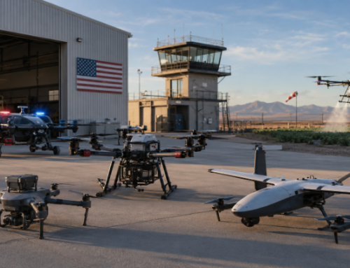
A thermographic camera drone lets you see temperature patterns from above, fast. That changes how you inspect assets: you can scan a whole roof, solar array, or electrical corridor and then zoom in on the few spots that actually need attention.
This is also why the market is accelerating. Industry forecasts peg the drone inspection and monitoring market at $16.4B in 2024, reaching $38.2B by 2030. In this guide we will look at sensors, settings, workflows, and how to avoid the mistakes that create false positives and bad decisions.
What a Thermographic Camera Drone Is
A thermographic camera drone is an unmanned(UAV) carrying a sensor that detects infrared radiation and converts it into a visual heat map (a thermogram). Unlike a normal camera that “sees” reflected light, an infrared drone camera “sees” emitted energy, which is why it works in low light and can reveal anomalies your eyes cannot.
You can have an integrated platform (like an enterprise drone) where thermal is built in, or a drone that operates with a separate thermal payload that is attached to it.
Not every thermal camera is meant for measurement.
- Non-radiometric thermal: shows relative heat patterns but does not reliably output per-pixel temperature values.
- Radiometric thermal: records temperature information (per pixel or per measurement mode), which is what you want for serious thermal drone inspection programs and repeatable reporting.
Many enterprise thermal drones are designed not just to show heat patterns, but also to measure temperature accurately. The DJI Mavic 3 Enterprise Thermal, for example, measures from -20°C to 150°C in High Gain Mode and 0°C to 500°C in Low Gain Mode. It also has a Noise Equivalent Temperature Difference (NETD) of ≤50 mK, which helps it detect subtle temperature differences, and it operates in the 8–14 μm infrared range. More on this shortly.
How Thermal Cameras Work on Drones
Thermal inspection with a drone is physics plus good field technique.
What the sensor is actually detecting
Most inspection drones use an uncooled VOx microbolometer. These sensors respond to longwave infrared (LWIR), commonly the 8–14 μm band.
What makes one thermal drone camera better than another
1) Resolution
Resolution determines how much thermal detail the camera can capture across a scene. In inspection work, that directly affects what you can detect, how early you can detect it, and how confidently you can interpret the result.
A 640×512 thermal sensor has become the practical baseline for many enterprise inspections because it gives you enough pixel density to identify hotspots, temperature patterns, and abnormal areas across a wide range of assets without the severe detail limitations of older 320×256 systems.
The key point is this: the more pixels you have on target, the better your chances of separating a real anomaly from background blur or mixed-pixel noise. That’s important when you are trying to distinguish a single overheating connector from the structure around it, a developing hotspot on a solar module, or a localized warm area that may otherwise disappear when viewed from too far away. Higher resolution does not automatically guarantee a better inspection, but it gives you more usable thermal information to work with.
This is why 640×512 remains widely used on current enterprise platforms. The DJI Mavic 3T/3TA records thermal video at 640×512 at 30 fps, and its thermal stills are also captured at 640×512. The DJI Matrice 30T also operates at 640×512 in normal mode, but it adds an infrared super-resolution mode at 1280×1024 for both video and photo capture. The Autel EVO Max 4T likewise captures thermal video and photos at 640×512.
A 640×512 thermal camera is usually enough for many professional inspection tasks, especially when flight altitude, lens choice, and target size are all matched properly. But it still requires discipline. If you fly too high, move too fast, or try to inspect very small targets at long stand-off distances, even a 640×512 sensor can run out of useful detail. In other words, resolution sets the ceiling for what the camera can see, but mission planning determines whether you actually get that detail on the asset.
It is also important to understand the difference between native resolution and enhanced or super-resolution output.
- Native resolution is the sensor’s actual pixel grid.
- Super-resolution modes can improve the apparent detail of the image, and they can be useful, but they do not fully replace the value of having more native pixels on target in the first place.
That is why you should treat super-resolution as a helpful enhancement, not a substitute for proper flight distance and framing.
DJI’s Mavic 3T/3TA thermal video resolution is 640×512. DJI’s Matrice 30T has a normal mode at 640×512, and an IR “super-resolution” mode at 1280×1024 in specs. Autel’s EVO Max 4T thermal camera also has 640×512 thermal video.
>>>Thermal Drones Analysis: 14 Best Long Range UAVs with Infrared Imaging Systems
2) Thermal sensitivity (Noise Equivalent Temperature Difference — NETD)
NETD tells you how small a temperature difference the sensor can separate from background noise. It is one of the clearest indicators of how well a thermal camera will pick up subtle anomalies before they become obvious failures. The lower the NETD, the more sensitive the sensor is to slight temperature variation, which is exactly what you want in inspection work where the earliest warning signs may be only a few tenths of a degree warmer than the surrounding area. DJI has both the Mavic 3T/3TA and the Matrice 30T at ≤50 mK @ f/1.0, meaning the sensor can detect temperature differences of 0.05°C or less under stated conditions.
That matters because not every problem shows up as a dramatic hot spot. Early-stage issues often appear as small thermal irregularities: a connector running slightly warmer than the others, a solar cell beginning to drift from its neighbors, or a localized area on a component that is not yet hot enough to stand out to a less sensitive sensor. With a NETD at or below 50 mK, these platforms are sensitive enough to reveal fine thermal contrast that might otherwise be lost in image noise.
During your drone inspection, NETD influences how confidently you can read a scene. A more sensitive sensor gives you cleaner separation between “normal” and “slightly abnormal,” which is especially useful when you are inspecting assets where the thermal signature is subtle rather than extreme. On a solar site, that can mean picking up faint temperature differences that point to developing mismatch or early hotspot behavior. On electrical assets, it can help distinguish a genuinely warming connection from normal operating variation. On building surveys, it improves your ability to see small heat-loss patterns instead of broad, vague temperature patches.
It is also important to understand what NETD does not mean. A low NETD does not guarantee the inspection is accurate on its own. Thermal sensitivity helps the camera detect fine differences, but the reliability of what you see still depends on the rest of the inspection setup: focus, flight height, environmental conditions, emissivity, reflected temperature, and the operator’s ability to interpret the image correctly. In other words, NETD improves the sensor’s ability to see detail, but sound inspection practice is what turns that detail into useful decisions.
3) Temperature measurement accuracy
For inspection work, temperature accuracy comes in because you are often deciding whether an anomaly is minor, urgent, or worth a follow-up inspection. A thermal image can show that one area is hotter than another, but the real question is how close that reading is to the actual surface temperature. That is why you look at radiometric accuracy specs alongside temperature ranges.
Take the DJI Mavic 3T/3TA as an example. It has an infrared temperature measurement accuracy of ±2°C or ±2% in High Gain mode and ±5°C or ±3% in Low Gain mode. We’ve also mentioned how it measures -20°C to 150°C in High Gain mode and 0°C to 500°C in Low Gain mode. High Gain is better when you need more sensitivity for lower-temperature inspection work, while Low Gain is better for hotter targets but with less precision.
Look at the EVO Max 4T as well. It has a radiometric measurement accuracy of ±2°C or ±2%, again using the larger value, within an ambient temperature range of -20°C to 60°C. The model has a measurement range of -20°C to 150°C in High Gain mode and 0°C to 550°C in Low Gain mode, plus center, spot, and area temperature measurement methods.
What this means is that a thermal drone is usually better at identifying meaningful temperature differences and hotspots than at acting like a lab thermometer. For example, if one connector, module, or bearing housing is running far hotter than similar nearby components, that difference is often more useful than the exact number alone. Accuracy specs still matter, though, because they tell you how much confidence you can place in the reading when writing reports, comparing assets, or deciding whether a defect needs urgent action.
4) Lens and standoff distance
Lens choice determines how much of the scene the thermal camera sees and how much detail you can capture from a given distance. The two specs you want to look at here are field of view and equivalent focal length.
A wider field of view covers more area in a single pass, which is useful for scanning large roofs, solar arrays, or broad structures quickly. A narrower field of view gives you a tighter view of the target, which helps when you need more detail on a smaller area without flying as close.
That trade-off is what controls your standoff distance: how far you can stay from the asset and still get thermal imagery that is detailed enough to be useful.
Why all this? Thermal inspection is limited by how many pixels actually land on the anomaly. If you are too far away, a hotspot, warm connector, or small defect can be spread across too few pixels to interpret confidently. If you fly too close with too wide a lens, you may get detail, but you lose efficiency because you need more passes to cover the same asset. Good thermal inspection is really a balance between coverage, safety, and on-target detail. The lens is what sets that balance.
The DJI Mavic 3T thermal camera uses a 61° DFOV lens with an equivalent focal length of 40 mm, while the Mavic 3TA uses a narrower 41.2° DFOV lens with a 60 mm equivalent focal length. Both have f/1.0 apertures and a focus range from 5 m to infinity. So the Mavic 3TA is better suited to situations where you want to stand farther off and still keep more detail on the target, while the Mavic 3T gives you broader coverage per frame.
The same logic shows up on the DJI Matrice 30T. Its thermal lens is at 61° DFOV, 9.1 mm focal length, and 40 mm equivalent focal length, with f/1.0 aperture and focus from 5 m to infinity. In other words, it is built around a fairly broad thermal view that works well for scanning assets efficiently, but it still depends on flight distance and mission planning to make sure enough pixels fall on the defect you are trying to detect.
Autel’s EVO Max 4T takes a slightly different approach. Its thermal camera is listed with a 42° DFOV, f/1.2 aperture, and IFOV of 0.92 mrad, alongside 640×512 resolution. A narrower 42° DFOV naturally gives a tighter thermal view than a 61° lens, which can help you hold more target detail at greater distance. The IFOV figure is especially useful because it tells you the angular size of each pixel, which directly affects how much physical area one pixel covers on the asset as standoff distance increases.
That is why standoff distance should never be treated as just a flight-safety issue. It is also an image-quality issue. The farther you are from the asset, the larger the ground area covered by each thermal pixel. At some point, a small hotspot, narrow crack-related heat pattern, or localized connector issue becomes too small relative to the pixel size and starts blending into the background. This is also why two drones with the same sensor resolution can perform very differently in the field if they use different thermal lenses. A narrower lens can preserve more usable detail at distance, while a wider lens can cover more area faster.
A bit more on focus range: When platforms specify thermal focus from 5 m to infinity, it means they are designed for stand-off inspection rather than ultra-close thermal work. That is important because it reinforces the intended use case: these systems are built to inspect from a safe working distance, not pressed right up against the asset. When you combine that with focal length and field of view, you get a much clearer picture of what the platform is actually optimized to do.
A good way to think about it is this: resolution tells you how many pixels you have, but lens and standoff distance determine where those pixels fall. If the lens is too wide for the task or the drone is flown too far away, even a capable thermal sensor can miss the very detail you need. That is why serious thermal inspection planning always starts with the target size, the required detail, and the safe working distance, then works backward to the right lens and flight profile.
5) Zoom thermal payloads for specialized work
Standard thermal payloads work well when you can fly reasonably close to the asset and still maintain safe access, but some inspections demand more stand-off distance from the start. That is especially true in utilities, energized infrastructure, rooftops with restricted access, flare stacks, elevated industrial assets, and other hazardous environments where getting physically closer is not always practical, safe, or efficient. In those situations, a zoom-capable radiometric thermal payload becomes far more valuable than a fixed wide-field thermal camera because it lets you keep more pixels on the target while staying farther away.
Keep in mind that thermal inspection quality depends on pixels on target. The farther away you are, the less detail each pixel holds unless the optical system is designed to recover that detail at distance. A zoom thermal payload helps solve that by narrowing the field of view as needed, so smaller anomalies do not disappear into a wide scene. That can make a huge difference when you are trying to isolate a hot connector on a power line, inspect roof-mounted equipment without overflying sensitive structures, or assess a component in an industrial area where the safest flight profile is not the closest one.
A good example is the FLIR Vue TZ20-R. This payload is built around dual FLIR Boson thermal cameras and is designed specifically for thermal zoom work in industrial inspection. It provides 5×, 10×, and 20× zoom capability, along with radiometric temperature measurement, so you are not just enlarging the image visually. You are retaining temperature measurement capability while inspecting from farther away. FLIR positions it for utility, roofing, solar farm, and other industrial inspection work where pilots need to identify thermal details clearly without closing the distance unnecessarily.
Most newer enterprise drones have zoom somewhere in the camera stack, but that is not always true optical zoom on the thermal sensor itself. Quite often, the drone has:
- a separate visual zoom camera, and
- a fixed thermal camera with digital zoom or super-resolution features.
For example, the DJI Matrice 30T integrates a powerful visual zoom camera plus a thermal camera, but its published specs separate those two systems. The zoom camera is optical, while the thermal side has the 640×512 resolution and super-resolution output rather than a true optical thermal zoom lens. The same pattern shows up on newer platforms like the DJI Matrice 4T, which offers 640×512 thermal with 1280×1024 super-resolution output.
Autel’s newer systems also move in that direction. The EVO Max 4T has a strong visual zoom camera and its thermal camera supports digital zoom, but that is still different from a dedicated optical zoom thermal payload.
Why thermal data can be “wrong” even when the drone is good
Thermal cameras do not automatically know what a surface is made of. The reading you see is affected by:
- Emissivity (how efficiently a surface emits infrared energy)
- Reflected apparent temperature (what the surface reflects from the environment)
- Wind and convection (which can cool surfaces and reduce contrast)
- Solar loading (the sun heating surfaces unevenly)
Thermal cameras cannot produce reliable readings without adjustments such as emissivity and reflected temperature, and that daytime collection can lead to expensive misinterpretations.
Industries Using Thermographic Camera Drones
A thermographic camera drone can be useful anywhere heat patterns reveal risk, loss, or failure. Here are the biggest real-world categories.
Wind turbine inspections
Most wind turbine blade inspections are still led by high-resolution visual imagery, but thermal plays a meaningful role in wind turbine thermal drone inspections in a few areas:
1. Electrical and balance-of-plant hotspots
Thermal is excellent for finding overheating in electrical components, connections, cabinets, and substations. (It is the same “hot connection” logic used in ground thermography, just faster to access with a drone.)
2. Nacelle and drivetrain supporting checks
Thermal can help detect abnormal heating on accessible surfaces (think cooling systems, housings, or abnormal friction signatures). This is not a replacement for internal sensor data, but it can be a strong “something is off here” indicator.
3. Where the business case is strongest: access and downtime
Drone-based inspection can reduce cost and revenue loss compared to rope access. A peer-reviewed study on offshore wind inspections reports that replacing rope-access inspection with drones can reduce costs by up to 70% and reduce revenue lost due to downtime by up to 90% (modelled under the study’s assumptions).
Solar farm monitoring
Aerial infrared thermography is widely used to identify PV anomalies (especially hotspots) quickly across large plants. Hotspots can be quickly identified via aerial infrared thermography due to the temperature differential from surrounding areas.
There is also a formal standards backbone here. IEC TS 62446-3:2017 defines outdoor thermographic inspection of PV modules and plants in operation, including requirements for equipment, ambient conditions, procedures, reporting, personnel qualification, and a guideline matrix for thermal abnormalities.
Building inspections
In building energy work, you are usually looking for:
- insulation gaps
- air leakage patterns
- moisture-related thermal anomalies
- thermal bridging
A drone becomes valuable because it can scan roofs and façades quickly and create repeatable documentation.
A UK heat-loss drone case study highlights two important operational truths:
- You typically want a minimum ~10°C indoor–outdoor temperature difference for meaningful heat-loss interpretation.
- Surveys should often be conducted hours after sunset to avoid solar gain confusing the results.
Academic research is also pushing toward better 3D thermal mapping using multimodal UAV imagery to create large-scale RGB + thermal 3D models for building analysis.
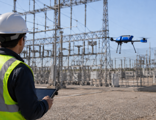
Electrical infrastructure
Thermal is one of the best ways to detect early-stage electrical issues because failing components often run hotter before they fail completely.
This is where “radiometric vs non-radiometric” matters most: if you are going to make decisions about maintenance priority, you want measurement capability, repeatable capture conditions, and consistent reporting aligned to standards (more on training below).
Search and rescue
In SAR, thermal drones help locate people or animals by heat signature, especially at night or through light smoke/haze. Thermal drones are actually mainstream tools across SAR and inspection.
Thermal Sensors Used on Drones
Your drone is only half the system. The sensor determines what you can detect and how confidently you can report it.
Integrated thermal sensors
These are built into platforms like Mavic 3T/3TA and Matrice 30T. DJI’s enterprise specs list microbolometer type, IR band, NETD, temperature measurement ranges, and accuracy.
Multi-sensor gimbals
Payloads like DJI’s Zenmuse H20T combine thermal plus zoom/wide and (in that case) a laser rangefinder. DJI positions it as a quad-sensor solution that includes a radiometric thermal camera.
Zoom radiometric thermal payloads
If you need to detect smaller hotspots from farther away, zoom payloads can matter. The FLIR Vue TZ20-R is marketed specifically for industrial inspection with radiometric measurement and zoom capability.
Best DJI Thermographic Camera Drones
The best drone is the one that matches your inspection distance, environment, reporting needs, and compliance constraints. This overview specifically looks at UAVs in the DJI ecosystem.
Category 1: Portable thermographic camera drone for rapid deployment
These are ideal when you need a compact drone with thermal camera that can be deployed quickly for small to mid-size assets.
DJI Mavic 3T / 3TA (Enterprise Thermal)
We’ve talked about thermal resolution 640×512, NETD ≤50 mK, temperature measurement ranges, and measurement accuracy details, plus common thermography features like spot and area measurement.
Best fit:
- rooftop checks
- small solar sites
- quick hotspot triage
- first-response support
Category 2: Rugged all-weather enterprise drone with strong inspection optics
If you inspect in harsher conditions or need more robust optics plus thermal:
DJI Matrice 30T
It comes with a VOx microbolometer thermal camera with NETD ≤50 mK, temperature measurement accuracy, and thermal resolution options including normal 640×512 and a super-resolution mode listed in specs.
Best fit:
- utilities and industrial sites
- longer missions in changing weather
- situations where zoom + thermal pairing speeds decisions
Category 3: Heavy-lift platform for interchangeable payloads and advanced workflows
When your work needs mapping-grade precision, multi-sensor payloads, or specialized inspection payloads:
DJI Matrice 350 RTK
The M350 RTK supports a wide range of payloads, including Zenmuse H20T and the newer Zenmuse H30T.
Pairing examples:
- Zenmuse H20T for a multi-sensor payload that includes a radiometric thermal camera (DJI lists 640×512 radiometric thermal and NETD figures on the H20 series pages).
- Zenmuse H30T if you need higher temperature measurement ranges for extreme-heat contexts (DJI lists high-gain and low-gain temperature measurement ranges on the official H30 series specs page).
Best fit:
- large solar farms at scale
- industrial facilities with complex inspection demands
- teams that need standardization across regions
Alternative enterprise options outside DJI ecosystems
Here are the best non-DJI thermal drones based on thermal quality, platform maturity, stand-off capability, autonomy, and inspection fit.
1) Skydio X10
This is the top pick for autonomy-heavy inspection work.
The Skydio X10 pairs a radiometric FLIR Boson+ 640×512 thermal sensor with under 30 mK thermal sensitivity, which is stronger than the typical ≤50 mK class you see on many enterprise drones. It also brings the thing Skydio is best known for: autonomy. In tight, cluttered, or GPS-challenged environments, that matters just as much as the thermal camera. This is the pick when your work involves infrastructure, confined industrial spaces, utilities, or repeated capture in difficult flight environments.
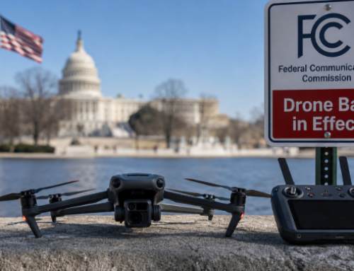
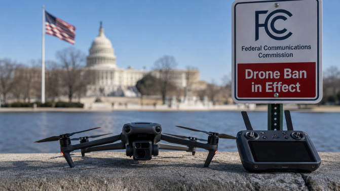
With U.S. policy tightening around foreign-made drones, many buyers are actively looking beyond DJI and other Chinese brands for thermal platforms that are easier to procure, fund, and deploy in regulated environments. Recent FCC action has blocked new equipment authorizations for many foreign-made drones, while federal funding rules and state-level restrictions are pushing more agencies and contractors toward approved or U.S.-aligned alternatives, which contributes to making the American-made Skydio X10 a natural fit.
2) Autel EVO Max 4T
The EVO Max 4T is the most convincing direct non-DJI competitor in the foldable enterprise class, especially as a compact all-rounder. It combines a 640×512 radiometric thermal camera, a 10x optical zoom visual camera, laser rangefinder, 42-minute flight time, and IP43 weather resistance in a package that deploys fast and travels easily. This is the pick if you want one drone that can handle thermal inspection, public safety, and general industrial work without moving into a bulkier airframe.
3) Teledyne FLIR SIRAS
The SIRAS deserves serious attention for thermal-first industrial picks. It uses a 640×512 radiometric FLIR Boson thermal camera, adds 5x thermal zoom, a 16 MP visible camera with 128x zoom, and comes in an IP54-rated professional platform. This is built much more like a purpose-driven industrial tool than a prosumer drone stretched into enterprise work.
4) Parrot ANAFI USA
The ANAFI USA is still relevant when size, portability, and secure deployment matter more than having the newest thermal stack. It carries a FLIR Boson thermal sensor, 32x zoom, and a very compact foldable design. Its thermal side is older, with 320×256 photo resolution, 9 fps thermal video, and ≤60 mK sensitivity, so it is not the strongest pick for detailed thermographic inspection compared with newer 640-class systems. But it is still a smart option when portability and rapid deployment are the priority.
Why it stands out: it is small, proven, and practical. A consideration for rapid response, security-sensitive work, and teams that value a lightweight deploy-anywhere platform.
5) Autel EVO II Dual 640T V3
This one gives you value if you want proven thermal without moving up to the Max series
The EVO II Dual 640T V3 remains a credible option because it gives you a 640×512 thermal sensor, up to 38 minutes of flight time, and a more established, field-proven package than many newer entrants. It is not as advanced as the EVO Max 4T in autonomy or integrated sensor stack, but it still makes sense if you want solid thermal performance without paying for the top tier.
It is the pragmatic pick. If you want reliable thermal capability at a lower step-up than the newest premium platforms, this is still one of the better non-DJI buys.
Benefits of Drone Thermography
A thermal drone inspection program works because it changes three things at once: speed, safety, and coverage.
Faster triage across big assets
On solar sites, aerial thermography is used to localize hotspots and anomalies quickly across arrays.
Safer access
You reduce the need for ladders, rope access, or sending teams into energized or hazardous zones.
Better documentation
A drone turns “we think it is overheating” into a geo-tagged dataset that can be compared over time, shared with asset owners, and tied to corrective actions.
A stronger business case in wind
Drone inspection can reduce costs and revenue loss compared to rope access models under certain assumptions, as shown in offshore wind inspection research.
Limitations and Challenges
Thermal inspection is powerful, but it is also easy to misuse.
False positives are common without good capture conditions
Solar gain, wind cooling, shade, and reflections can distort readings.
Thermal patterns do not always reveal root cause
On PV, thermography may flag a hotspot, but confirming cause and impact can require follow-up measurements. Aerial thermography can provide valuable module condition data, but other ground-based measurements may be required to diagnose identified faults.
Standards exist for a reason
For machinery thermography programs, ISO provides guidance on using infrared thermography for condition monitoring and diagnostics.
For PV plants, IEC TS 62446-3 defines inspection requirements, including equipment, ambient conditions, reporting, and personnel qualification.
For building thermography, ISO’s building thermography standards describe infrared thermography as a tool to identify energy-wasting defects and anomalies.
Cost of Thermographic Drone Inspections
Pricing varies wildly by geography, asset type, travel, reporting depth, and whether you are delivering “pretty thermals” or defensible inspection outputs.
What actually drives cost
1. Asset size and complexity
A single rooftop is not a 200 MW solar plant. Flight planning, permissions, and data handling scale with size.
2. Thermal resolution and standoff requirements
If you need cell-level clarity on PV, flight altitude and pixel coverage matter. Some guidance discussing IEC 62446-3 notes a minimum pixel-per-cell requirement for PV module recording, tying image resolution to measurement credibility.
3. Reporting and follow-up
The report is often where actual value lives: anomaly classification, prioritization, and recommendations.
4. Operational constraints
Night work, airspace constraints, wind conditions, and safety systems all impact cost.
Why cost is not the only metric
For wind inspections, the economic case is often connected to downtime and access. Offshore wind inspection research models significant reductions in cost and revenue loss when drones replace rope access in certain inspection contexts.
For building heat-loss programs, the drone’s value is often avoiding misdirected retrofit spending by showing where heat is actually escaping, providing a way to visualize improvement areas before tendering.
Training and Certification for Thermal Drone Pilots
If you want clients to trust your numbers, you need more than flight skills.
Thermography standards and competency
ISO has a recognized personnel qualification standard for thermography as part of condition monitoring programs. ISO 18436-7 outlines qualification and assessment for personnel performing thermal measurements and analysis for machinery condition monitoring.
For machinery applications, ISO 18434-1 provides guidance on applying infrared thermography to machinery condition monitoring and diagnostics.
For building thermography, ISO’s building thermography standards frame infrared building thermography as a tool to identify energy-wasting defects and anomalies.
Industry training ecosystems
Many thermography training providers align with recognized practices such as ASNT SNT-TC-1A and ISO-based schemes. If your service includes temperature measurement and decision-making, make sure your training and reporting approach can be justified against recognized standards, not just “experience.”
Grow your inspection career with thermography training
Build field-ready thermography skills. Get certified. Land industry contracts.
Thermography Level 1 Certification
Get a strong foundation in thermography principles, thermal image interpretation, and inspection best practices to prepare you for field-work.
- Ideal if you are building your thermography knowledge from the ground up
- Designed to help you understand thermal data with more confidence
- A practical starting point for inspection-focused professionals
Thermography Level 2 Certification
Move beyond the basics and strengthen your ability to analyse thermal findings, refine inspection workflows, and produce client-ready deliverables.
- Best for learners ready to deepen their inspection and analysis skills
- Supports more advanced interpretation and reporting confidence
- A smart next step after foundational thermography training
How Thermographic Drones Detect Heat Loss
A thermographic drone detects heat loss by measuring surface temperature patterns that correlate with energy escaping the building envelope.
Here is the simplest way to interpret what you see:
- Warm streaks on an exterior wall at night can indicate heat leaking from inside.
- Patchy roof warmth can point to insulation gaps or moisture issues.
- Linear “hot lines” often suggest thermal bridging through structural elements.
But you must fly under conditions that make heat loss visible. A minimum 10°C temperature difference between inside and outside and emphasizes avoiding solar gain is recommended, usually surveying hours after sunset. That way you don’t accidentally “diagnose” sunlight effects as insulation failure and push clients into unnecessary work.
Thermal Imaging Drones for Solar Panels
Thermal drone inspections of PV plants are designed to find:
- hotspots at cell, module, or string level
- failed bypass diodes (often visible as localized heating)
- connector and BOS heating (depending on scope and access)
A key reason this work is scalable is that aerial infrared thermography can quickly identify hotspots due to temperature differences.
Why IEC TS 62446-3 matters
If you are involved with PV thermography, you will hear “IEC compliant” often.
IEC TS 62446-3:2017 defines outdoor infrared thermography for PV modules and plants in operation and includes requirements for equipment, ambient conditions, procedure, reporting, personnel qualification, and abnormality classification guidance.
Wind Turbine Thermal Drone Inspections
Thermal is valuable in wind when you use it for what it does best: detect abnormal heat.
The strongest wind use cases tend to be:
- electrical hotspots (connections, cabinets, substations)
- supporting checks where abnormal heating can indicate friction, cooling issues, or other operational anomalies
- rapid screening across multiple assets to prioritize maintenance
Offshore wind inspection research models that replacing rope access with drones can reduce costs significantly and reduce downtime-related revenue loss under certain operational models.
FAQs
What is a thermographic camera drone
A thermographic camera drone is a drone equipped with a thermal imaging sensor that detects infrared radiation and visualizes temperature patterns for inspection and monitoring.
Is a thermographic camera drone the same as a thermal imaging drone
Yes, a thermographic camera drone and a thermal imaging drone typically refer to the same thing, meaning a drone system designed to capture thermal imagery for analysis.
What is the difference between radiometric and non-radiometric thermal drone cameras
Radiometric thermal cameras record temperature measurement data, while non-radiometric cameras mainly show relative heat patterns without reliable measurement output.
What resolution should I look for in a thermal drone camera
A 640×512 thermal sensor is a common baseline for professional inspections, while higher effective detail depends on lens, altitude, and pixel coverage of the target.
What is NETD and why does it matter for thermal drone inspection
NETD indicates how small a temperature difference the sensor can detect, and lower NETD generally helps you spot subtle anomalies more clearly.
Can thermographic drones detect heat loss in buildings
Yes, thermographic drones can detect heat loss by showing exterior temperature patterns that indicate escaping heat, especially when indoor–outdoor temperature difference and timing minimize solar effects.
When is the best time to fly a thermal imaging drone for heat loss
The best time is usually after sunset when solar gain has dissipated and you have a meaningful indoor–outdoor temperature difference for contrast.
Are thermal imaging drones for solar panels considered a standard practice
Yes, aerial PV thermography is widely used to identify anomalies like hotspots, and IEC TS 62446-3 defines requirements for outdoor infrared thermography of PV plants in operation.
Does IEC TS 62446-3 apply to drone inspections
Yes, IEC TS 62446-3 covers outdoor PV infrared thermography and includes drone-based approaches in the context of simplified aerial inspections for module thermography.
What training supports professional thermal drone inspection work
Professional thermal drone inspection work is supported by recognized thermography standards and qualification schemes such as ISO 18436-7 for personnel competence and ISO 18434-1 for machinery thermography guidance.
Why do thermal drone inspections sometimes produce false positives
Thermal drone inspections can produce false positives because emissivity, reflections, wind cooling, and solar loading can distort apparent temperatures and patterns.