

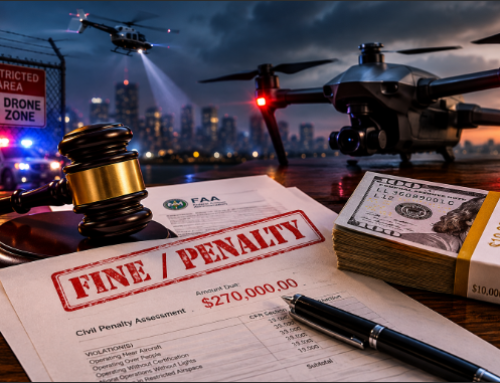
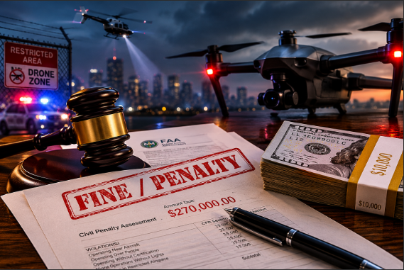
The U.S. government has banned most Chinese drones (like DJI and Autel) for official use, so first responders are turning to American or allied brands.
Current status:
- The U.S. federal government has placed restrictions on the use of Chinese drones (especially DJI) for federal agencies through laws like the NDAA (2019 Section 848) and subsequent executive orders.
- The U.S. Department of Defense has blacklisted DJI, labeling it a national security threat and added it to the Section 1260H list
- Many federal agencies are banned from purchasing or operating Chinese-made drones, which amounts to a de facto ban at the federal level.
However:
- There is no nationwide ban that applies to all public safety agencies. State and local agencies (like fire, police, and sheriff departments) are not federally required to stop using DJI, though some states (e.g. Florida, Arkansas, Tennessee) have enacted their own bans or restrictions.
- Federally, the NDAA 2025 audit deadline (Dec 23, 2025) will bar all new DJI imports unless a security review is done, and the American Security Drone Act prohibits any federal funds from supporting covered foreign drones starting Dec 22, 2025.
- Many first responder agencies are still using DJI drones, while others are transitioning to compliant systems due to policy pressure, funding eligibility, or procurement guidelines.
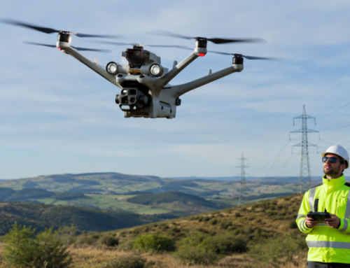
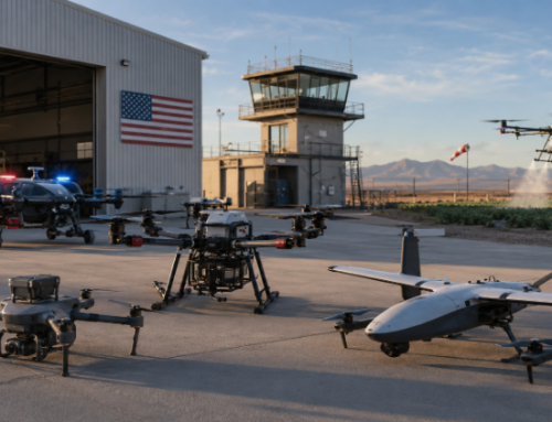
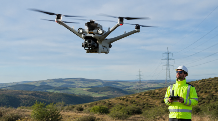
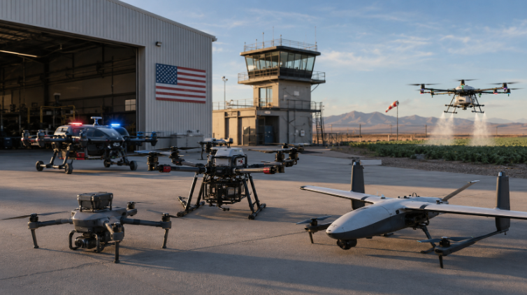
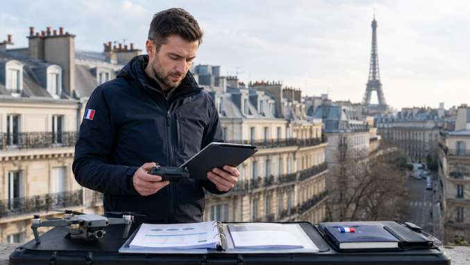
For public safety – whether it’s search-and-rescue in the woods, police work, firefighting, or disaster mapping – there are now plenty of capable NDAA-compliant and Blue UAS options. These drones give you features like thermal cameras, long flights, and rugged designs, without the data-security worries.
Below is a quick glance at top picks, followed by more detail on each.
| Drone Model | Origin (NDAA) | Best Use Cases | Key Features | Year Introduced |
|---|---|---|---|---|
| Brinc LEMUR 2 | USA (Yes) | Police, tactical rescue | Glass-breaker, thermal + 4K camera, 2-way audio, LiDAR maps | 2023 |
| Skydio X10 | USA (Yes) | DFR (Police/Fire), SAR | AI obstacle avoidance, swappable payloads (zoom, thermal), 40+ min flight | 2023 |
| Skydio X2E | USA (Yes) | SAR, inspections | Lightweight, autonomous flight, 35 min, color+thermal cameras | 2020 |
| Parrot ANAFI USA | France/USA (Yes) | SAR, fire response, inspection | 32× zoom, FLIR thermal, 32 min, IP53 weatherproof | 2020 |
| Teal 2 | USA (Yes) | Border security, police | Compact, 640×480 FLIR thermal, AI-assisted tracking (used by US CBP) | 2023 |
| Teal Golden Eagle | USA (Yes) | Tactical ISR, rescue, fire | Dual EO/IR (FLIR), 30+ min, encrypted comms, GPS-denied navigation | 2020 |
| Freefly Astro Prime | USA (Yes) | Surveying, heavy-lift | 20 lb payload, LiDAR/camera ready, sub-cm RTK, NDAA architecture | 2024 |
| Inspired Flight IF800 | USA (Yes) | Inspections, rescues, mapping | Rugged hexacopter, 40+ min, supports LiDAR/IR sensors, NDAA-compliant | 2023 |
| Red Cat Edge 130 | USA (Yes) | Wide-area ISR/mapping | Hybrid VTOL fixed-wing, 125 min flight, 20 km range, EO/IR or mapping cameras | 2024 |
| AeroVironment Puma 3 AE | USA (Yes) | Long-range reconnaissance | Fixed-wing hand-launched, ~2.5 hr endurance, EO/IR payloads | 2020 |
Each of these platforms is ready-to-fly today and designed for U.S. agencies. We’ll break down why they’re top choices as DJI alternatives below, as well as who is already using them:
Search & Rescue Drones
Search teams and disaster crews need long flight time and thermal cameras to find people. A top pick is Parrot ANAFI USA (assembled in Massachusetts). It has a 32× optical zoom and a FLIR thermal sensor, perfect for spotting hikers or fire hotspots from the air. It’s Blue UAS–approved and meets the 848 NDAA rules, so agencies can use federal funds to buy it.
Another go-to is Skydio’s X2E series. These American-built drones use AI for obstacle-avoidance and can fly in GPS-denied areas (like forests). They carry both a visible camera and a 320×256 FLIR unit, with about 35 min of flight time. Fire departments and SAR teams praise Skydio’s drones because they “get there first” with live thermal video.
In fact, Tulsa Fire Department used Skydio drones on a big blaze to map smoke plumes and hot spots before firefighters arrived.
For really large areas, fixed-wing VTOL drones like the Red Cat Edge 130 can be ideal. It takes off vertically and then cruises as a plane, covering up to 125 minutes in flight. It can carry either a long-range EO/IR (day+thermals) camera or a high-res mapping camera array. Systems like this (all NDAA-compliant) let teams survey hurricane damage or flood zones quickly.
Similarly, AeroVironment’s Puma 3 AE (also US-made) can fly for a couple of hours, carrying stabilized thermal/EO cameras. It is already used by U.S. Border Patrol and other agencies for border surveillance and search missions.
Maximize the Puma 3 AE's multi-mission capabilities with the PS2500 battery, enabling up to 3 hours of continuous operation on land and in maritime environments.
— AV (@aerovironment) January 27, 2025
Learn more: https://t.co/AyGhIlqLxL
📷 courtesy of the DoD pic.twitter.com/6r2qJVcGqq
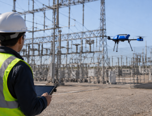
Police & Tactical Drones
Modern police forces value drones that can launch instantly and keep officers safe. The Brinc LEMUR 2 is built for SWAT and emergency teams. It’s quadcopter with a rugged frame (it can even crash and self-right) and a hard-glass breaker for entry. It packs a 4K camera, thermal imager, IR spotlights, and a loudspeaker/mic for two-way comms. It even has LiDAR for making real-time floor plans of a building, aiding indoor search. Importantly, the LEMUR 2 is made in the USA and fully NDAA-compliant.
In late 2023, Brinc delivered its first units to U.S. police and fire agencies. As PoliceMag notes, officers can use the Lemur 2 to “surveil areas too dangerous to send a person”.
Skydio’s drones also dominate police use. The new Skydio X10 (successor to the X2) flies about 40 minutes and can swap sensors (zoom/thermal/HD cams). It’s American-made and Blue UAS–certified. Many PDs now deploy X10s as “drones-as-first-responders.”
For instance, St. Cloud (FL) PD installed roof-mounted docks with Skydio X10s. When a 911 call comes in, a drone auto-launches in seconds, giving live aerial video to officers before they arrive. This DJI-free program – costing about $890K over five years – let St. Cloud officers gather life-saving information faster and plan safer approaches.
Similarly, Redmond (WA) and San Francisco police report huge gains from Skydio DFR: drones arrive in under 90 seconds and have already helped intercept suspects and locate missing persons. The X10’s quick deployment, obstacle avoidance, and parachute safety kit make it great for patrol work.
Also Read: Miami Beach PD Integrates Skydio DFR Program With Intelligence Center
Another proven choice is Parrot ANAFI USA. Besides SAR, it’s popular with law enforcement for standoffs or perimeter searches. A special mil-grade version (“ANAFI USA MIL”) has even been fielded by U.S. Customs/Border Patrol, ICE, and Secret Service. These agencies use it to conduct surveillance from safe distances – for example, ANAFI USA’s camera can view an entire tornado’s damage path in one shot, an asset for Federal Emergency Management Agency (FEMA).
The ANAFI USA (civil version) is weather-resistant and folds up small, making it easy for a patrol car kit. It stores encrypted data and flies silently (so it can scout quietly).
Finally, Teal Drones has U.S.-made models like the pocket-sized Teal 2. The Border Patrol recently ordered 106 Teal 2s. They carry a 640×512 FLIR thermal camera and AI-assisted tracking software.
Teal’s founder notes their sales are mostly to the Pentagon, “with other sales to municipal police departments and U.S. Customs and Border Protection”. These lightweight quadcopters help agents patrol at night – Teal even calls it “Dominate the Night.”
Firefighting & Emergency Response Drones
Firefighters are using drones more and more to size up blazes. A drone can launch immediately, flying thermal and visible video back to the incident commander before crews arrive. DFR (Drones-as-First-Responders) is even catching on in fire departments.. In LIke that Tusla example where seven Skydio drones were deployed across a river to handle a huge petroleum tank fire. Within minutes they tracked smoke and hotspots in real-time, helping crews coordinate safely.
Skydio models are a favorite here as they self-navigate around tall structures and trees, letting non-expert operators fly effectively. Features like AI obstacle avoidance and radiometric thermal imaging (which shows exact heat values) mean Skydio drones can autonomously send back precise thermal maps. The new Skydio X10 was co-developed with fire agencies to meet real emergency needs.
For smaller, hand-launched ops, Skydio X2 or Parrot ANAFI USA also fit firefighting needs: both carry dual thermal/color cameras and fly ~30 minutes. Drones help spot hidden hot spots in a structure, trace fire spread in a forest, or even guide roof-venting crews. Every major fire department now considers drones part of the toolbox. DFR in particular changes everything” by getting a view on scene before people arrive.
Disaster Response & Large-Scale Ops
After hurricanes, wildfires, earthquakes or industrial accidents, agencies need drones for wide-area surveillance and mapping. Hybrid VTOLs (that take off like helis but then fly forward) shine here. For example, the Edge 130 (by Red Cat/Draganfly) is a U.S.-made 3-rotor VTOL that can hover for close-ups and then cruise for over 2 hours. It can swap between an EO/IR camera for ISR and a 3-camera 39-MP mapping array. With encrypted comms and Blue UAS certification, it’s suitable for government disaster mapping. Fixed-wing UAS like the AeroVironment Puma or SwissDrones SDO helidrone (authorized for BVLOS) can also survey many square miles, spotting survivors or damaged infrastructure.
Even multi-rotors can be used: heavy-lift drones like the Freefly Astro Prime (carbon-fiber frame, 20 lb payload) let teams carry LiDAR scanners or multiple sensors to rapidly scan a collapsed building.
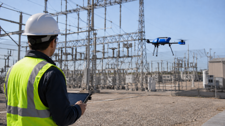
The IF800 Tomcat hexacopter similarly handles large payloads (LiDAR, thermal) on hour-plus flights. These systems are NDAA-compliant and ready to integrate custom sensors, making them fit for FEMA and infrastructure rescue.
In short, U.S. agencies now have domestic drone options for every public-safety mission – from narrow-canyon canyon rescues to storm-scale damage assessment – and many of these are already in active use or field tests by fire, police, border patrol and emergency teams.
View Current Police Drone Usage Statistics Across America
Why these drones for DJI alternatives?
Each choice above is NDAA- or Blue-certified (so federal grants or contracts can buy them), and they’re built to withstand tough conditions. Many are used right now by U.S. agencies: for example, CBP’s border agents fly Teal 2 quads, FEMA trains on Anafi USA platforms, and dozens of PDs and FDNY stations have Skydio or Brinc drones docked on roofs. By picking these alternatives, first responders get comparable (or better) tech than DJI’s, but with trusted supply chains and support.
Related Reading: Tariffs, Trade Wars, and Drone Users Caught In The Middle